Team: Susana B. Adamo (Columbia University); Carolynne Hultquist (Columbia University); Cascade Tuholske (Montana State University); Greg Yetman (Columbia University); John Squires (Columbia University)
Summary: We examine the relationship between hazardous air quality and temperature, and socioeconomic characteristics of school districts, in New York State (NYS). We focus on New York City (NYC) schools serving low-income minority populations and located in environmental justice communities characterized by high levels of hazard exposure.
The project objectives are: to measure changes in hazardous air quality and temperatures for public schools serving environmental justice communities in New York State with Earth Observation (EO) data; to pilot student-led citizen science to combine in-situ and EO data for air quality and temperature monitoring in and around public schools; and to assess feasibility of student-led citizen science approach and utility of EO data to monitor air quality and temperature in and around public schools.
Advancements include:
• We developed a temperature dataset derived from EO, including measurements and trends, and advanced in the acquisition, pre-processing and mapping of socioeconomic data on schools, and air quality data (PM2.5, NO2, O3).
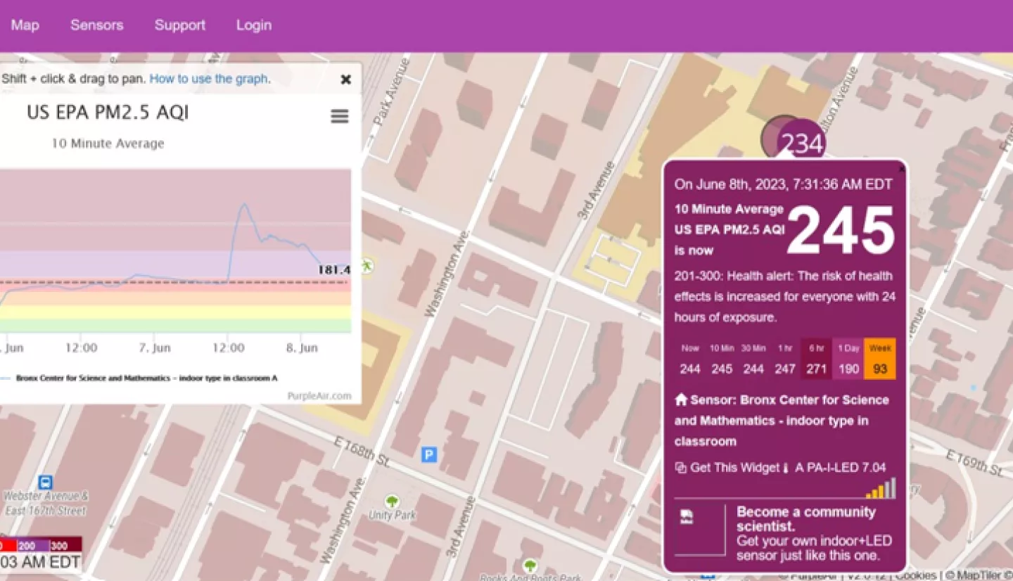
• We lectured and had in-class workshops on several topics, such as “Air Pollution: Impacts on Health Reduction of Air Pollutants & Air Quality and Health” and “Geographic Information Systems for Environmental Justice”. For Task 2 (collection of environmental data), we installed indoor and outdoor Purple Air sensors at the BCSM, and distributed mobile sensors among BCSM students (AP environmental sciences class) for collecting air quality data.
• We developed a web platform in ArcGIS Online for the high-school students to upload the data they collected with the mobile sensors, and combine them remote sensing data on air quality.
During our first year, we calculated measures for hazardous air quality and temperature for each school district in NYS, using data derived from NASA satellites, aiming to communicate environmental hazards in easy-to-understand terms, e.g., heat exposure as the number of days above certain extreme thresholds. We paired the environmental data with socioeconomic data from the National Center for Education Statistics (NCES) to inform environmental justice analysis.
The project is working with high school students from the Bronx Center for Science and Mathematics (BCSM) to monitor air quality and temperature with stationary and handheld sensors within and around schools, working with the school to provide education on interpreting hazards through NASA satellite and local sensor data.
The project team have been working closely with partners at the BCSM for the planning and execution of all activities involving high-school students. Representatives from partner NGO WEACT, as well as from Fordham University’s Fresh Air project and multi-media platform Palabra, were also part of some of the in-school activities.