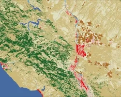
Spatially explicit information on land cover and land use extent and change is required for national and regional land use planning and management, water use monitoring,greenhouse gas emissions estimation in the context of IPCC and REDD+ agreements, and nature conservation strategy development. This information is especially important for rapidly developing countries,such as Southeast Asian nations that share the lower portion of the Mekong River basin(Myanmar, Cambodia, Lao PDR, Thailand, and Vietnam). The primary goal of SERVIR program is to enhance capacity of national agencies in regional and national-scale land cover and land use monitoring using publicly available satellite imagery, image processing, and analysis methods. Publicly available medium spatial resolution satellite data, specifically in the form of the NASA/USGS Landsat image archive, provide the only practical way for operational land cover monitoring at national and regional scales. Our research team proposes to improve the capacity of the regional SERVIR-Mekong hub and national monitoring agencies in the processing and analysis of regional Landsat time-series data, developing regionally consistent annual land cover maps, product validation and uncertainty assessment, and implementation of monitoring results in national and regional planning and management. We will provide annual regionally consistent cloud-free Landsat data time-series, multi-temporal metrics, and a hardware/software complex for regional image time-series characterization to the SERVIR-Mekong hub along with training on algorithm implementation. Together with SERVIR-Mekong, we will develop and implement a set of satellite data characterization models to produce vegetation structure continuous variables (tree canopy cover, tree canopy height), leaf phenology, and forest cover dynamics (forest cover loss/gain) at annual intervals for 2000-2015. Developed annual and change detection products will be validated using the recommended good practices and quality reference data. All resulting datasets will be available on-line for visualization, analysis, and download. Metadata and project reports will accompany delivered products and will summarize product methodology and uncertainties. Together with the SERVIR-Mekong hub, our team will educate national stakeholders on implementation of these data in national and regional land cover/use mapping and change assessment, including operational annual national wall-to-wall monitoring. The project’s focus is forests, but guidance and examples of the method’s use in mapping and monitoring other land cover, such as cultivated rice area, will be provided. The implementation of regionally consistent annual land cover/use and vegetation structure datasets facilitates national mapping and monitoring initiatives, data transparency, and improves consistency between national monitoring programs. Our project directly responses to the proposal call, SERVIR Applied Science Team (AST), and SERVIR-Mekong goals. The project will be fully integrated with regional SERVIR-Mekong activities and will influence broad implementation of freely available operational Landsat data in national and regional planning and management. We believe that the extensive experience of our team in large-scale Landsat data processing and characterization will benefit SERVIR AST, regional program hubs, and responsible national monitoring agencies. Our research team has all image processing infrastructure in place, and proposed activities will be complimented by our ongoing projects supported by SilvaCarbon, NASA, Global Forest Watch, and the Gordon and Betty Moore Foundation.
Project
