Imagen
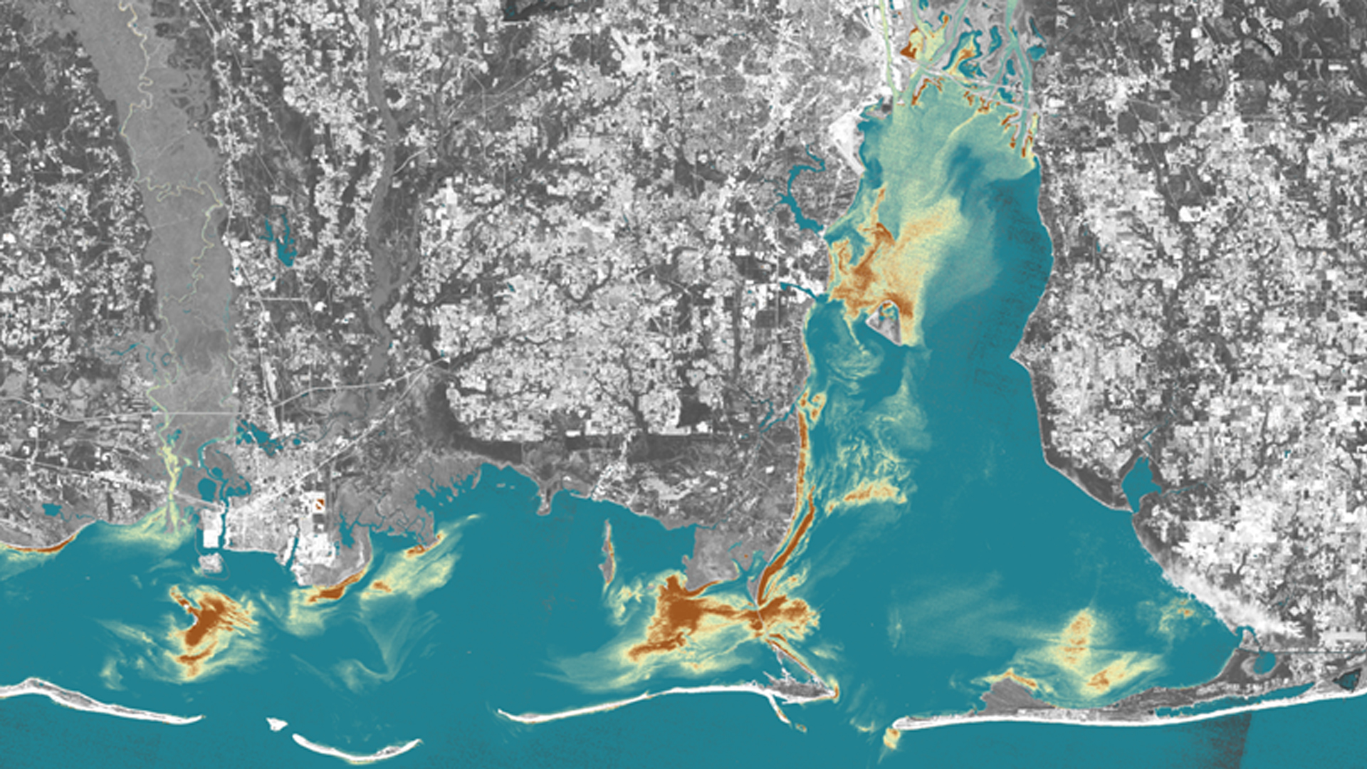
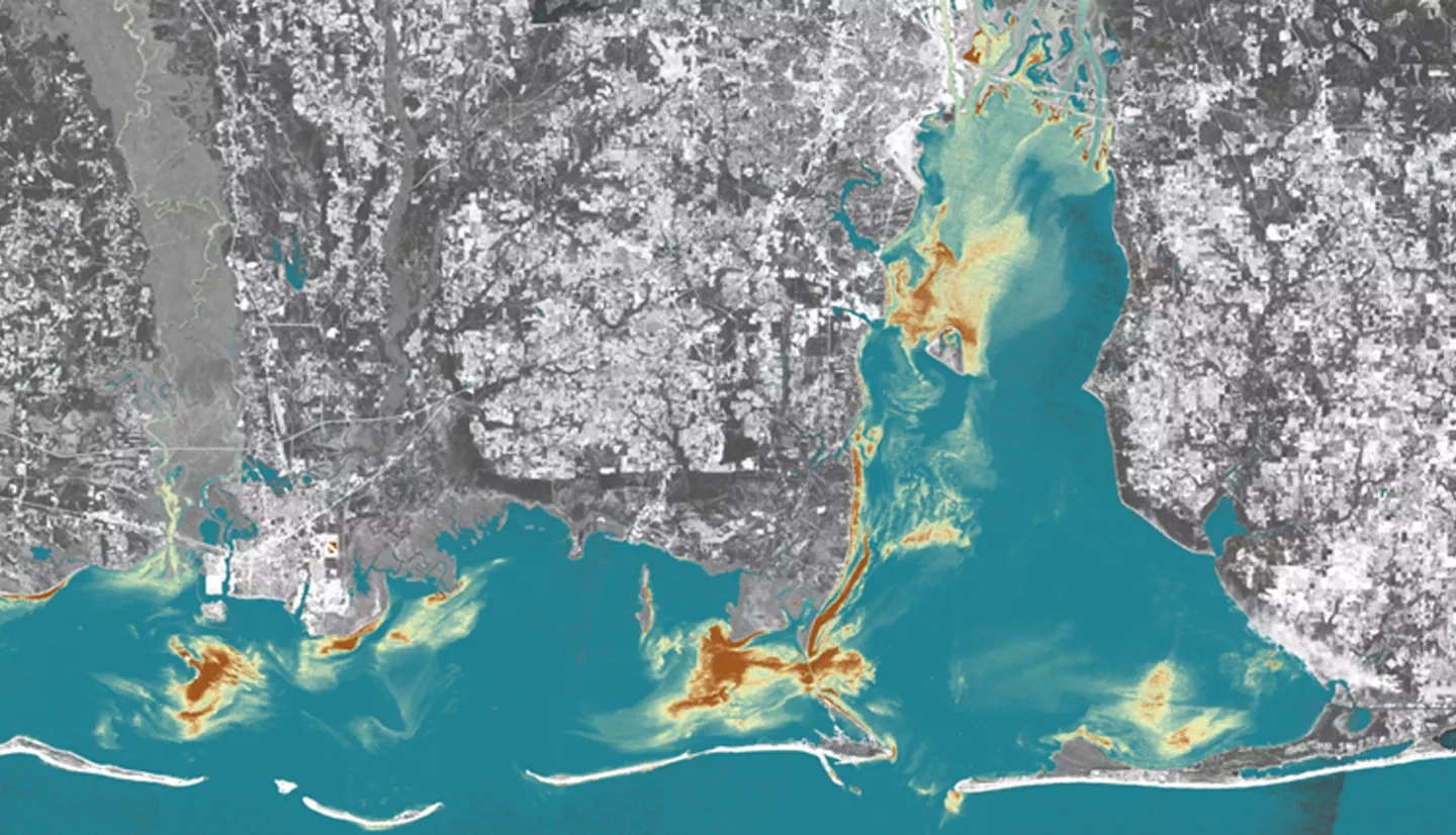
The Mobile Bay and Mississippi Sound are the main coastal estuaries along the Alabama and Mississippi Gulf Coast. They serve as the primary drainage outlets for the Mobile Bay and Pascagoula River watersheds and provide a gradient of coastal water salinity conditions needed for a diversity of wildlife species and coastal habitat types. Coastal water "health" conditions have a direct impact on the native biota that are sensitive to water quality, including the Eastern oyster (Crassostrea virginica), a keystone species, and the West Indian manatee (Trichechus manatus), a vulnerable species. This project addressed the dynamic coastal ecosystem by creating time series analyses to monitor salinity, temperature, and turbidity changes for the Mobile Bay and Mississippi Sound from June 2007 to May 2017. The Aqua Moderate Resolution Imaging Spectroradiometer (MODIS) was used to detect salinity and sea surface temperature, while Landsat 5, Landsat 8, and Sentinel-2 Multispectral Instrument (MSI) were employed to detect turbidity levels and validate sea surface temperature. Such data products were used to compute habitat suitability maps for oysters and manatees in the Mobile Bay and Mississippi Sound to assess the optimal areas and conditions for habitat restoration initiatives. Project partners will use product results to better understand manatee movements and habitat suitability for oysters.