Start Date: Dec. 16, 2021
Type: Hurricanes & Cyclones
Region: Asia, Oceania - Philippines
Info & Resources:
- NASA Disasters program resources for Hurricanes and Tropical Cyclones
- NASA Earthdata Toolkits – Tropical Cyclones
- Updates from NASA Earth Observatory: Super Typhoon Rai
- Weather Information: Bulletins on Typhoon Rai (Odette) from the Philippine Atmospheric, Geophysical and Astronomical Services Administration (PAGASA)
Update Dec. 30, 2021
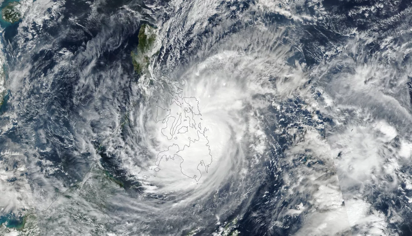
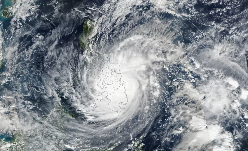
Super Typhoon Rai, locally known as Odette, made landfall over five Philippine regions on Dec. 16-17, causing widespread destruction and fatalities. As of Dec. 28, media reported that the storm had killed 397 people, injured 1,147, and left 83 others missing. More than 500,000 people remain displaced because of the storm.
According the Asian Disaster Reduction Center, the Philippines typically see around 20 tropical cyclones annually—more than any other region on Earth. Rai is the 15th typhoon to pass through or close to the Philippines this year, and the strongest storm to hit the islands in 2021.
The NASA Earth Applied Sciences Disasters program area has activated efforts to collaborate with partners to provide Earth observation data and mapping to assist the impacted region.
NASA Disasters coordinators, researchers and partners are responding to a request from the World Food Programme and have provided damage proxy maps (DPM)s, flood proxy maps (FPM)s and near-real-time Black Marble products. Researchers are looking at the critical infrastructure exposure within the affected region in and around the cities of Cebu, San Carlos, and Naga. Partners at the Earth Observatory of Singapore Remote Sensing Laboratory released the DPM and FPM products to provide awareness for those on the ground.
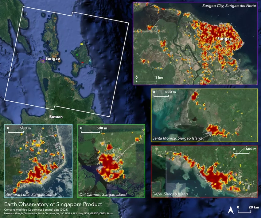
The Earth Observatory of Singapore - Remote Sensing Lab (EOS-RS) created the Damage Proxy Map (DPM) map above, which was derived from synthetic aperture radar (SAR) images acquired by the Copernicus Sentinel-1 satellites operated by the European Space Agency (ESA) from Aug. 28, 2021 to Dec. 20, 2021. The large white polygon indicates the coverage area and each pixel measures about 30 meters across. More significant surface change is depicted as the color varies from yellow to red. Preliminary validation was done by high-resolution optical imagery comparison. This damage proxy map can be used as guidance to identify damaged areas but may be less reliable over vegetated or flooded areas. A lack of colored pixels over vegetated areas does not necessarily indicate a lack of damage.
RELATED PROJECTS
- Open Critical Infrastructure Exposure for Disaster Forecasting, Mitigation and Response
- Advancing Access to Global Flood Modeling and Alerting using the PDC DisasterAWARE Platform and Remote Sensing Technologies
- Global Rapid Damage Mapping System with Spaceborne SAR Data
- Integrating SAR Data for Improved Resilience and Response to Weather-Related Disasters
LINKS & RESOURCES
- Earth Observatory of Singapore – Remote Sensing (EOS-RS) & Advanced Rapid Imaging and Analysis Singapore (ARIA-SG) Products Repository
- NASA Earthdata Toolkits - Tropical Cyclones
- NASA Earthdata Pathfinders - Cyclones
- NASA Disasters Program Hurricanes & Tropical Cyclones Support One-pager
RELATED ACTIVATIONS