Using Earth Observations to Build Knowledge and strengthen Communities
The Indigenous Peoples Initiative focuses on building relationships across NASA and Indigenous communities through place-based remote sensing training, community engagement, and co-production of knowledge.
The Indigenous Peoples Initiative engages with indigenous communities to foster ethical and culturally relevant space for the use of Earth observations in monitoring, mapping, and managing natural and cultural resources. The pillars of this work include community engagement and the co-production of place-based remote sensing trainings specific to Indigenous lands and territories.
We aim to strengthen the relationships between NASA and Indigenous communities through meetings and knowledge sharing activities, as well as co-developing a global Indigenous geospatial community of practice through the Group on Earth Observations (GEO). Through dialogue and discussion focused on indigenous needs and priorities, our remote sensing trainings provide participants with the data and resources needed to address specific natural resource issues facing their lands.
Geospatial Trainings
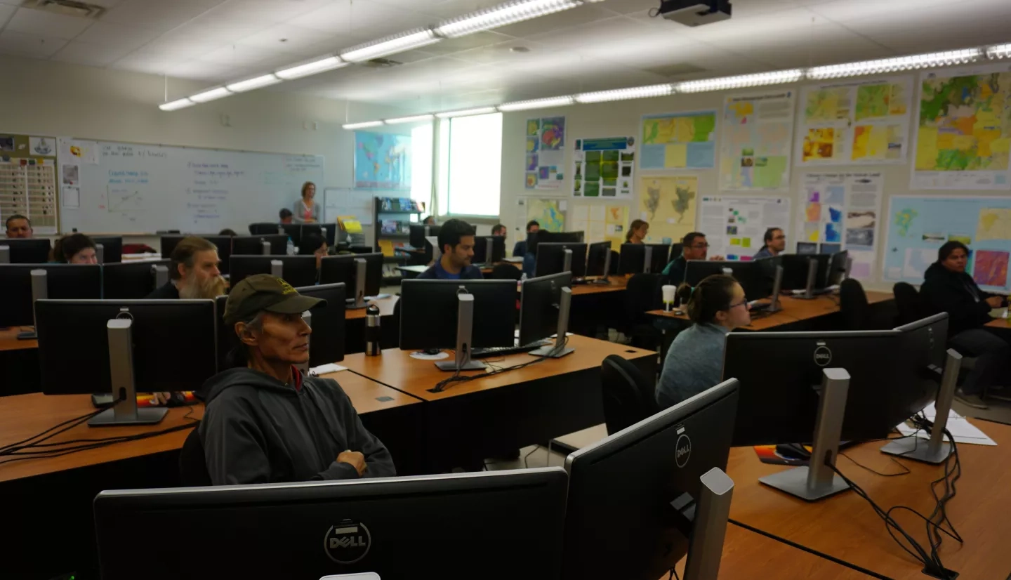
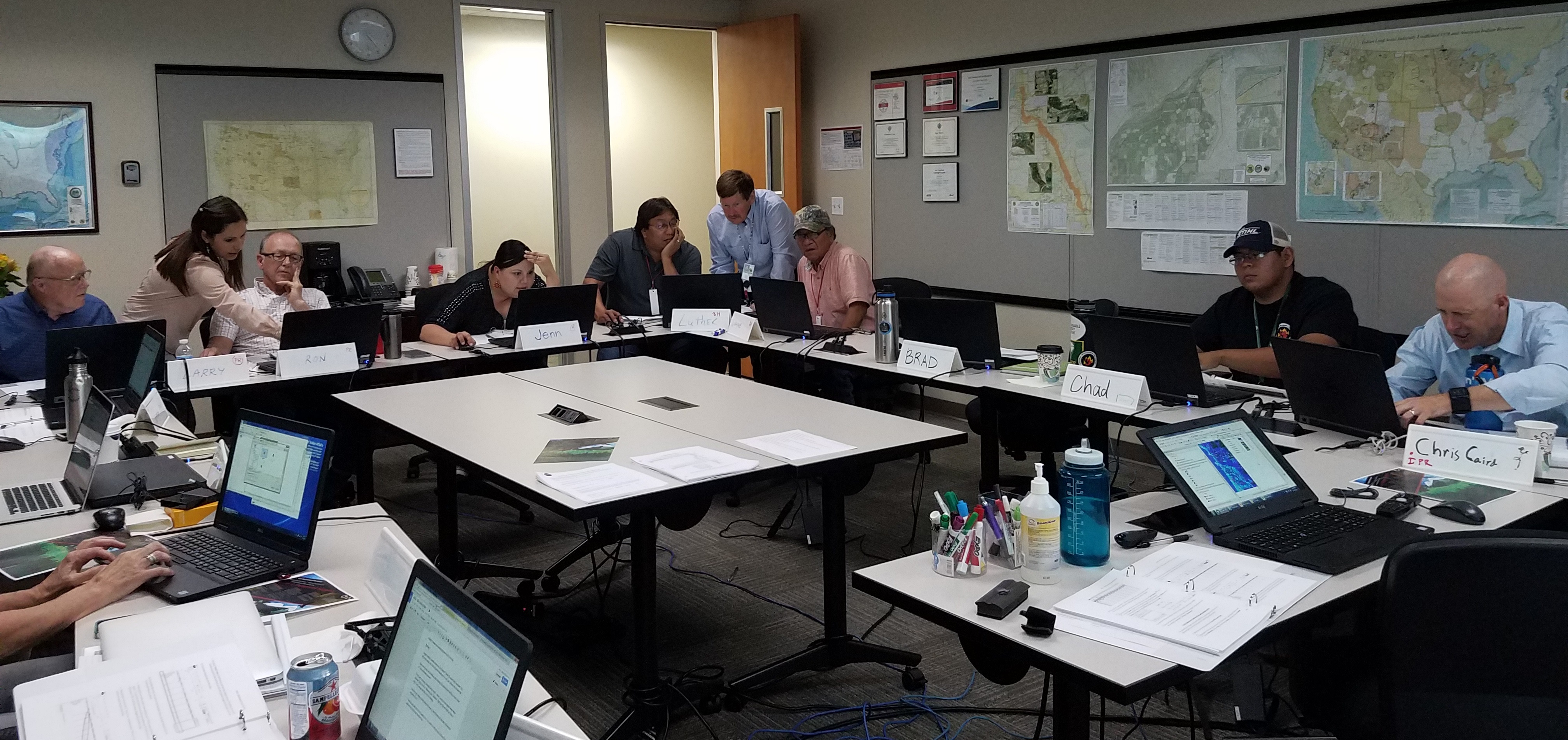
Through in-person and virtual workshops, the Indigenous Peoples Initiative provides place-based and culturally relevant approaches to the use of NASA Earth observations for ecological forecasting, water resources, disasters, and ocean and coastal applications.
These trainings are needs-based and begin with dialogue around the appropriate geospatial tools, themes, and techniques to improve the capacity within that community to use Earth observations. This includes the use of web-based and open-source software. Past trainings have provided lessons and hands-on exercises on topics such as: introduction to remote sensing, vegetation health and calculation of indices, land cover classification, accuracy assessment of maps, coastal and wetland mapping, drought and agricultural monitoring, and much more.
Trainings have been conducted on tribal lands in partnership with tribal natural resource management offices, regional tribal networks, tribal colleges, and other federal agencies. The Indigenous Peoples Pilot has worked with organizations such as the Navajo Nation, the Samish Indian Nation, the Sault Ste. Marie Tribe of Chippewa Indians, the Institute of Tribal Environmental Professionals, Northwest Indian College, the United Tribes Technical College, and the Bureau of Indian Affairs Branch of Geospatial Support to host these events.
[ TRAINING: An Introduction to Remote Sensing for Tribal Lands ]
Building Relationships
The Indigenous Peoples Initiative engages communities and builds relationships by attending and hosting meetings, conferences, and workshops centered around the indigenous geospatial community in the United States and globally. We host knowledge exchange workshops, convene conference sessions and town halls, and contribute to the growing community of practice around the Indigenous geospatial community.
highlights include:
- A knowledge exchange workshop held in collaboration with the Red Cliff Band of Lake Superior Chippewa, which focused on building partnerships with NASA and the tribal nations, Indigenous knowledge systems and "two-eyed" seeing, and future recommendations for the Indigenous Peoples Pilot.
- Conference sessions held at the National Tribal GIS Conference, the Tribal Leaders Summit, the Society for Conservation GIS, and the National Adaptation Forum in partnership with NASA's Minority University Research and Education Project (MUREP), NOAA, and the Olohana Foundation.
- A key side-session held at the 2019 GEO Week ministerial Summit in partnership with Conservation International was the first Indigenous-focused session in the history of GEO and included panelists from Kenya, Ecuador, Australia, and the United States. It focused on the importance of indigenous peoples to participate in GEO as well as emphasized how Earth observations could benefit Indigenous communities.
Team

Dr. Amber Jean McCullum is a researcher and capacity building specialist in the Earth Science Division at NASA Ames Research Center. Her work in the Applied Sciences focuses on project management, engagement and relationship building across NASA and Indigenous communities, and creating remote sensing trainings for land and water applications. She is the team lead for the Indigenous Peoples Initiative, where she has worked towards creating a more equitable and inclusive space for the use of Earth Observations for Indigenous community action. She is also the Impact and Transition Lead for NASA's Western Water Applications Office (WWAO) and the lead trainer in land management for NASA's Applied Remote Sensing and Training (ARSET) Program. She has led multiple projects centered around the co-development of remote sensing tools for the Navajo Nation, including the Drought Severity Evaluation tool. She received her B.S. in Geology and Environmental Geosciences from the College of Charleston, her M.S. in Geology from San Francisco State University, and her PhD in Environmental Studies from the University of California Santa Cruz.
Sativa Cruz (Chicana/Genízaro/Tewa) is an Applied Scientist in the Earth Science Division at NASA Ames Research Center. Following an internship with NASA Headquarters, where she supported Environmental Justice (EJ) efforts within the Applied Sciences Program, she joined NASA’s Indigenous Peoples Initiative (IPI). Sativa supports IPI’s capacity building efforts through the co-creation of place-based remote sensing trainings for Tribal natural resource professionals and Native communities. She has recently joined the Applied Remote Sensing and Training (ARSET) Ecological Conservation team as an instructor to further enable use of Earth of Observations at the global scale. Her academic background includes a BSc. in Environmental Science and a minor in Sustainability from New Mexico State University, as well as a M.F. in Forest Ecosystems and Society from Oregon State University. She is currently studying hydrology at the New Mexico Institute of Mining and Technology. Sativa is a member of Ohkay Owingeh Pueblo located in Northern NM.