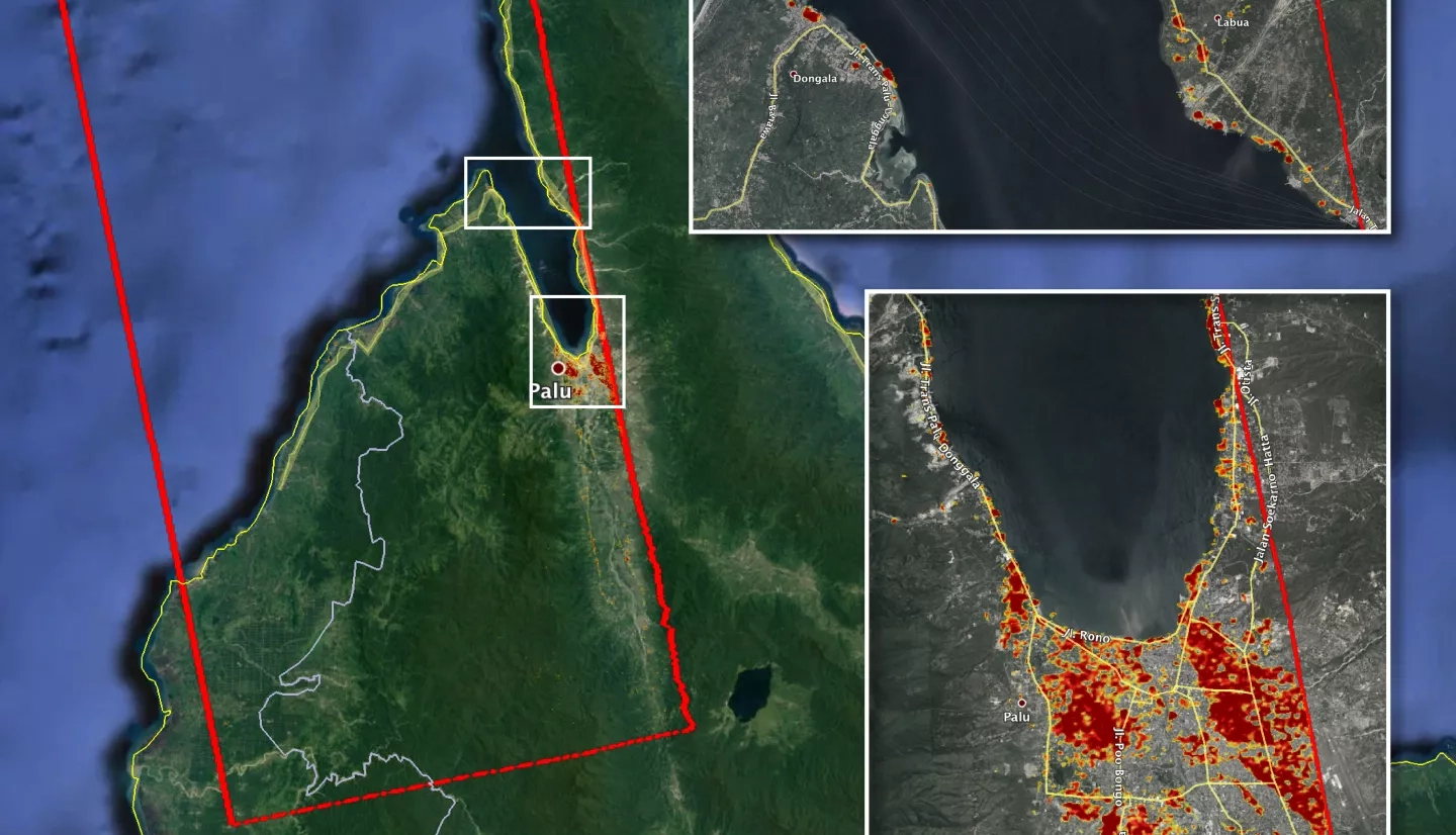
The Advanced Rapid Imaging and Analysis (ARIA) team at NASA's Jet Propulsion Laboratory and Caltech in Pasadena, CA created a Damage Proxy Map (DPM) version 0.7 depicting areas in Central Sulawesi, Indonesia, including the city of Palu that are damaged. The damaged areas are depicted as red and yellow pixels. Damage occurred as a result of the magnitude 7.5 earthquake on September 28, 2018. The map is derived from synthetic aperture radar (SAR) images from the ALOS-2 satellite, operated by Japan Aerospace Exploration Agency (JAXA).
The map covers an area of 67 by 70 kilometers, shown by the large red polygon. Each pixel measures about 30 meters across. The color variation from yellow to red indicates increasingly significant ground surface change. Preliminary validation was completed through collaboration with the Earth Observatory of Singapore comparing local media information and photos. Damage proxy maps are used as a guide to identify damaged areas; however, the maps may be less reliable over vegetated areas. For example, the scattered single colored pixels over vegetated areas may be false positives, and the lack of colored pixels over vegetated areas does mean that damage has not occurred.
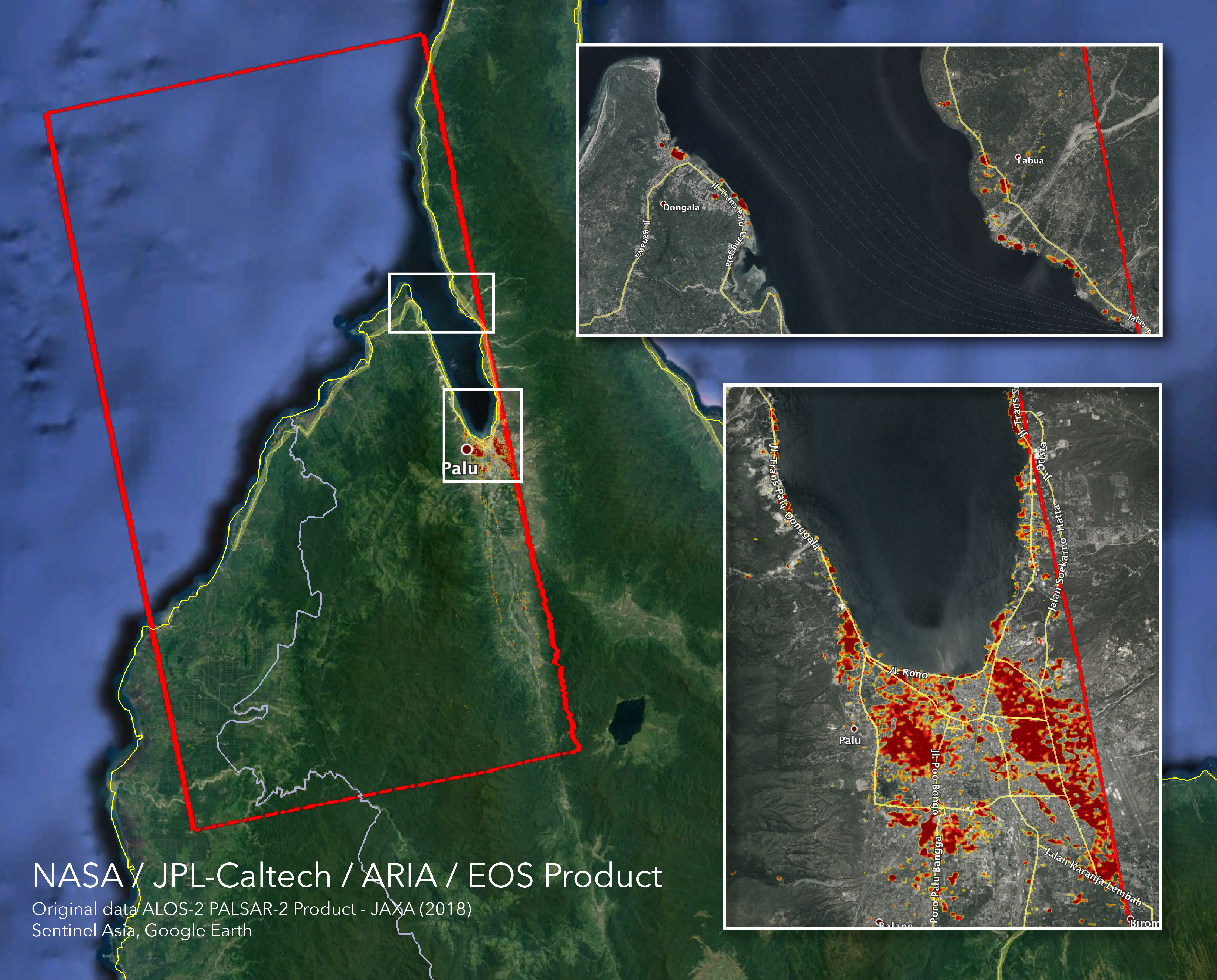
The DPM was created by the NASA-JPL / Caltech ARIA team, and the ALOS-2 data was provided by JAXA. The Earth Observatory of Singapore coordinated with the Sentinel Asia to timely task the ALOS-2 satellite. The algorithm development was carried out at JPL under a contract with NASA.
For more information about ARIA, visit: http://aria.jpl.nasa.gov


