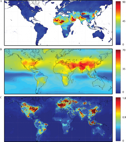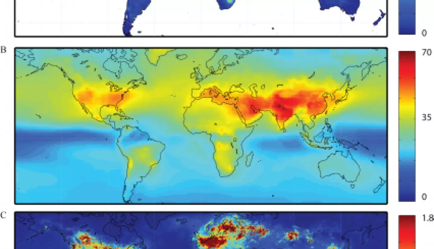
Millions of new child asthma cases globally in 2019 were associated with the traffic-related air pollutant nitrogen dioxide, with more than two-thirds of those cases occurring in urban areas. Cities also are experiencing very high levels of another pollutant, fine particulate matter known as PM2.5.
The findings are the result of a nearly 20-year survey of global air pollution trends using NASA satellite data combined with other data sets on population and public health. The work is published in two studies in the January 5 edition of “The Lancet Planetary Health.”
“Our research showed that, between the years 2000 and 2019, the vast majority of the world’s urban population lived in areas with unhealthy levels of air pollution, leading to millions of cases of pediatric asthma and early death” said the study’s lead author, Susan Anenberg, with the George Washington University Milken Institute School of Public Health.
”Satellite data enabled us to track pollution levels in nearly all urban areas worldwide, which we hope will help cities and countries around the world put in place health-protective policies that reduce the fossil fuel emissions that lead to air pollution.”
The study is the first to consider trends in air pollutant concentrations as well as the corresponding burdens of mortality data over a 19-year timeline worldwide. The work is supported in part by the NASA Applied Sciences Health and Air Quality program area. Fine particulate air pollution (PM 2.5) consists of particles in a size range of 30 times less wide than a human hair.
Measurements of this air pollutant were supplied by data from the Moderate Resolution Imaging Spectroradiometer (MODIS) instrument and the Multi-angle Imaging SpectroRadiometer (MISR) instrument, both aboard the NASA satellite Terra; the NASA ocean color project SeaWiFs; and the global 3-D model of atmospheric chemistry, GEOS-Chem. Measurements of nitrogen dioxide came from NASA’s Ozone Monitoring Instrument (OMI) aboard NASA's Aura spacecraft, along with the earlier NO2 observing satellites SCIAMACHY and European Space Agency's GOME-2 instrument. The study also relied on population and urban built-up area datasets that use satellite data.