Published
The GFMS uses real-time TRMM Multi-satellite Precipitation Analysis (TMPA) precipitation information as input to a quasi-global hydrological runoff and routing model.
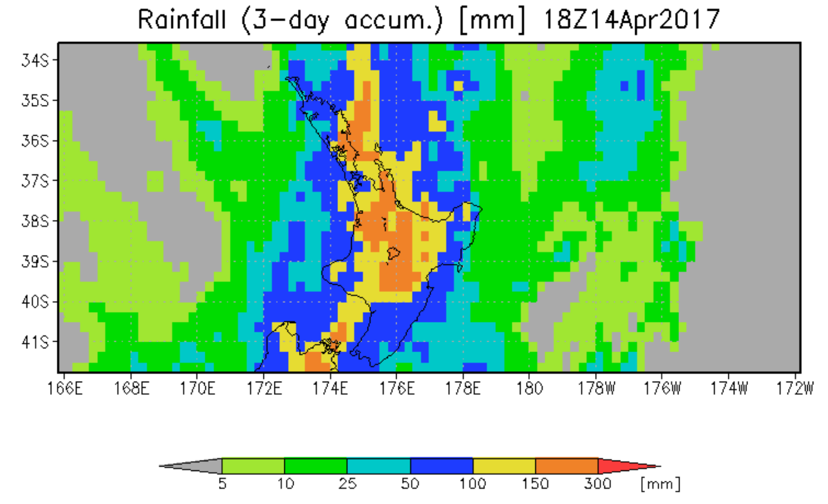
- In addition, the latest maps of instantaneous precipitation and totals from the last day, three days and seven days are displayed.
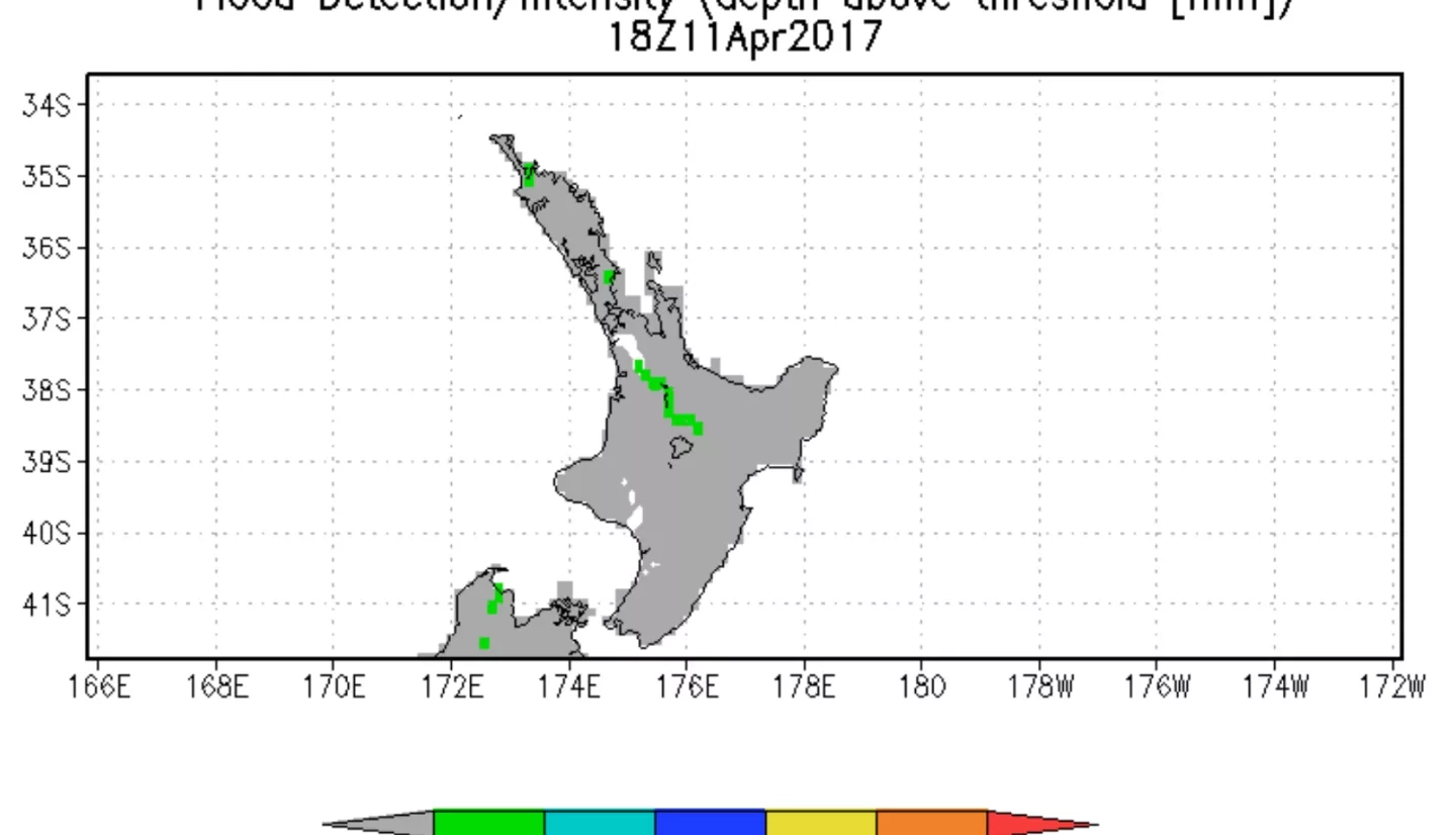
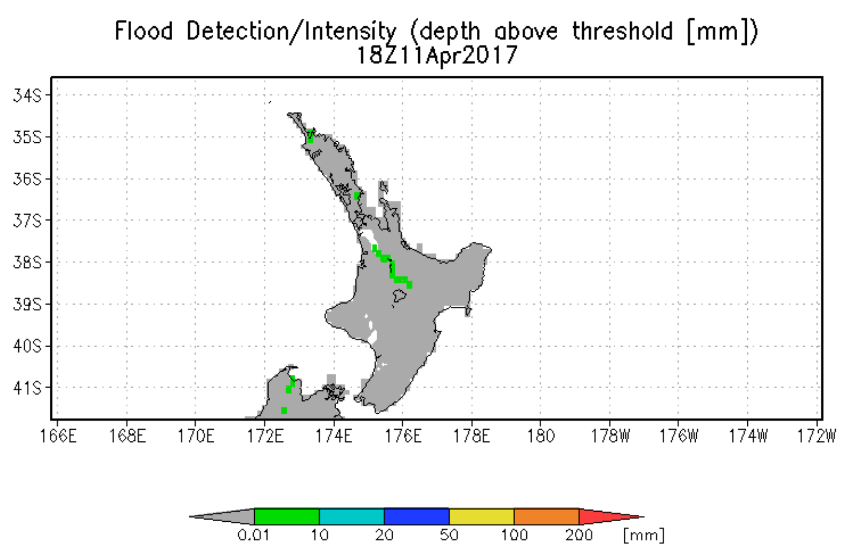
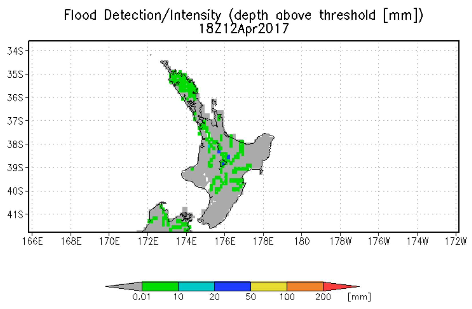
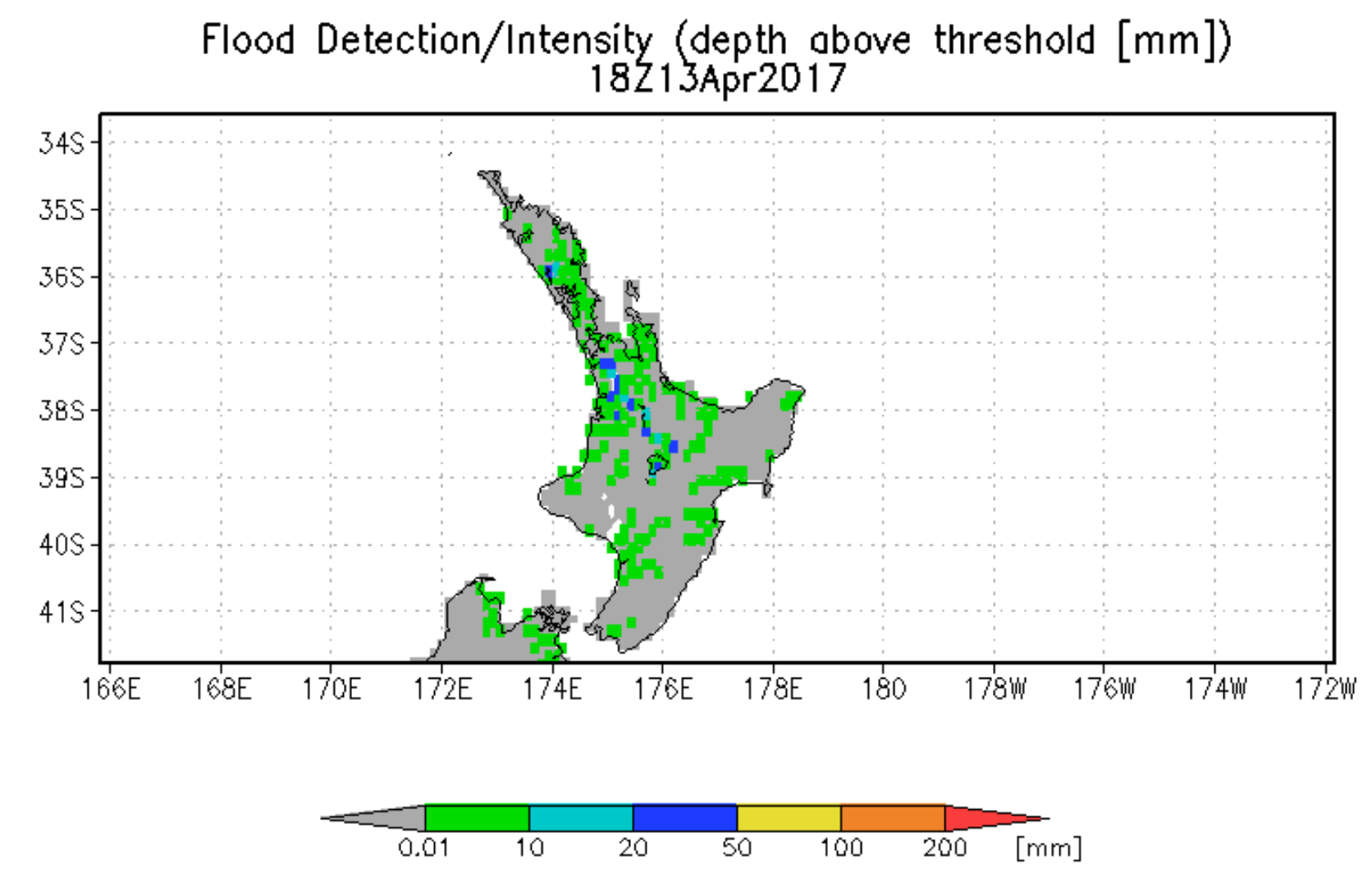
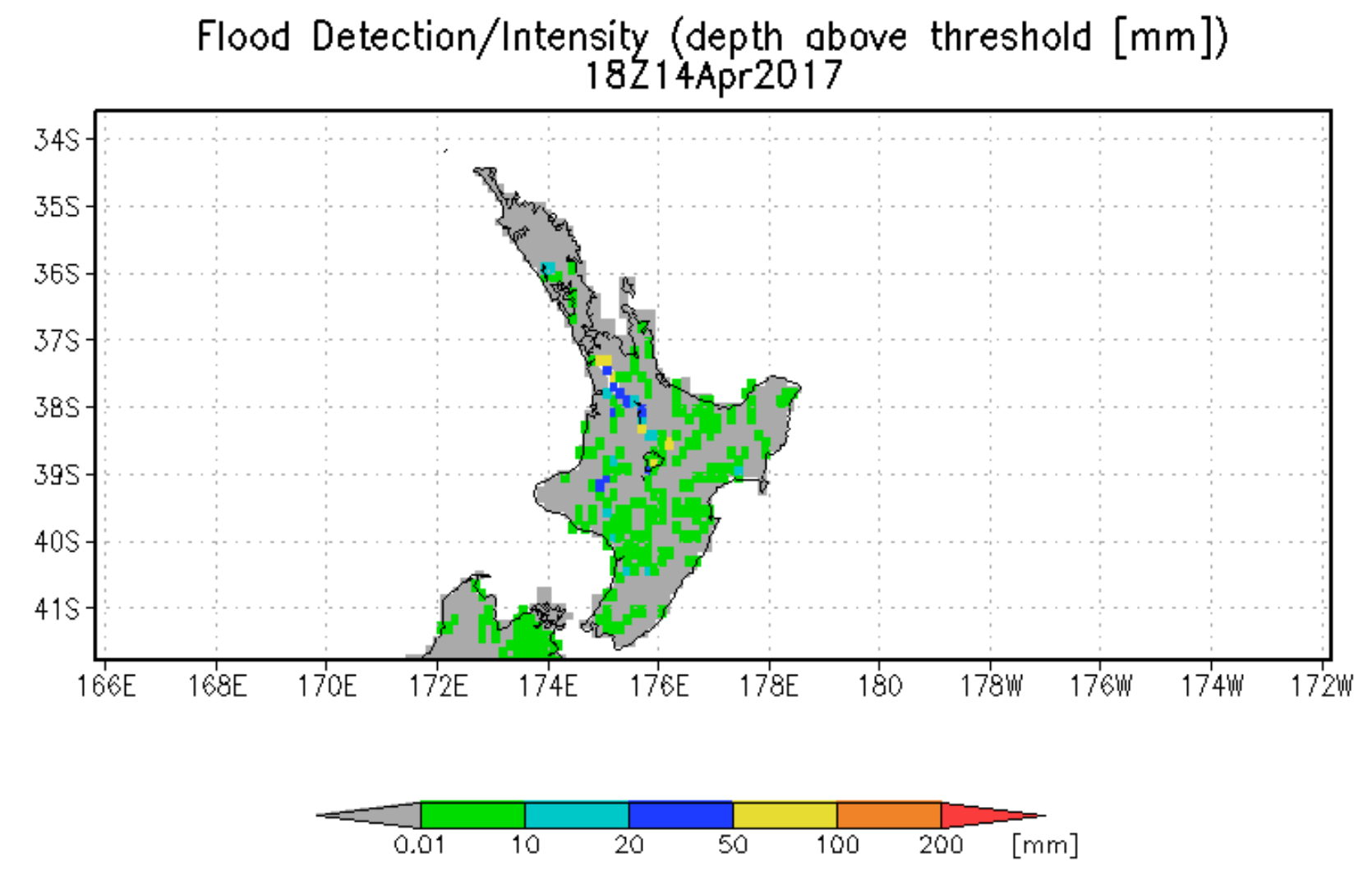
- Flood detection/intensity estimates are based on 13 years of retrospective model runs with TMPA input, with flood thresholds derived for each grid location using surface water storage statistics.
- Streamflow, surface water storage, and inundation variables are also calculated at 1km resolution.
Plots of forecast rain from NASA GEOS-5 global model.
New Zealand flood forecasts from the Global Flood Monitoring System (http://flood.umd.edu)
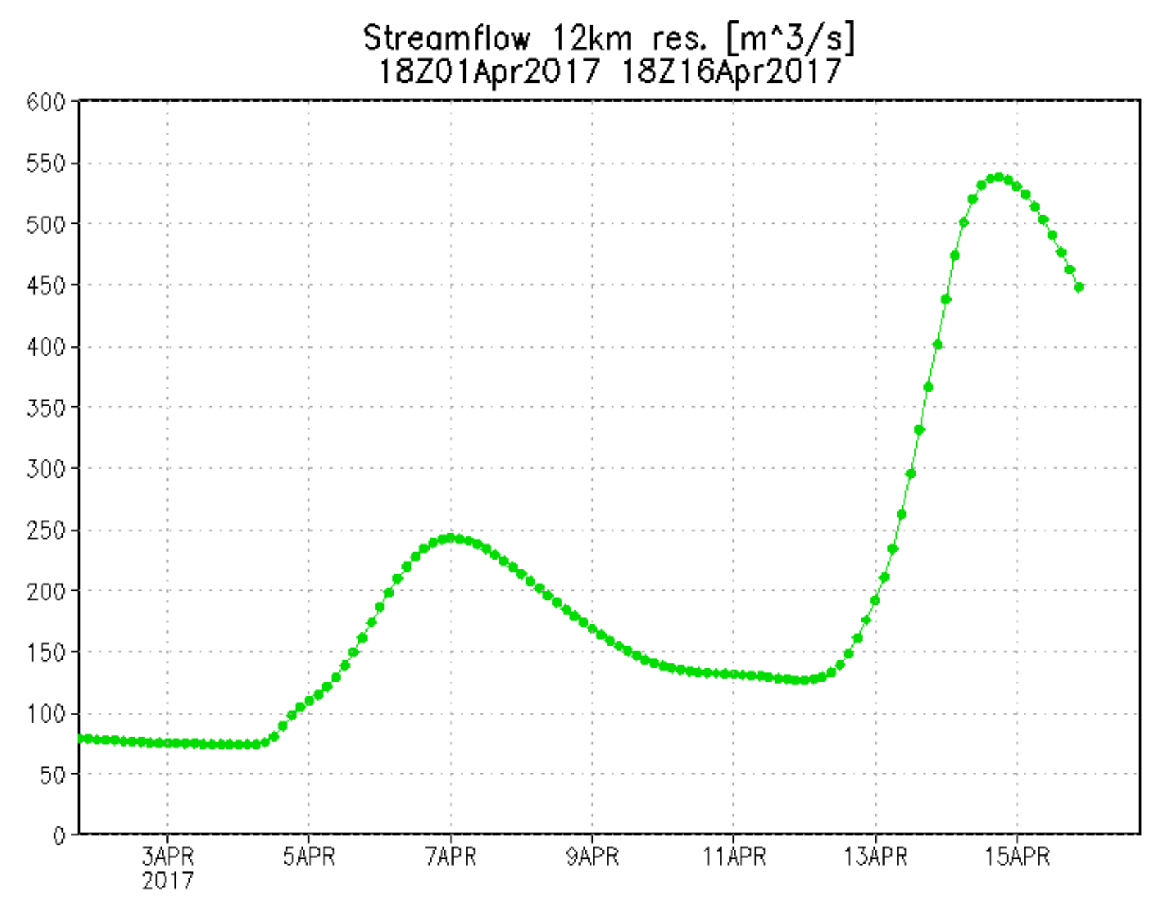
New Zealand streamflow forecast at 37.42S 175.05E on North Island
656


