NASA has created and provided to emergency response organizations a detailed damage assessment map of the Bahamas based on satellite data after Hurricane Dorian hit the islands earlier this week.
For over a week, a response team from NASA’s Earth Science Disasters Program has worked to create maps of impacts and potential impacts from the storm and make them available to decision makers.
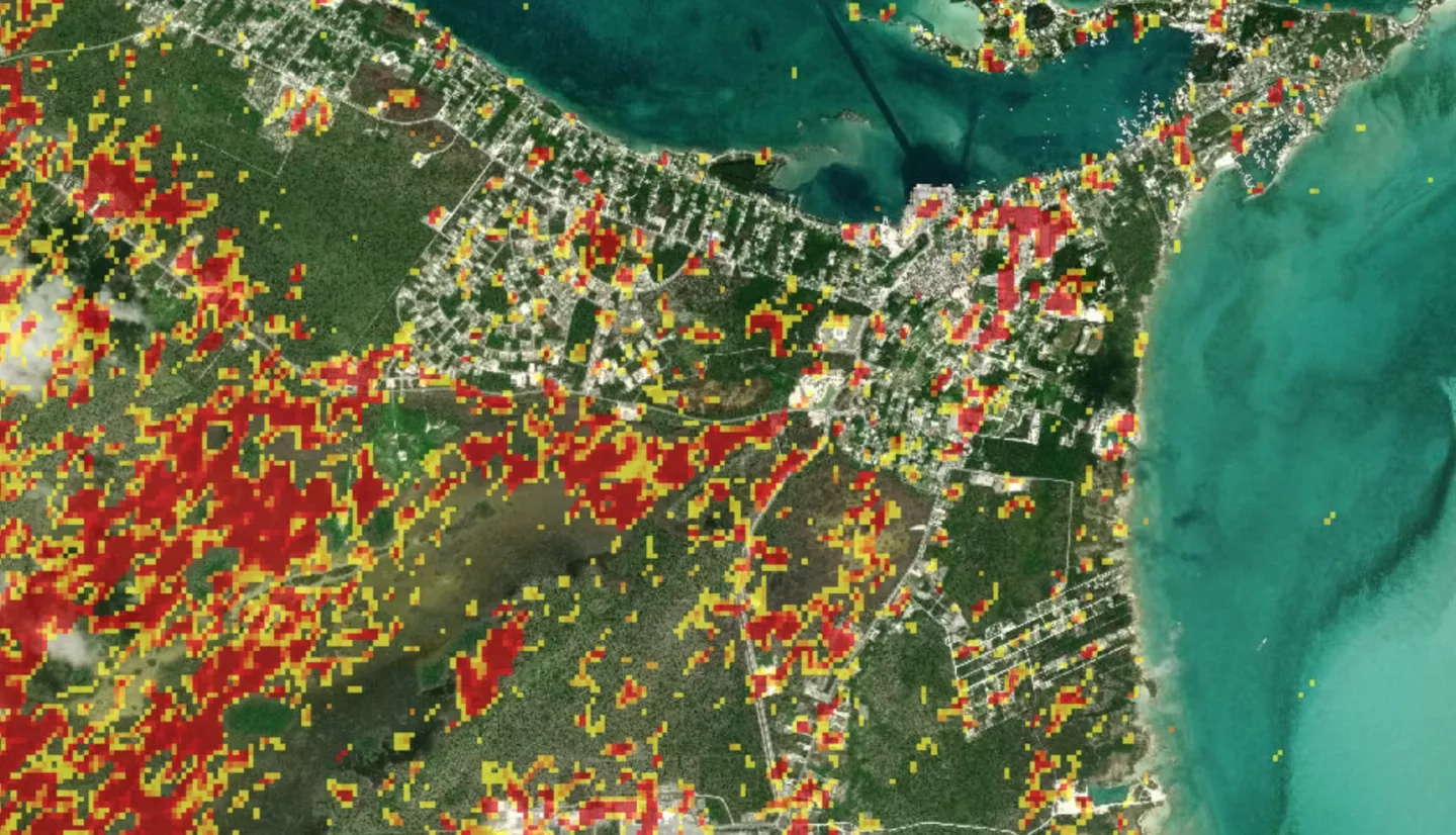
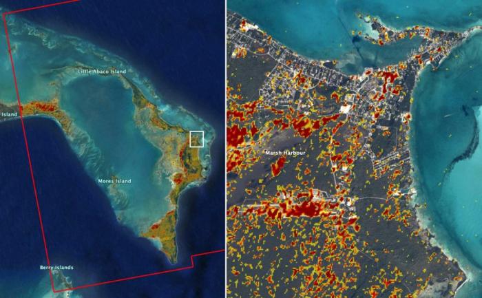
The new damage assessment map used satellite data from the European Union’s Sentinel-1 Copernicus instrument to identify areas (shown in red and yellow) that were likely most affected by the storm’s Category 5 winds and storm surge. The map was created by the Advanced Rapid Imaging and Analysis (ARIA) team at NASA’s Jet Propulsion Laboratory in collaboration with the European Space Agency, the California Institute of Technology and the Earth Observatory of Singapore.
This interactive map from the NASA Disasters Mapping Portal displays the ARIA Damage Proxy Map (DPM) data from September 2nd, 2019 for Marsh Harbour, a town in the Abaco Islands. Areas that are likely damaged from winds and storm surge are shown in yellow and red. The Abaco Islands are Bahamian islands and cays that form a 120-mile-long chain. Marsh Harbour is the commercial center of the Abacos. View more Hurricane Dorian products on the NASA Disasters Mapping Portal.
NASA’s Disasters Program has also been contacted by the Caribbean Disaster Emergency Management Agency for assistance in providing high-resolution flood maps. That agency’s disaster response teams are attempting to reach inundated areas, many of which remain inaccessible. This type of map will give Bahamian officials a better understanding of flood impacts and where the help is most urgently needed.


