NASA's Applied Remote Sensing Training Program (ARSET) is offering trainings specifically tuned for air quality professionals on how to make the transition from using the time-honored MODIS instrument to a new and different set of aerosol data.
MODIS stands for Moderate Resolution Imaging Spectroradiometer. This instrument, mounted on NASA's Terra and Aqua satellites, is responsible for one of the longest data records in our repertoire. For almost 20 years the MODIS instruments have been viewing the entire Earth every 1 to 2 days in 36 different spectral bands and 3 different spatial resolutions, before the images are collected at ground stations in White Sands, New Mexico and brought to your desktop.
Aside from being one of the longest data records available, the collection of MODIS data is also one of the most versatile. Deriving sea surface temperature, land surface temperature, vegetation health and aerosol concentrations are just a few of the capabilities of this sensor that has become one of the workhorses of Earth science. With the large spatial coverage and frequent revisit times, it is no wonder that MODIS has become an integral data source for scientists who study and monitor air quality.
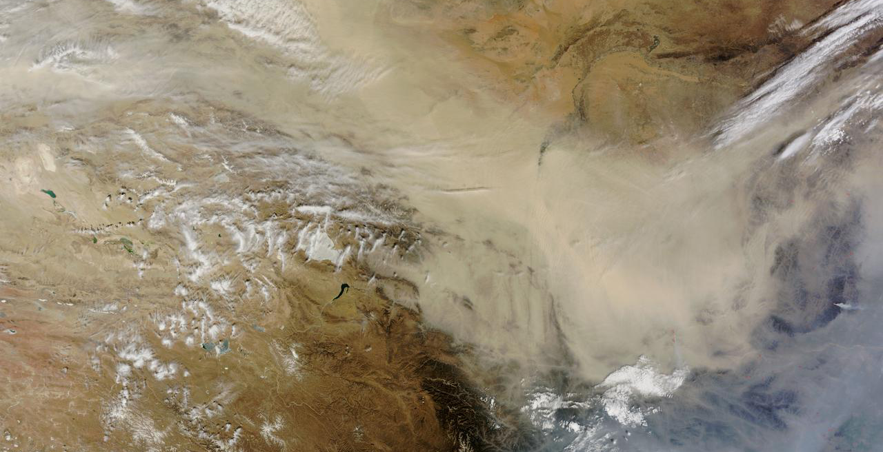
Image of a dust storm in the Gobi Desert captured by Terra MODIS. Credit: NASA Goddard
Nothing lasts forever, though. However useful, older satellite instruments are inevitably replaced with newer as technology advances. Enter VIIRS, the Visible Infrared Imaging Radiometer Suite. Launched aboard the Suomi NPP spacecraft in October 2011, VIIRS is capable of doing what MODIS does, only at higher spatial resolution (350m and 750m versus 500m and 1000m respectively).
Developed by Raytheon, VIIRS is part of system of satellites called the Joint Polar Satellite System (JPSS), a collaborative program between NASA and the National Oceanic and Atmospheric Administration (NOAA). This coordinated system of satellites allows us to view our planet holistically, taking into account a broad range of environmental variables with full global coverage twice a day. With the improvement in resolution, VIIRS is capable of picking up things that MODIS may have overlooked. This improved capability and coordination with other satellites makes the case for VIIRS carrying the torch into the future.
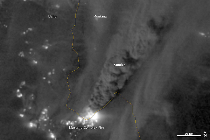
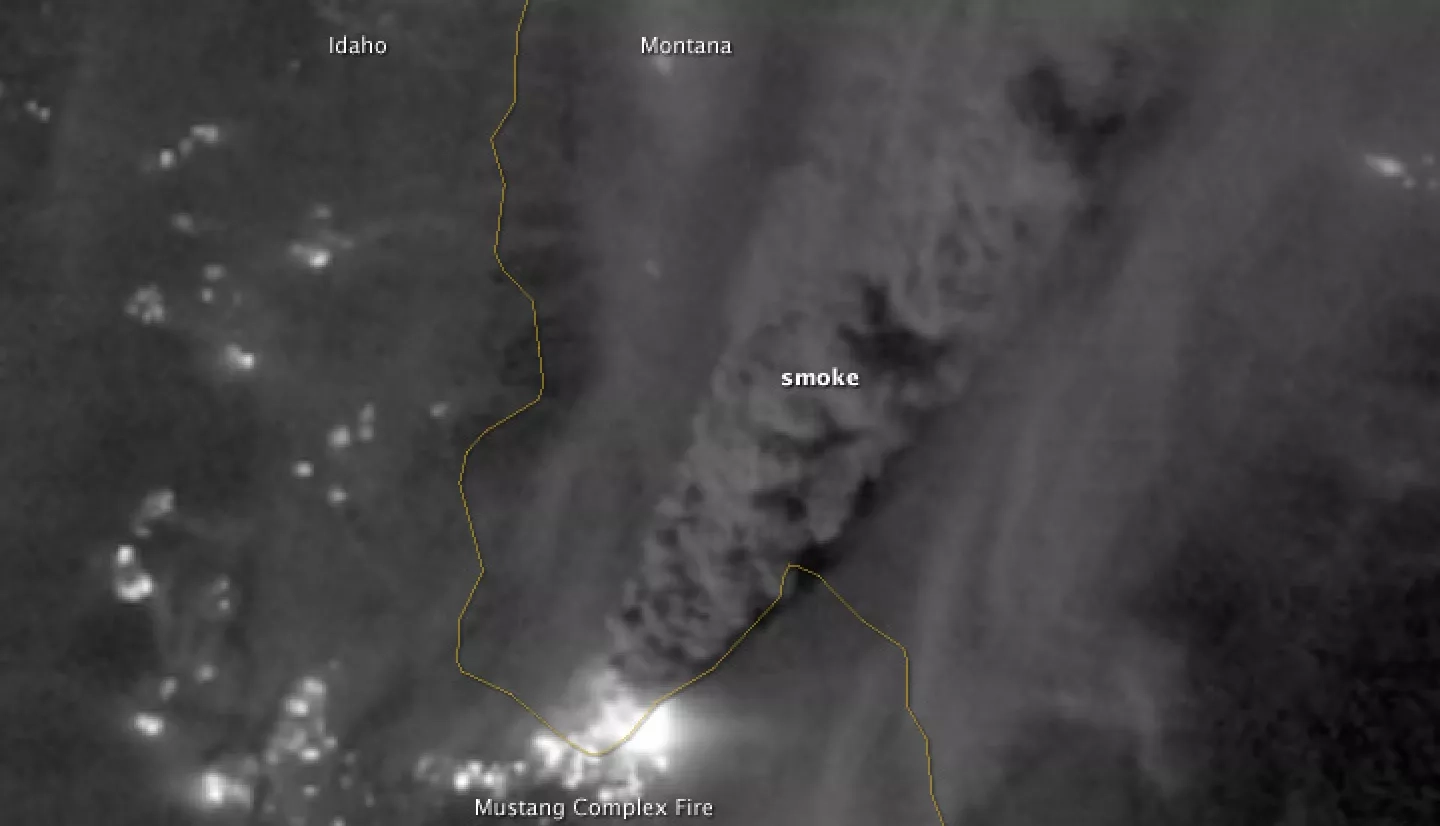
Nighttime image of the Mustang Complex Fires in Idaho captured by VIIRS in 2012. Credits: NASA Goddard
Making the switch requires a little bit of homework on the part of the user, though. Aside from differences in the way you download the data, the processing and analysis part will likely differ as well. Twenty years is certainly a long time to get set in your ways but making the switch does not have to be painful.
If you use MODIS for air quality applications, ARSET has already done the homework for you. We will be offering an advanced, online training on how to make the switch. The training, titled MODIS to VIIRS Transition for Air Quality Applications, will air on October 22nd. There will be two identical sessions, one in the morning (9:00 a.m. ET) and one in the afternoon (4:00 p.m. ET). Each session will run for an hour and a half and will cover data access, differences between MODIS and VIIRS aerosol data products and understanding how VIIRS-derived aerosol optical depth (AOD) can be used for modeling and monitoring air pollution transport.
This online training is tailored specifically for those interested in using VIIRS for air quality applications, but anyone interested can join in. Who knows, you might even learn something. As a matter of fact, if you already use MODIS you should probably just get this one out of the way. If you would like to attend, registration is free and open to the public. For details, visit appliedsciences.nasa.gov/arset.


