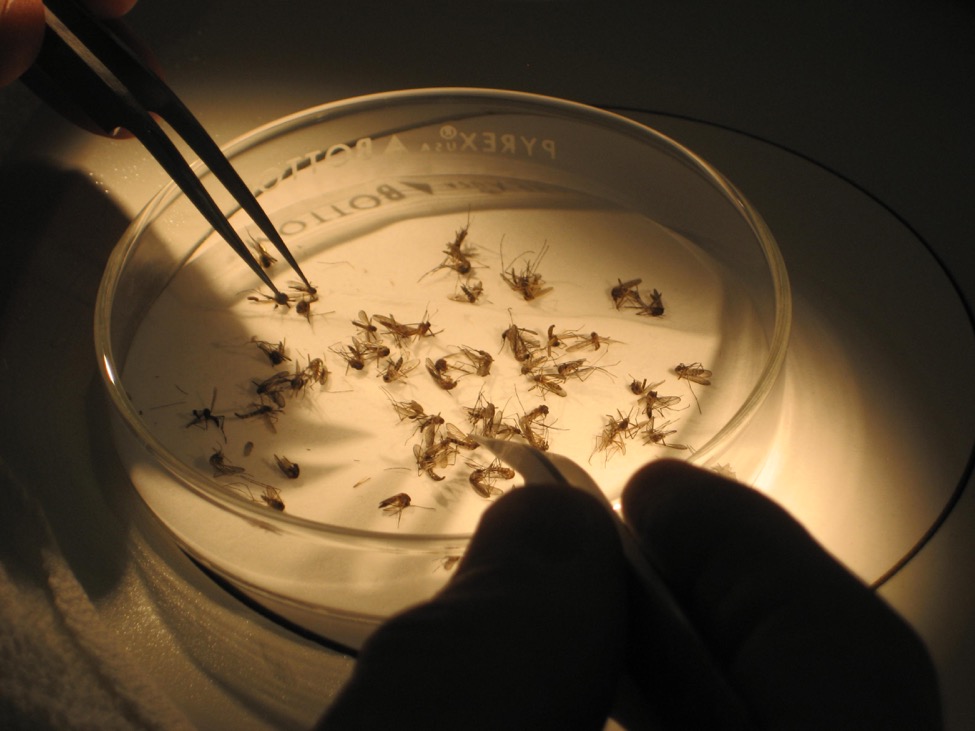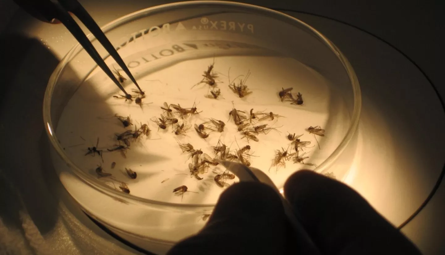
Each June, the American Mosquito Control Association promotes the National Mosquito Control Awareness Week, which aims to raise awareness about the threat that mosquitoes can pose to human health. It offers a platform to highlight efforts of mosquito control experts to help protect communities' health. NASA's Health and Air Quality program area took part to highlight how researchers can use NASA Earth observation data to help track mosquito habitats and predict the risk of disease transmission. We asked two program management staff about the value of NASA data applied to public health initiatives and four NASA-funded scientists about how they apply NASA data and resources to help communities stay safe.

NASA Health and Air Quality Applications for a Changing World
John Haynes – Program Manager, NASA Applied Sciences Program
Remote sensing by satellites can fill information gaps that on-the-ground analysis cannot capture. NASA satellite data, like local temperature and rainfall, can help assess environmental conditions and identify mosquito habitats. Researchers from NASA's Health and Air Quality program area are combining this information with field observation data and data from citizen scientists to examine environmental risks – like mosquito-breeding sites – in affected communities.
Using Satellite Data to Enhance One Health Networks
Helena Chapman – Associate Program Manager, NASA Applied Sciences Program
The "One Health" concept emphasizes the interconnectedness between human, animal and environmental health. Vector-borne diseases represent an estimated 17% of all communicable diseases, directly affecting human and animal health. By using NASA satellite data, technology and other resources to incorporate the "One Health" concept into vector control, this holistic approach can strengthen disease surveillance programs and communication among stakeholders and communities.

Thermodynamics and Mosquitoes: NASA's NextGen Remote Sensing
Jeffrey Luvall – NASA Marshall Space Flight Center, National Space Science and Technology Center
Global public health is entering a new informational age. NASA satellites can now measure "surface energy budgets" – the local temperatures at ground level – to understand what areas could be ideal for mosquitoes to thrive. Luvall's team uses a combination of NASA satellites, including the ECOsystem Spaceborne Thermal Radiometer Experiment (ECOSTRESS) and the Global Ecosystem Dynamics Investigation (GEDI) onboard the International Space Station to measure temperatures and track Earth's forests and topography. This next generation of NASA's remote sensing instruments will significantly improve scientists' ability to study mosquito life cycles and habitats, so public health officials can better understand where the risk of mosquito-borne illnesses may be greatest.

VectorSurv Gateway to Track the Spread of Mosquitoes
Chris Barker – University of California, Davis
VectorSurv stands for the "Vectorborne Disease Surveillance System," and it serves as a gateway to store, visualize and analyze mosquito surveillance data collected and managed by mosquito control and public health agencies. Launched in 2006 initially in California and now in a growing number of other U.S. states, VectorSurv now serves multiple states and territories, allowing each state to manage its own data and laboratory testing to inform mosquito-control policies. Barker's team helped incorporate NASA Earth observations into VectorSurv, which now includes data such as land-surface temperature information from NASA's Terrestrial Observation and Prediction System (TOPS) and NASA's North American Land Data Assimilation System (NLDAS). NASA data are used to estimate seasonal and spatial variation in mosquito reproductive potential and the risk for transmission of viruses such as Zika and dengue as a function of the viruses' incubation periods and mosquito survival.

West Nile Virus in South Dakota, Louisiana and Beyond
Mike Wimberly and Justin Davis – University of Oklahoma, Norman
Wimberly and his team support public health decision-makers in their efforts to control West Nile virus by monitoring environmental risk factors using data from NASA Earth-observing platforms. These include various instruments and satellites, like the North American Land Data Assimilation System (NLDAS), the Moderate Resolution Imaging Spectroradiometer (MODIS) and the Soil Moisture Active Passive (SMAP) satellite. Wimberly’s team, including Davis, developed the Arbovirus Monitoring and Prediction (ArboMAP) system for accurate, real-time prediction of human West Nile virus cases in South Dakota, relying on weather and mosquito data provided by NASA satellites and mosquito control districts. Recently, the scope of this project was expanded to include Louisiana, Oklahoma and Michigan – distinct environments from South Dakota – which will help the team prepare to study even more regions across the county. This information can help local officials better target mosquito control efforts across the state.

Malaria Early Warning System
William Pan – Duke Global Health Institute
In the Amazonian region of South America, the countries of Colombia, Peru, Ecuador and Venezuela have experienced a resurgence in malaria, attributed to challenges like climate change and the expansion of mosquito habitats. To inform malaria control policies, Pan's team developed a Malaria Early Warning System for Peru, which is capable of forecasting malaria outbreaks up to 12 weeks in advance. Pan's team uses multi-layered data from NASA's Land Data Assimilation System (LDAS), human population density, and weekly malaria surveillance to forecast both the incidence of malaria and probabilities of an outbreak (as defined by the local Ministries of Health). The team is working with the Peruvian Centers for Disease Control and the Ecuadorian Ministry of Public Health to train and implement the system locally.