Since December 28th, 2019 the island of Puerto Rico has been affected by a series of hundreds of small earthquakes, which culminated in a powerful 6.4 magnitude earthquake on the morning of Tuesday, January 7th (Source: https://www.usgs.gov/news/magnitude-64-earthquake-puerto-rico) This Tuesday earthquake caused widespread damage to infrastructure in a region that is still recovering from the effects of 2017’s Hurricane Maria, leaving more than 2,000 people in shelters, nearly 1 million without power and hundreds of thousands without water.
The NASA Earth Applied Sciences Disasters Program has activated a “Tier 1” response to the earthquakes in Puerto Rico, which entails collecting information and coordinating with stakeholders and university partners. The program is participating in inter-agency calls with federal agencies leading the response effort including the Federal Emergency Management Agency (FEMA), the United States Geological Survey (USGS) and the U.S. Department of Health and Human Services (HHS), along with the Earthquake Engineering Research Institute, to provide NASA Earth-observing data in support of the response and recovery for this disaster.
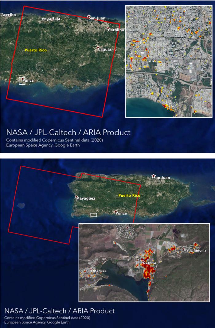
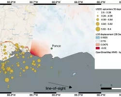
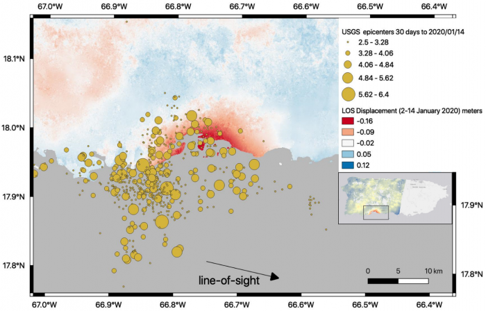
Estimating Surface Displacement and Damage
Several data products in support of the earthquake have been published in geographic information system (GIS) format on the NASA Disasters Mapping Portal, which allows the data to be more easily ingested and analyzed by other agencies and researchers. The Advanced Rapid Imaging and Analysis (ARIA) team at NASA's Jet Propulsion Laboratory and California Institute of Technology in Pasadena, California, have used Synthetic Aperture Radar (SAR) data from several recent European Space Agency-operated (ESA) Copernicus Sentinel-1 satellite overpasses of the region to identify potential damage to structures and displacement of the surface. Damage Proxy Maps can be used to identify damaged structures (Image 1), and displacement maps (Image 2) show shifts in land surface due to the tectonic activity. Learn more about these products here: https://www.jpl.nasa.gov/news/news.php?feature=7573
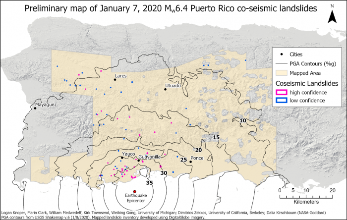
Mapping Landslides
Scientists have conducted preliminary mapping of landslides inferred to have occurred during the period of strong ground shaking related to the January 7th Mw6.4 earthquake. One hundred twenty landslides were mapped and are widely dispersed across the affected area, with the highest concentration in the southwestern portion of the island, nearest the epicenter. This data has been posted at the NASA Disasters Mapping Portal. The landslide team is coordinating directly with the USGS Landslide Hazard program to provide relevant information for site analyses and assessments.
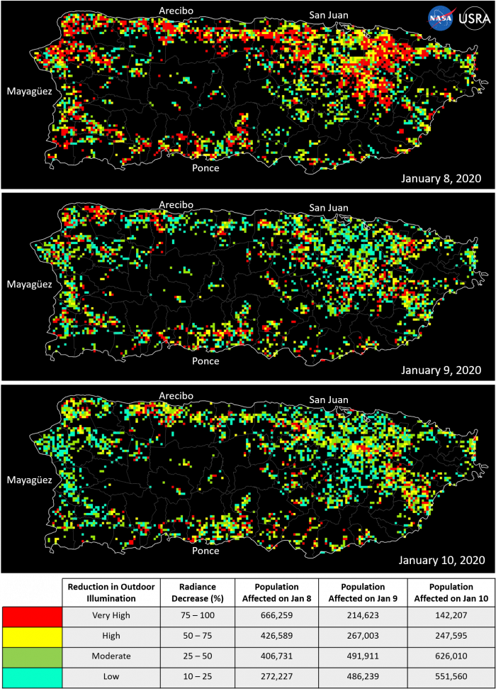
Assessing Power Outages and Recovery Efforts
Scientists at University Space Research Association (USRA) collaborating with NASA have used the NASA-NOAA Suomi NPP data to assess power outage maps based on day-night-band data. These “Black Marble” maps are being provided to FEMA Region II’s Geospatial Resource Center by USRA’s Earth from Space Institute (EfSI), and are being used to inform response efforts on the ground. Learn more about these products here: https://www.usra.edu/black-marble-data-shows-puerto-rico-at-night-after-....