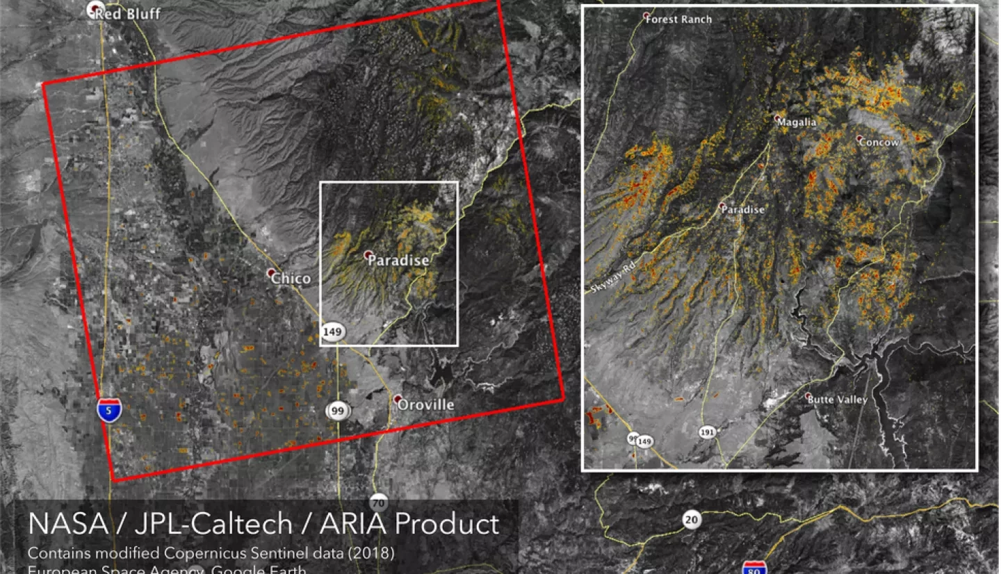
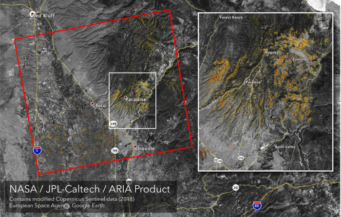
Monday, November 12, NASA shared enhanced satellite map images featured above of the Camp Fire in Northern California and The Woolsey Fire in Southern California. These images are called Damage Proxy Maps. The yellow and red spots show changes to the grounds surface, with red indicating more severe fire damage. "Although the maps may be less reliable over vegetated terrain, like farmland, they can help officials and first responders identify heavily damaged areas and allocate resources as needed," NASA says. The Camp Fire north of Sacramento wiped out the town of Paradise and is responsible for at least 48 deaths, making it the deadliest in the state's history. The Woolsey Fire near Los Angeles has claimed at least two lives and burned through the community of Malibu, claiming the famous Paramount Ranch movie set in the process.


