The word sentinel stems from the Old Italian words sentina, meaning "vigilance," and sentire, "to hear or perceive." As the Sentinel-6 Michael Freilich satellite soars to orbit in late November 2020, it will soon be easy to see just how apt “sentinel” describes it. The spacecraft, which is about the size of a small pickup truck, carries the latest advanced instruments to collect the most accurate global data yet on sea level and its changes over time.
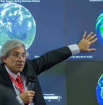
NASA’s Earth Applied Sciences Disasters Program uses Earth-observing satellites to help scientists and decision-makers improve prediction of, preparation for, response to, and recovery from disasters, including floods, hurricanes and tsunamis. Sentinel-6 Michael Freilich’s mission will augment the agency’s flood preparedness and response capabilities which include satellite observations, data systems, and modeling capabilities.
Sea rise is a crucial indicator of how Earth's climate is changing. Sentinel-6 Michael Freilich and the follow-on mission of its twin, Sentinel-6B, will add more than a decade of observation data to a nearly 30-year observation dataset that helps researchers understand our home planet.
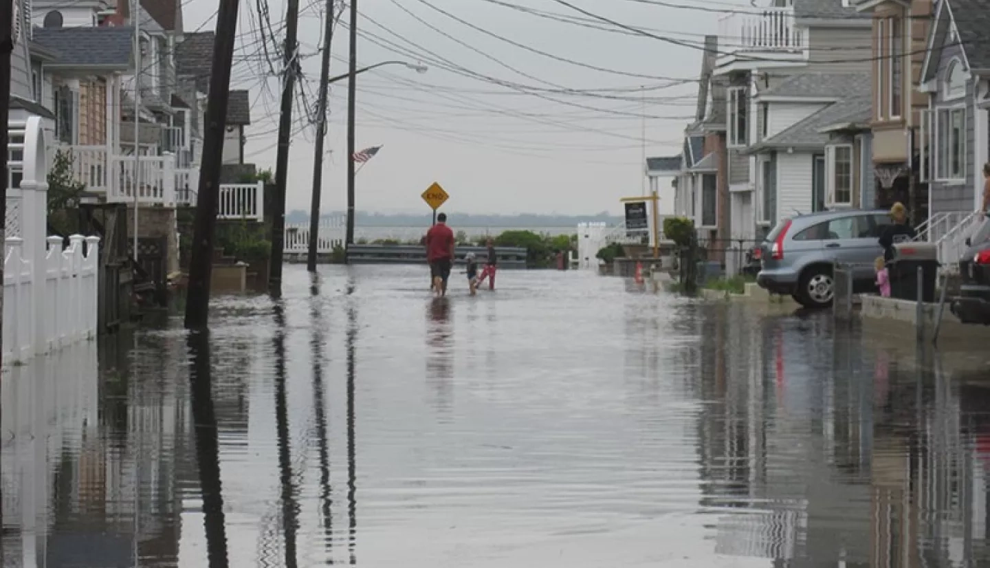
More than 200 million people live near coastlines and low-lying areas around the world. While architects and planners in coastal regions can design and build cities to protect against flooding, sea level rise has caused that buffer to shrink. Even 'blue-sky" flooding – where water seeps into septic systems and onto parking lots and roads on sunny days – is becoming more common. That can delay first responders when speed matters most. Rising seas also worsen the impact of coastal flooding from storms, damage coastal habitat, and disrupt economies worldwide.
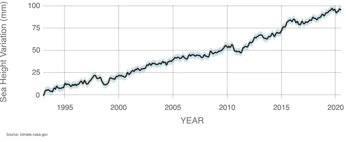
Sea levels currently rise globally at a rate of more than 0.13 inches (3.3 millimeters) per year. At first glance, a few millimeters of sea rise per year may not seem like a cause for immediate concern, but it isn't a problem to set aside for the future. When combined with sinking lands and the increasing occurrence of disasters and storm surges, those millimeters add up to cause concern for many areas worldwide.
According to a 2018 NOAA report, high-tide flooding along the Northeast Atlantic coast in the U.S. doubled between 2000 and 2015 – from an average of three days per year to six. On the East Coast and Gulf Coast, the frequency is up by roughly 200% over the last 20 years. NOAA projects that without additional flood management efforts, tidal flooding frequency will double or triple by 2030 and could be as much as 15-fold higher by 2050.
“It’s not just scientific curiosity,” says Ben Hamlington, a research scientist at NASA’s Jet Propulsion Laboratory who leads the agency’s Sea Level Change team. “It really impacts the daily lives of people and their ability to plan for their future.”
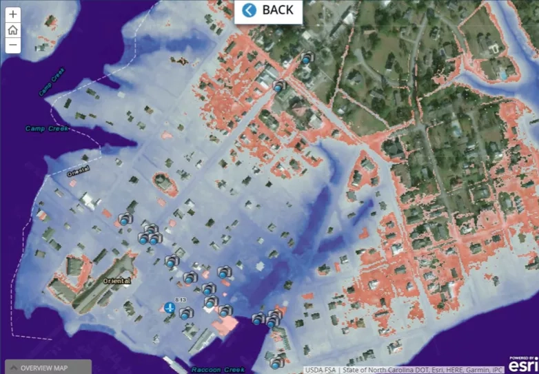
Increasing sea level, coupled with severe storms, associated storm surges, and land subsidence, leave coastal communities particularly vulnerable. As part of the effort to improve such communities' resilience, NASA's Disasters Program leads an initiative called Communities and Areas at Intensive Risk (CAIR). CAIR brings together academia, emergency management, scientists from NASA, and other federal agencies to learn how to use remote sensing and modeling. One area of the program focuses specifically on coastal risk and resilience, including a mid-Atlantic CAIR project that demonstrated the ability to integrate Earth observations, in-situ data and physical models into actionable, trusted knowledge.
Understanding the physical processes behind natural hazards and the potential impact that specific threats may bring to particular communities is central to effective decision-making for disaster preparedness, response and recovery. Sentinel-6 Michael Freilich will contribute to datasets that help coastal residents plan new roads, update building codes, retrofit vulnerable structures, protect electrical grids and networks, and more clearly understand and communicate the risks of tropical storms, hurricanes and tsunamis.
Once in orbit, Sentinel-6 Michael Freilich will collect sea level measurements down to the centimeter for 90% of the world's oceans. The spacecraft also carries an array of instruments that will help improve weather forecasts by providing meteorologists new information on atmospheric temperature and humidity. The satellite’s radar altimeter will collect measurements of sea surface conditions, including significant wave heights. Data collected by the GNSS-RO instrument will complement existing observations of the atmosphere.
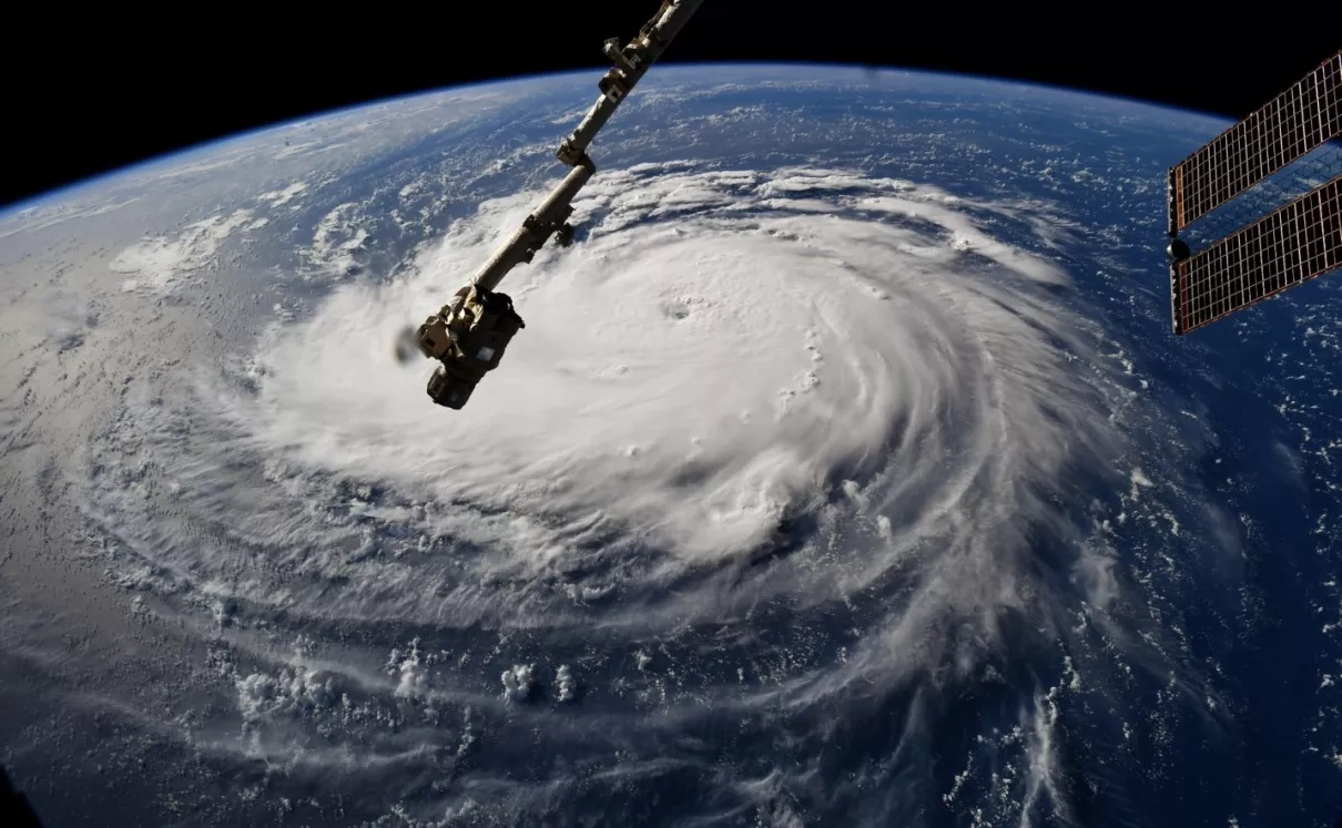
Researchers will also have the ability to track features such as small coastal currents and eddies that pinch off from larger currents, such as the Gulf Stream. Those eddies can be several degrees warmer than the surrounding ocean, serving as fuel for hurricanes. Moreover, information on the temperature and humidity of the atmosphere and the temperature of the sea's upper layer will help improve models that track the formation and evolution of dangerous weather.
Sentinel-6 Michael Freilich’s high-resolution capabilities mean that scientists will be able to monitor the ocean closer to coasts than they could with previous sea level missions. Data from the spacecraft will support a continual improvement of physics-based hydrodynamic models, which help predict where and when flooding will happen and how long it will take for waters to recede. Maps derived from these models help disaster managers and responders know which roads to close to keep their communities safe.
The second part of the satellite's moniker, "Michael Freilich," is just as fitting as its "sentinel" designation. As the former director of NASA's Earth Science Division, Michael Freilich dedicated his career to better understanding the Earth. Understanding leads to insight, and insight leads to informed decisions that can ultimately save lives.
Under Freilich's leadership, NASA established cutting-edge programs to use small satellites and payloads hosted on commercial satellites to advance Earth science research and demonstrate new technologies. Freilich also pioneered the International Space Station's broad use as a platform for Earth-observing instruments, a unique observing platform for the Earth system. Because the space station passes over locations on Earth at different times of day and night – and under varying illumination conditions – that capability has become especially important for collecting imagery of unexpected natural hazards and disaster events such as volcanic eruptions, earthquakes, flooding and tsunamis.
Freilich made increasing awareness and collaboration with the international scientific community a priority over his nearly four-decade career. "Earth Science shows perhaps more than any other discipline how important partnership is to the future of this planet," said Thomas Zurbuchen, associate administrator for NASA’s Science Mission Directorate. "Mike exemplifies the commitment to excellence, generosity of spirit and unmatched ability to inspire trust that made so many people across the world want to advance big goals on behalf of our planet and all its people by working with NASA.” Michael Freilich's legacy is honored through not only the name of a new spacecraft but through the ongoing commitment of NASA to forge relationships throughout the world with organizations that share a goal of understanding and protecting our home planet.
Shortly after launch, the public can follow the Sentinel-6 Michael Freilich at: https://climate.nasa.gov/earth-now/#/


