Published
Rewrapped Sentinel-1 Interferogram for the M7.2 Pinotepa de Don Luis, Mexico earthquake from Feb 16, 2018.
Ascending Sentinel-1 SAR interferogram rewrapped to 10cm color contours of line-of-sight surface deformation. The frame was processed automatically by the UAF SARVIEWS processing service (http://sarviews-hazards.alaska.edu/). Sentinel-1 data from 02/05/18 and 02/17/18 was used. Contains modified Copernicus Sentinel data [2018]. Data accessed through the Alaska Satellite Facility.
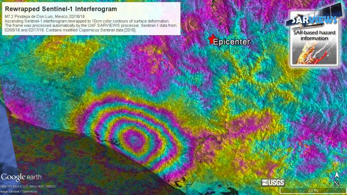
Information was available for public download within 24 hours of event. Intererograms show surface deformation and can be used to estimate damage and shaking during event. Image products can be used for damage assessment.


