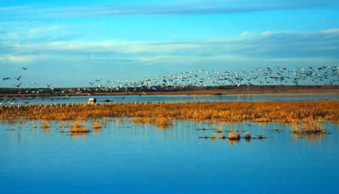
Almost half the birds that migrate along North America’s Central Flyway make a stop at the Cheyenne Bottoms Wildlife Area in Kansas. Cheyenne Bottoms is a popular outdoor destination and an invaluable wildlife oasis that covers nearly 20,000 acres of marshland.
The marsh occasionally sees variations in its sediment content and water levels, but when these become more dramatic or prolonged, it raises concerns for the marsh’s management team. In 2013, a NASA DEVELOP project partnered with Cheyenne Bottoms managers to show how imagery from space could assist in its management and conservation strategies. “Our primary management effort at Cheyenne Bottoms is aimed at slowing or stopping succession of the marsh,” said Karl Grover, the area's field supervisor. Succession is the gradual process by which ecosystems change or degrade over time.
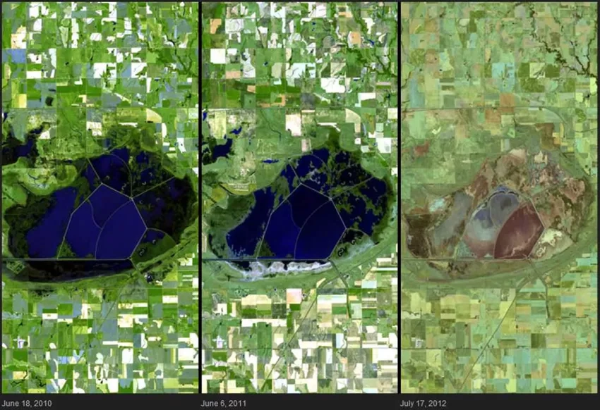
One of Cheyenne Bottoms's biggest ecological management undertakings in recent years was in the 1990s, when managers divided the marsh into five pools connected by dikes and canals. “The reason,” Grover said, “was to allow for placement of water in smaller pools when available water was in short supply. This reduces surface area, and therefore [reduces] evaporative loss and hopefully extends the period that wetland habitat is provided in the basin – even if on a limited basis.”
DEVELOP is a NASA Earth Applied Sciences Program that builds interdisciplinary partnerships focused on addressing environmental and other Earth science issues affecting society. The team used data from Earth-observing satellites and created two new maps of the area. The first was of different classes of landcover, which helps show areas of the marsh at the highest risk of changing or degrading. The second map was of water clarity. Silt and other particles can become suspended or dissolved in the water, causing the water to appear cloudy. This condition is known as turbidity – and high levels of turbidity can harm fish and other aquatic life by reducing the water’s dissolved oxygen and raising water temperatures.
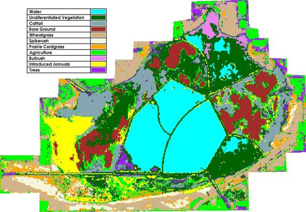
For monitoring turbidity, the team used satellite imagery to track the marsh’s overall water clarity on a seasonal and annual basis. To determine landcover and track the health of the marsh the team tapped into imagery that categorized 11 classes of landcover.
“Utilizing NASA Earth-observing systems … will allow Cheyenne Bottoms's management to better preserve their wetland habitat and provide a sustainable destination for migrating birds, local wildlife and outdoor enthusiasts.”
– Amanda Bordeaux, NASA DEVELOP
“The end product provided to the partner was a time series of maps showing changes in ground cover,” said NASA DEVELOP team member Tiffani Ome. “Comparing these maps will aid in assessing the effectiveness of their current management practices by showing areas of Cheyenne Bottoms that are experiencing vegetative change.”
One example of that vegetative change is the threat of a non-native plant, the wetland reed Phragmites australis. “Phragmites, an invasive species, is rapidly becoming the biggest challenge, as it is worse than cattail for spreading and diminishing habitat diversity,” Grover said.
Luckily, the maps showed that invasive species like Phragmites were dominating fewer areas of the marsh than previous years, especially in areas where Cheyenne Bottoms management focused its efforts – a good indication that conservation efforts were working.
DEVELOP team member Amanda Bordeaux stressed that this project is now giving Cheyenne Bottoms a more complete picture of this valuable ecosystem. “Utilizing NASA Earth-observing systems ... will allow Cheyenne Bottoms’s management to better preserve their wetland habitat and provide a sustainable destination for migrating birds, local wildlife and outdoor enthusiasts.”
This story is part of our Space for U.S. collection. To learn how NASA data are being used in your state, please visit nasa.gov/spaceforus.


