
The Texas Commission on Environmental Quality (TCEQ) is looking to the clouds to help keep the air above the second-largest state clean. Specifically, TCEQ wants to know when and where clouds will form over the state to help improve the accuracy of its air quality forecast models. These models give Texas air management officials the guidance they need to comply with the Environmental Protection Agency’s (EPA) Clean Air Act – a federal mandate that requires states to reduce and control certain harmful emissions and pollutants.
Clouds have a complicated relationship with air pollution and air quality. These floating masses of condensed water vapor can affect the mixture of gasses and particulates in the air, air and ground temperature, wind speed and direction, and humidity levels. All of those can vary according to the vertical and horizontal size of the clouds, as well as the time it takes them to form, move and dissipate.
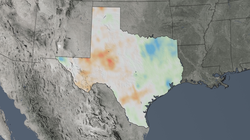
Although scientists have long known about the complex relationship between clouds and air quality, it has been difficult to get accurate cloud simulations in air quality models. Getting the cloud component wrong can throw off the whole simulation, producing results that aren’t applicable in real-world scenarios. Poor simulations mean Texas could end up spending money to control emissions that aren’t really a problem, while harmful emissions may remain overlooked.
Now, improvements in cloud-gazing are helping Texas comply with the Clean Air Act, thanks to a joint project with NASA and the EPA. TCEQ partnered with a team of scientists led by principal investigator Arastoo Pour Biazar from the National Space Science and Technology Center at the University of Alabama in Huntsville. Despite being headquartered in Huntsville, Biazar’s air pollution simulations have covered many areas in the United States.
Biazar and his team used data from Earth-observing satellites to help correct the timing and placement of clouds in air quality simulations. This more accurate cloud information is critical because clouds can impact air quality in numerous ways. For example, clouds reduce the amount of sunlight hitting Earth’s surface, which in turn can impact pollutants like ground-level ozone – a key component of smog.
Ground-level ozone is formed from a chemical reaction between sunlight and the pollutants in the air. However, the presence of cloud cover can impact this reaction. “Clouds not only inhibit ozone production, they can also result in a net reduction of ozone [in certain areas],” Biazar said.
“A major concern for air quality managers, such as TCEQ, is to have confidence in their model results. While it is very difficult to estimate the cost savings … the decisions made based on these model simulations cost the state billions in direct and indirect costs.”
–Arastoo Pour Biazar, National Space Science and Technology Center
TCEQ is now using the improved air quality model to support Texas’s State Implementation Plan (SIP) to comply with the Clean Air Act. In particular, TCEQ submitted a SIP revision for the Houston/Galveston metro area in 2016 that used the results from Biazar’s project to address updated ground-level ozone standards set by EPA.
“While it is very difficult to estimate the cost savings … the decisions made based on these model simulations cost the state billions in direct and indirect costs,” Biazar remarked. “A major concern for air quality managers, such as TCEQ, is to have confidence in their model results. Reducing the errors of cloud impacts on air pollution gives air quality managers increased confidence that their model is robust and, perhaps, leads them to a decision with significant savings for the state.”
Everything may be bigger in Texas, but this improved air quality data from space will help keep the effects and expense of air pollution from being one of them.
This story is part of our Space for U.S. collection. To learn how NASA data are being used in your state, please visit nasa.gov/spaceforus.


