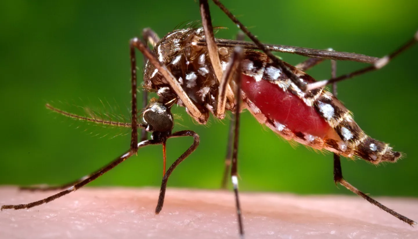
Mosquitoes flourish in warm, wet conditions. Most of the time, their bites are just a nuisance, but they can spread harmful diseases to humans such as malaria, West Nile and Zika.
To reduce the risk of these diseases, NASA scientists are working with local governments, doctors and public health officials, even pest control companies – all to find new and innovative ways of combating mosquitoes. By modeling and forecasting potential disease outbreaks across geographic areas, they are combining satellite data of diverse environmental factors, such as temperature, soil moisture and precipitation, with data on human factors, like population density in villages and traveling across borders. These new, comprehensive views of entire ecosystems can provide new information that national and local authorities can apply to environmental health initiatives that aim to mitigate risk of exposure to mosquitoes and the diseases they may transmit.
Zapping Zika & Sentinel Chickens
California's central surveillance laboratory for mosquito-borne diseases is at the Barker Laboratory, located at the University of California, Davis. Funded in part by the Health and Air Quality Applications area of NASA Earth’s Applied Sciences, Chris Barker and his team are critical members of California's response to monitoring two mosquito species that can spread the Zika virus, Aedes aegypti and Aedes albopictus.
Barker and his team contribute to the California Vectorborne Disease Surveillance System (CalSurv). The project includes data from NASA satellites, public health reports and even 'sentinel chickens.' Via regular blood tests, more than six dozen chickens living in coops around California serve as an early warning system for the spread of West Nile virus. Barker and his team use data like these as well as NASA satellite data, such as precipitation observations from the Global Precipitation Measurement mission (GPM), land cover/land use data from the Landsat satellites, as well as vegetation data from the Moderate Resolution Imaging Spectroradiometer (MODIS) aboard NASA's Terra and Aqua satellites and the newer Visible Infrared Imaging Radiometer Suite (VIIRS) aboard the Suomi National Polar-orbiting Partnership (Suomi NPP) satellite. Combining both satellite and ground data allows Barker and CalSurv to continue to monitor the potential risk of Zika transmission.
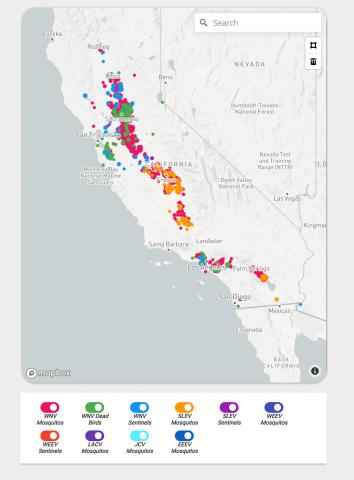
CalSurv began as a partnership with the California Department of Public Health, the Davis Arbovirus Research and Training (DART) Lab at the University of California, Davis, and the Mosquito and Vector Control Association, which is comprised of 60 local mosquito and vector control agencies in California. The technique is now moving beyond California, where it is being used in Europe as well as in Utah, New Jersey and the U.S. territory of Guam.
Mapping Malaria in the Amazon
Containing malaria outbreaks in the Amazonian Rainforest is particularly difficult because it is challenging to identify the specific locations of frequent disease transmission. People may be bitten by malaria-infected mosquitoes (Anopheles spp.) while away from home working in the deep forest, but they do not show clinical symptoms until they return home and seek medical care at their local health center. As a result, public health officials' response to control malaria-laden mosquitoes, like the deployment of preventative insecticide-treated bed nets and indoor sprays, may be distributed to areas with low incidence rates of malaria instead of where they are actually needed.
Now, with funding from the Health and Air Quality Applications area of NASA's Earth Applied Sciences, the Peruvian government is collaborating with researchers to use NASA satellite data to track the human and environmental events that precede an outbreak.
In the Peruvian Amazon, the Anopheles darlingi mosquito is most responsible for spreading malaria. Scientists are turning to the agency’s fleet of Earth observing satellites to develop a system that uses satellite and other data to help forecast malaria outbreaks months in advance and prevent them from happening. Credits: NASA's Goddard Space Flight Center/Joy Ng Predicting Malaria Outbreaks with NASA Satellites
William Pan of the Global Health Initiative at Duke University in Chapel Hill, N.C., and Ben Zaitchik of Johns Hopkins University's Department of Earth and Planetary Sciences in Baltimore, Md. lead the development of this regional-based statistical model to identify malaria hotpots. They combined population estimates, predictions about travel behaviors based on seasonal migration studies, and data from NASA's Land Data Assimilation System (LDAS), which includes provides inputs from NASA's GPMmission and Terra, Aqua and Landsat satellites. Using real-time precipitation, temperature, soil moisture and vegetation data, their work results in better predictions about high-risk environmental regions that favor mosquito habitats.
Testing a Space-Based Surveillance and Response System
There is a vast amount of data and research conducted worldwide on all aspects of mosquito-borne diseases. The sheer quantity and diversity of work means that it is difficult to organize the information in an easily accessible way, where all stakeholders in the network understand the technical language. That is why the Health and Air Quality Applications area of NASA Earth’s Applied Sciences supports an initiative to bring this information together. It focuses on the health and societal benefits as organized by a global network of governments, organizations and observers called the Group on Earth Observations (GEO). Part of the Global Earth Observation System of Systems (GEOSS), their estimated 400 million open data resources come from more than 150 national and regional providers such as NASA, the European Space Agency, international organizations such as the World Meteorological Organization and the commercial sector such as Digital Globe.
One EO4HEALTH project is led by John Malone of Louisiana State University in Baton Rouge, LA. The project focuses on providing databases and templates as well as creating standard operating procedures and tutorials for using online data access and analysis capabilities. It includes data from the newest NASA Earth satellite missions, like the ECOsystem Spaceborne Thermal Radiometer Experiment on Space Station (ECOSTRESS), installed onboard the International Space Station in 2018 and NASA's Soil Moisture Active Passive (SMAP) satellite. An initial target of the project is a surveillance and response system for viruses like Zika and others carried by Aedes aegypti mosquitoes in Latin America. By beginning here, Malone's goal is to create an infrastructure that gives scientists worldwide access to open data resources and appropriate training on how to use these resources for their own research mapping and modeling of mosquito-borne diseases.
Malaria Prevention in Myanmar
The warm, humid climate and dense forests of Myanmar make this Southeast Asia country a mosquito paradise. Myanmar is also one of five countries where there are documented cases of the malaria-causing Plasmodium organism being resistant to the established artemisinin-based combination therapies.
To reduce disease transmission and forecast malaria hotspots, Tatiana Loboda of the Geographical Sciences Department at University of Maryland, College Park, Md. and her team are developing the Myanmar Malaria Early Warning System (MMEWS). Supported by the Health and Air Quality Applications area of NASA Earth’s Applied Science, they are moving the satellite-based malaria forecasting beyond the narrow scope of monitoring and forecasting and including information on the human population, like density and socio-economic status.
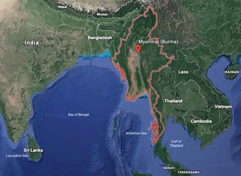
The result is a gauge of a particular area's malaria burden potential, which can serve as a guide for both malaria treatment and elimination activities. It also focuses on observations of environmental changes within target areas rather than indiscriminately across entire regions. For example, this early warning system is creating "base maps" that show different types of bodies of water as identified from microwave sensors, optical data and satellites like Landsat. Local officials and representatives from the United Nations World Health Organization then use these maps to track the spread of artemisinin-resistant malaria within the population.
South Dakota West Nile Virus
Despite having a cool climate and being rather sparsely populated, South Dakota is a persistent hot spot for West Nile virus in the United States due to the increased presence of the Culex tarsalis mosquito species. It prefers cooler temperatures, lays its eggs directly on the surface of standing water and is effective at carrying and transmitting the virus that causes West Nile. Michael Wimberly and his team are developing an early warning system for human West Nile virus in a project supported by the Health and Air Quality Applications area of NASA Earth's Applied Sciences. Wimberly is formerly of South Dakota State University and is now with the University of Oklahoma, in Norman, Okla.
Before scientists identified West Nile virus in the United States in 1999, people generally believed Culex tarsalis to be one of the more harmless mosquito species. They may be more prevalent in South Dakota now due to increased development like office parks and homes that include reservoirs, standing water or other poorly drained soils. Working with the South Dakota Department of Health, Wimberly and his colleagues are supporting public health decision makers in their testing for West Nile virus by monitoring environmental risk factors from NASA Earth observing missions like the North American Land Data Assimilation System (NLDAS) and the SMAP satellite. By tracking daily weather, long-range weather forecasts, mosquito infections and human West Nile virus cases, Wimberly's team developed the computer code for the Arbovirus Monitoring and Prediction (ArboMAP) system. This early warning system combines meteorological data access via Google Earth Engine and is currently being applied to predict outbreaks in both South Dakota and other neighboring states.


