Researchers with the U.S. Department of Veterans Affairs (VA) are using NASA Earth observations of smoke and other air pollution to study the health impacts on veterans who were deployed to Afghanistan, Iraq, and other areas of Southwest Asia in the years after September 11, 2001. Military personnel who were deployed in these regions are at risk for developing respiratory problems due to exposures to particulate matter, smoke, and fumes from burn pits, dust storms, and other sources.
Working with VA, NASA-funded researchers created an online research resource that compiles NASA satellite data on air pollution around specific military bases. Eric Garshick, a pulmonary physician at VA Boston, said the resource will be used to conduct research to assess associations between medical conditions and exposures encountered during deployment and ultimately help medical researchers identify affected veterans.
“It’s important to our efforts to understand and help address the risk our veterans face not just from combat, but from the conditions in which they served,” Garshick said.
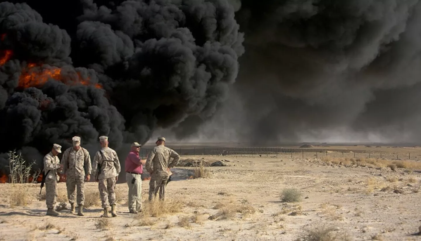
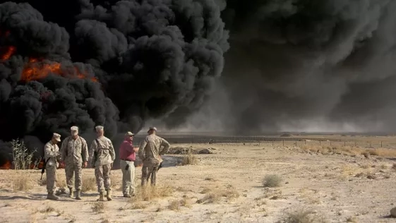
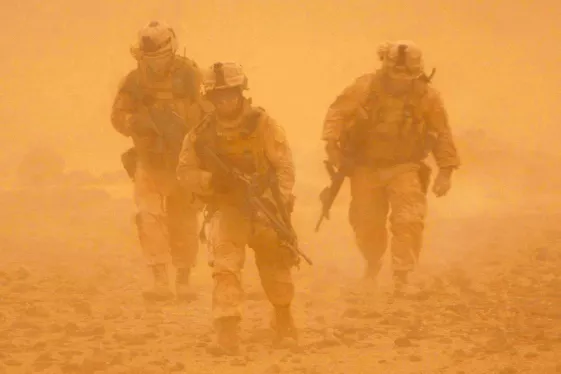
During the wars in Iraq and Afghanistan, some soldiers and support staff endured high concentrations of air pollutants. For example, military units often burned trash in large, open pits. The trash ranged from human and medical waste to plastics, chemicals, and mechanical parts. Most military personnel also faced exposure to fine dust from desert dust storms. NASA Earth science data can help identify such chemical and dust pollution and where it originated.
“It’s a unique opportunity to be able to use NASA Earth observations to study ways we can improve veterans’ health,” said Meredith Franklin of the University of Toronto. Franklin is the principal investigator for the project, which was a collaboration with the VA and Petros Koutrakis of the Harvard T.H. Chan School of Public Health. The project was funded by NASA’s Earth Applied Sciences Health and Air Quality program area.
A New Tool for Veterans’ Health
Franklin’s team used satellite observations to create an exposure assessment tool called the Source-Differentiated Air Quality System (SDAQS). This web-based tool produces air quality information about each military base in a format that allows researchers at the VA and other institutions to directly access it through visualizations and data downloads.
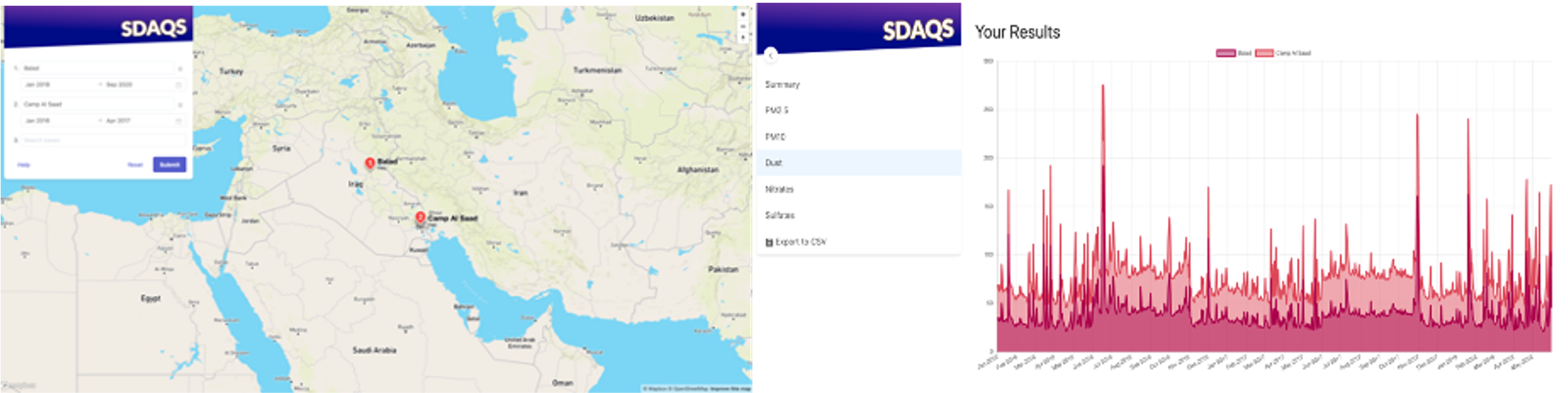
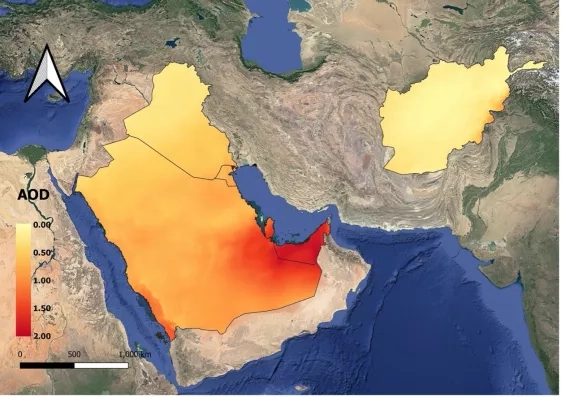
SDAQS includes data on the air pollutant PM2.5, inhalable particles that are generally 2.5 micrometers or smaller – small enough to move deep into the lungs and respiratory tract. The data come from NASA’s Multi-Angle Implementation of Atmospheric Correction (MAIAC) algorithm, which was used by the team to derive measurements of average PM2.5 concentrations based on data collected by the Moderate Imaging Spectroradiometer (MODIS) instruments on NASA's Terra and Aqua satellites.
The SDAQS exposure assessment tool also integrates data from NASA’s Multi-angle Imaging SpectroRadiometer (MISR), which allows researchers to distinguish the sources of specific pollutants. For example, MISR can estimate concentrations of desert dust and of pollution from burning fuels, such as elemental carbon and sulfates.
The exposure information obtained from NASA satellites will be used in a VA study linking this information with the deployment histories of over 5,000 veterans. Garshick said the goal is to help researchers trace associations between the different pollution exposures and specific health conditions. Such a resource could help doctors identify lung conditions in veterans based on the concentrations and types of pollution where they were deployed.
Looking Ahead for Health
The work is part of a larger federal effort to better identify and track the respiratory health of veterans. In November 2021, the Biden Administration announced a federal effort to better understand, identify, and treat medical conditions suffered by troops deployed to toxic environments. Congress passed a law called the PACT Act, which expands VA health care and benefits for veterans exposed to burn pits and other toxic substances.
Franklin and her team are looking forward to the next satellite resource: data from the upcoming Multi-Angle Imager for Aerosols (MAIA) mission. MAIA marks the first time NASA has partnered with epidemiologists and health organizations on a satellite mission. A collaboration with the Italian Space Agency, MAIA is scheduled to launch in late 2024.
“It’s very fulfilling to connect NASA data to efforts to support veteran’s health,” Franklin said. “They put their lives on the line for our country, and they deserve every effort to protect their health.”
This story originally appeared on NASA.gov: NASA Data Helps Track Veterans’ Exposure to Air Pollution.


