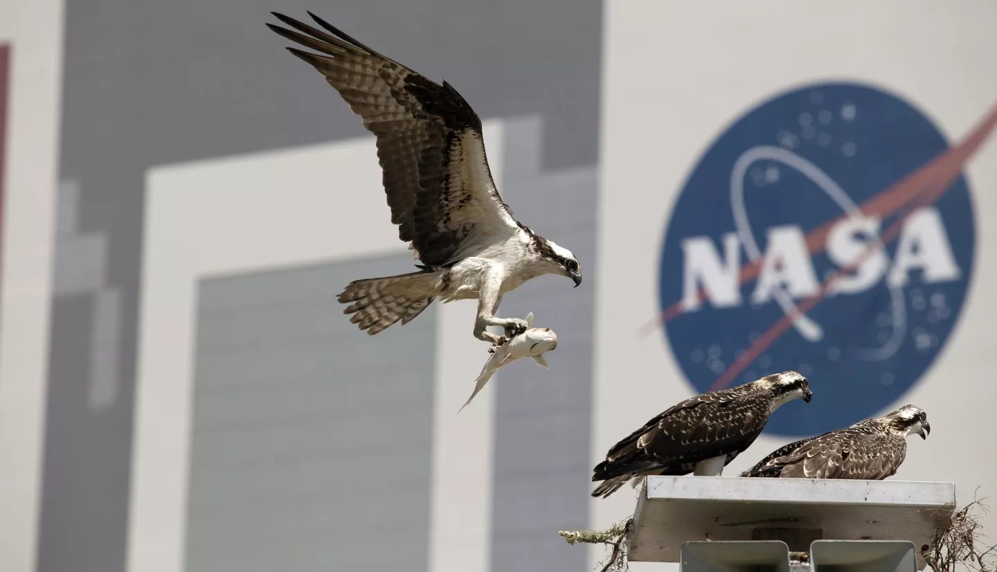
Innovative NASA tools provide new ways to protect birds as they migrate. Bright artificial lights can cause birds to become disoriented as they navigate. Nighttime lights also frequently cause fatal window collisions.
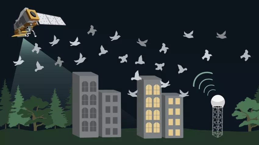
Conservationists now use NASA satellite data and other high-tech observations to monitor bird migration and create plans for conservation. For decades, ornithologists relied primarily on catch and release of birds as well as field observations of them and their habitats. Researchers long used data from Landsat, a NASA and U.S. Geological Survey mission, as well as from the MODIS instruments and other data sources to classify bird habitats and track weather and climate.
NASA’s Biological Diversity & Ecological Conservation programs support new uses of remote sensing data to understand bird populations. They include ground-based surveillance of weather and how it affects birds, tracking flocks of the birds themselves, and studying how nighttime light affects bird behavior.
Ground-based Radar Informs Bird Migration Forecasts
Researchers now use ground-based weather surveillance radar to detect birds as they migrate. Radar observes any mass in the atmosphere that can scatter microwave energy back to the device. The radar is also used to track flocks of birds. Roughly 80% of migratory bird species migrate at night, and this ground-based radar directly observes these nocturnal migrations.
BirdCast is a tool co-developed by NASA-funded principal investigator Dr. Kyle Horton. It uses ground-based radar and NASA satellite observations to produce nightly forecasts of bird migrations in the U.S. BirdCast forecasts bird migration, provides live updates on flock movement, and offers bird migration alerts. BirdCast receives over 2 million page views per year from approximately half a million users.
“For many years, we’ve broadly understood the drivers of avian migration,” Horton asserts. “But only through data integration, and leveraging radar remote sensing, can we now automatically forecast nightly movements with a high degree of accuracy.”
Tools for Tracking Individual-based Animal Movement
NASA’s Ecological Conservation program area helped fund GPS-based ways to track animal movements. MoveBank and MoveApps archive and visualize movement of individual animals. These platforms have archived over 6.3 billion animal locations since 2012.
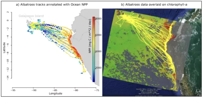
MoveBank has a Env-DATA Track Annotation Service and ECODATA apps. These let users easily link animal movement data with NASA satellite observations of environmental conditions including weather, land-use, and vegetation. For example, principal investigator Dr. Gil Bohrer studied Galapagos Albatross migration to uncover how wind, ocean productivity, and chlorophyll concentrations affect their long-range trips.
Bohrer and fellow principal investigator Dr. Jill Deppe leveraged MoveBank data to investigate how fat reserves, humidity, and winds affect songbird migration behaviors.
NASA’s Internet of Animals project advances animal tracking by allowing researchers to process larger datasets, track more species over greater time and space, and gather details such as accelerometry, heart rate, and temperature.
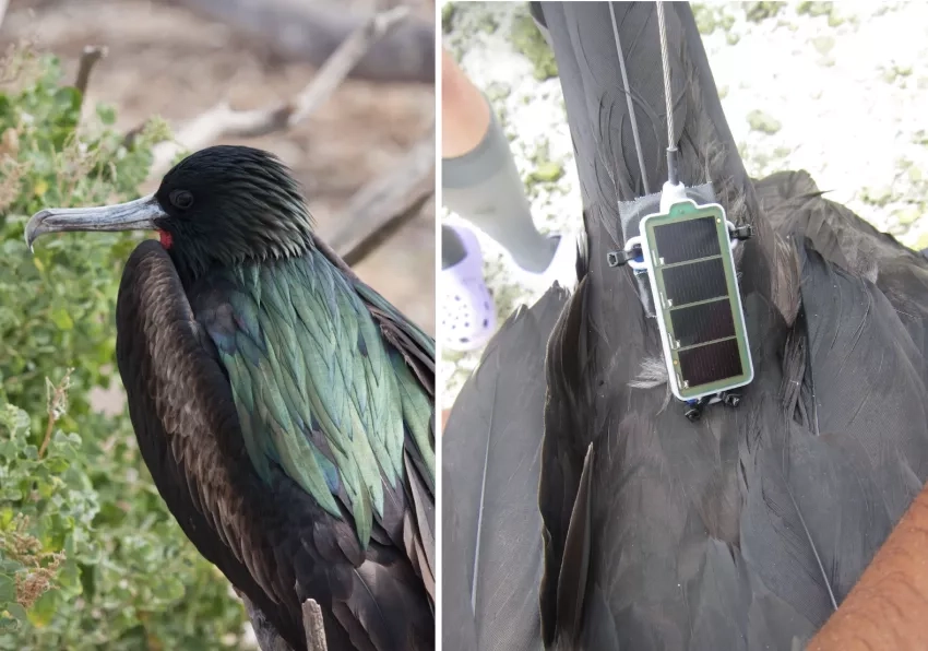
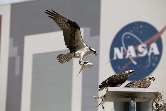
As a part of this project, NASA scientists, including Morgan Gilmour and Ian Brosnan, attached small sensors to Great Frigate birds to collect data while they fly through the planetary boundary layer. This is the lowest layer of our atmosphere. The data provided insights to environmental processes such as air quality, weather, and climate. While some satellites’ data is restricted by clouds or nighttime darkness, the sensors on these Great Frigates collect data regardless of weather or time of day. Additionally, Great Frigates soar at heights where meteorological sensors cannot reach.
In addition to providing information about environmental processes, the sensor data can inform conservation. “By incorporating sensors into biologgers, we can also take in-situ observations of the animals’ environment, which can help us understand more about their habitats, and how they use them, and can also help scientists validate other types of observations, like from satellites. Taken together, all of these tools can improve our understanding of how animals move, how they use their environment, and how they respond to climate change” Gilmour said.
To inform seabird conservation, Gilmour and colleagues combined the data from the sensors aboard the birds with remotely sensed data for a project named the Palmyra Bluewater Research project. They assess whether marine protected areas are effectively preserving breeding habitat and key resources for seabirds under different climate change scenarios.
“Recent advances in biologging technology have enabled us to understand how animals like frigatebirds interact with their environment. This is especially important for marine animals in the ocean, which is logistically challenging to study in and of itself! In turn, this knowledge can inform conservation efforts for animals’ breeding habitats, along their migratory routes, and in their wintering areas.” Gilmour said.
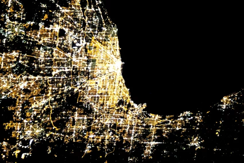
Artificial Lights at Night Data Help Reduce Collisions of Birds and Buildings
Artificial light at night poses a severe threat to birds that migrate at night, causing them to become disoriented as they navigate. Nighttime lights also frequently cause fatal window collisions or confusion and exhaustion.
Dr. Kyle Horton uses data from the VIIRS sensor onboard the NASA-NOAA Suomi NPP satellite to predict how city lights impact bird migration and population density. Such research informs local efforts such as the Chicago Audubon Society’s Lights Out Initiative, which encourages building owners to turn off nighttime lighting during peak bird migration events.
“Unlike many conservation issues that birds face, reducing light pollution can have an immediate positive impact on birds,” Horton says.
These three techniques show how NASA programs support avian ecology and conservation. They also are part of the agency's Earth Science to Action strategy to increase data accessibility and usability.
The authors would like to thank Jessica Burnett, NASA Ecological Conservation Program Coordinator, for science review and editorial insight.
References and Resources:
Horton, K.G. et al. (2022). The correlation between eBird community science and weather surveillance radar-based estimates of migration phenology.
Global Ecology and Biogeography, 31 (11) 2219-2230.
Bohrer, G. et al. (2013). The environmental-data automated track annotation (Env-DATA) system: linking animal tracks with environmental data. Movement Ecology, 1 (1) 3-3.
Deppe, J.L. et al. (2015). Fat, weather, and date affect migratory songbirds’ departure decisions, routes, and time it takes to cross the Gulf of Mexico. PNAS, 112(46), E6331–E6338.
Horton, K.G. et al. (2022). Seasonal associations with light pollution trends for nocturnally migrating bird populations Ecosphere, 13 (3).
I. G. Brosnan, M. E. Gilmour, J. Adams, S. Khajehei, S. M. Maxwell, R. Pavlick, S. A. Shaffer, A. Wegmann. “Can tracked great frigatebirds (Fregata minor) be used to measure the dynamics of the planetary boundary layer height?” American Geophysical Union Annual Meeting, San Francisco, CA, USA, 2023.
Gilmour, ME, J Adams, N Holmes, SM Maxwell, SA Shaffer, A Wegmann. “How do marine protected areas protect seabirds now and in the future?” Pacific Seabird Group Annual Meeting. Seattle, WA, USA. 2024.


