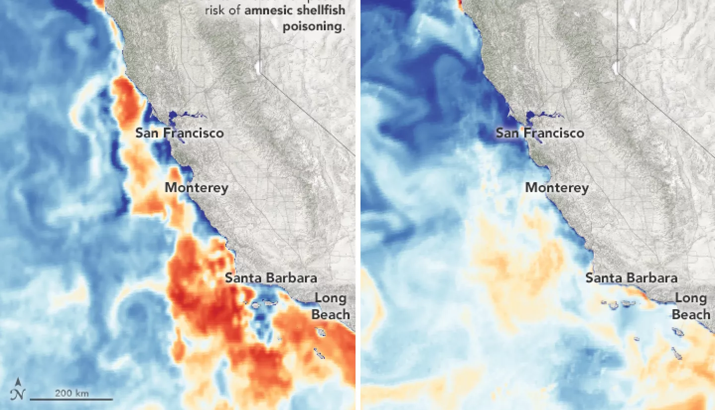
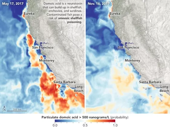
Harmful algal blooms are detected off the coast of California throughout the year. These blooms can make shellfish dangerous to eat, but NASA satellite data can guide safer harvests of mussels and oysters.
It's important for public officials to know exactly when the levels will turn toxic. That’s why NASA-funded researchers created the (C-HARM) tool.
Some phytoplankton species produce a neurotoxin called domoic acid. These phytoplankton are usually present at moderate levels in the Santa Barbara Channel. But when they build up in high concentrations in shellfish, they can be harmful to humans.
C-HARM makes predictions about toxin levels using models and ocean satellite data. Sampling at piers along the coast and offshore helps confirm these forecasts. Now, various groups use C-HARM to manage coastal resources. For example, the West Coast Marine Mammal Stranding Network can use the maps to help predict marine mammal stranding events.
More information available at the NASA Earth Observatory story Using Scientific Muscle to Grow Safer Mussels.


