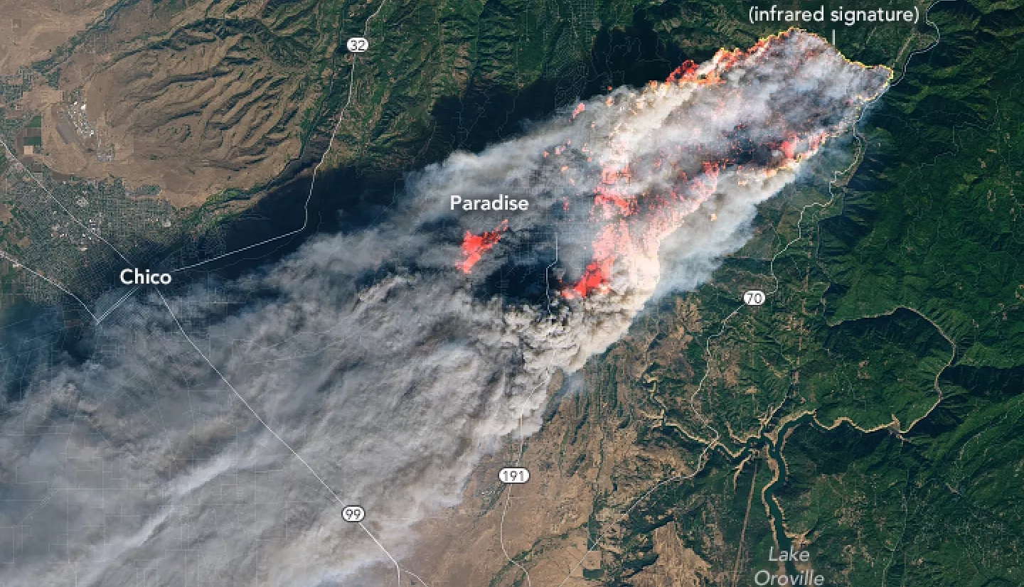
With a historically dry summer and an active fire season underway in the western United States, fire responders and public health officials are looking to NASA satellite observations to inform their efforts to protect local communities from the impacts of unhealthy air quality. A NASA-supported project created a new, experimental tool that incorporates near real-time fire detection data from satellites. The tool uses this information to create in hourly estimates of emissions to better track fire smoke as it billows into surrounding communities. The U.S. Forest Service piloted the use of this tool for the first time in summer 2020, when historically large fires in California blanketed vast areas of the state in smoke for days.

This view from above was able to help fill a gap in available on-the-ground data because the response to the COVID-19 pandemic limited travel by fire response personnel. “Due to COVID-19, I was deployed virtually to a fire and was able to start in with my forecast right away, from my home, using these new remote sensing tools, without having to travel first,” said Leland Tarnay, an ecologist with the U.S. Forest Service’s Remote Sensing Lab and one of the Air Resource Advisors (ARA) deployed by the Interagency Wildland Fire Air Quality Response Program. These advisors are technical specialists trained to quickly analyze fire incidents and communicate impacts to fire response teams, air quality regulators and the public.
“Julie [another ARA] arrived on site a few days later and was able to corroborate the remotely-sensed emissions,” Tarnay continued. “She got our forecast information into the room and into phone conversations where managers were trying to decide whether to close the park.”

“The new data means we can get a more consistent yardstick that corroborates and fills in the less frequent emissions information we get from the fires’ day-to-day ‘perimeter’ data,” Tarnay added. “This is important because those data are sometimes not available, up to date, or otherwise don’t reflect the fire activity producing the smoke impacts we’re trying to forecast.”
This new tool used by Tarnay and his fellow Air Resource Advisors is the product of an Applied Sciences Heath and Air Quality project. It's led by Susan O’Neill, the principal investigator of this project as part of NASA’s 2017 California Wildfires Tiger Team, an initiative within the Health and Air Quality Applied Sciences Team (HAQAST).
Furthermore, the public can view the real-time satellite information from several webpages, including NOAA’s AerosolWatch and NASA’s Worldview. Incident management teams and scientists access these forecasts and pollution estimates on a website custom-tailored for their use. The data used by Tarnay and others come from a range of NASA Earth observations, such as the Moderate Resolution Imaging Spectroradiometer (MODIS) sensor onboard NASA’s Terra and Aqua satellites.

O’Neill and her team work with end users like Tarnay to constantly refine the forecasts they’re giving to first responders. “It’s been reciprocal,” says O’Neill. “ARAs have worked one-on-one with us to improve smoke forecasts. They know how important it is to take into account variabilities and uncertainties that go into these models and are helping us to do that better.”
The test run of the pilot project showed promise and opportunities for improvement as a useful tool for fire response managers. O’Neill and her team are incorporating that feedback into refining the tool and testing this during specific fires. By continuing to improve these resources, they hope to help first responders and decision makers have the best information possible to help protect public health.
More about this work can be found in the NASA.gov story NASA Smoke Signals for Air Quality. O’Neill has also worked with the Applied Sciences Disasters program area on several fires since 2020. More information about how the Disasters program area helps inform fire response can be found at the Tracking Damage and Air Quality Impacts from Fires page.
This story is part of our Space for U.S. collection. To learn how NASA data are being used in your state, please visit nasa.gov/spaceforus.


