A pioneering system is using satellites to expedite wildfire recovery—while the fires still rage
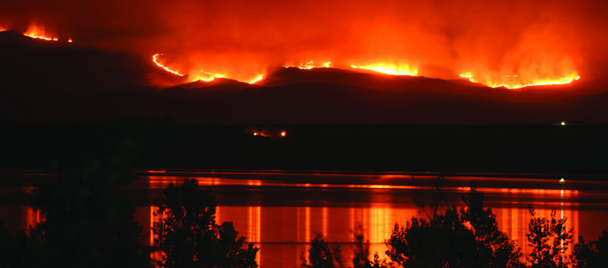
It was born from a lightning bolt. In less than a week, it grew into the largest ongoing wildfire in the United States.
An Insatiable Appetite
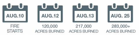
The Soda Fire ignited on August 10, 2015, burning across the rugged landscape of southwest Idaho and eastern Oregon. Feeding on sagebrush, cheatgrass, and mountain mahogany, the blaze expanded quickly, from 78,000 acres on the morning of August 12, to 120,000 acres by that afternoon.
When Keith Weber, director of the Idaho State University (ISU) GIS Training and Research Center, heard about the fire’s quick growth that day, he knew what lay ahead. Through his team’s partnership with the Bureau of Land Management’s (BLM) Boise District, their work to facilitate the use of satellite data for post-fire rehabilitation had become part of active fire-fighting efforts.
“The fire was an unusual one,” Weber remarked. “One of those rapidly moving mega-fires that can be very problematic.”
His assessment proved right. By the next morning, the wildfire had exploded to more than 210,000 acres.
A Request for Data
During this rapid expansion, the BLM reached out to Keith Weber for the information it needed immediately—near real-time data on the fire’s extent and recent impacts. That information is critical for the BLM’s Emergency Stabilization and Rehabilitation team, which must quickly assess the fire’s damage, as well as determine areas that require rapid treatment and restoration.
Access to this information was now possible thanks to a beneficial mapping system that Weber helped develop called the Rehabilitation Capability Convergence for Ecosystem Recovery (RECOVER).
“The land management agencies were doing all the work to fight the fire,” said Weber. “What we were doing was supporting them so they could make good decisions quickly about how to fight the fire, and later, how to manage the land after the fire.”
“RECOVER makes available all geospatial data relevant to a wildfire in five minutes. That includes a collection of NASA Earth-observing satellite imagery and derived products… Now that is truly awesome.” Keith Weber, Idaho State University
The Big Picture
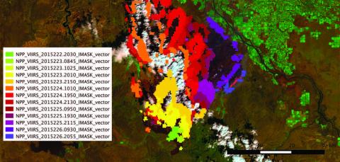
In partnership, ISU, BLM, and NASA built RECOVER to establish a novel way of providing information for rapid remediation during and after wildfires using already-existing satellite data. It does this by creating a single tool that automatically integrates a multitude of data and imagery layers, such as current and archived Terra-MODIS imagery, Landsat imagery, and Suomi NPP’s Visible Infrared Imaging Radiometer Suite (VIIRS) instrument data. The RECOVER system then assembles and superimposes the information on top of imagery of burned and burning areas to produce near-real time updates in an easy-to-use interface accessible on a standard Web browser.
By gathering up to 20 different datasets, like wildlife habitat and local topography, RECOVER helps BLM rehabilitation crews assess the situation more completely and quickly. Before this, remediation crews would have had to wait for the fire to be contained first, and then complete an assessment before submitting a rehabilitation plan. The assessment would include surveying multiple websites for information on soil layers, plant species composition, burn severity mapping, and other data, according to Gregory Mann, a fire ecologist with the BLM.
That process of collecting information was typically challenging and time-consuming—often taking several days to more than a week to complete. “When we’re dealing with large fires, it’s extremely difficult,” Mann added.
From Days to Minutes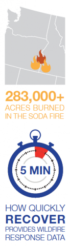
The massive Soda Fire ultimately burned more than 283,000 acres across the Northwest. Thanks to RECOVER, crews were able to automatically generate and refresh derived data while the fire was still actively burning—something that wasn’t possible before.
In fact, by the time the wildfire was contained, crews already had a complete and ready-to-use customized analysis of the Soda Fire. With that data at their fingertips in a matter of five minutes, the teams could promptly determine where to target their rehabilitation efforts.
“RECOVER supported our early rapid assessment for rehabbing after the fire even while firefighters were still on the ground,” Karen Miranda, information officer for the Emergency Stabilization and Rehabilitation team, said. “Pre-planning before the fire is fully contained helps our work move forward as quickly as possible.”
Keith Weber leads this project.


