Kansas City Disasters II (Fall 2022)
Team: Nora Carmody (Project Lead), Dain Kim, Kameron Lloyd, Ruby Nagelberg
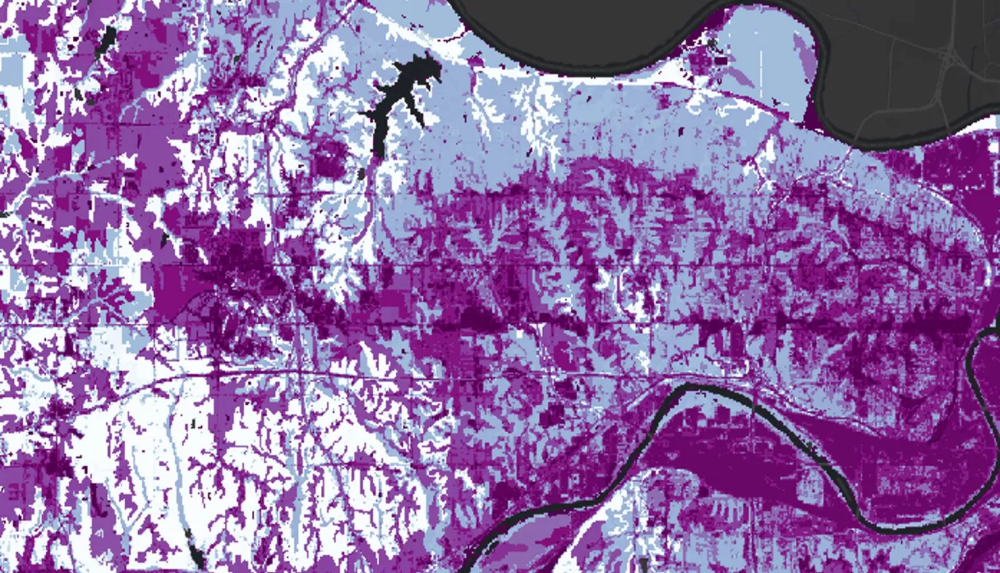
Summary: In pluvial flood events, stormwater runoff can pollute ground and surface water, posing a threat long after the rain has ceased. In Wyandotte County, Kansas, this contamination is compounded in historically disinvested neighborhoods by high levels of impervious surface cover, a combined sewer system, and socioeconomic vulnerability. The DEVELOP Kansas City Disasters I team conducted water quantity analyses to assess flood vulnerability in Wyandotte County. To complement their research, we, the Kansas City Disasters II team, addressed water quality concerns related to stormwater retention and combined sewer system overflows (CSOs). We acquired precipitation data from NASA’s Global Precipitation Measurement (GPM IMERG) from January 2000 to December 2020 and ancillary data such as land cover classifications from the USGS’s National Land Cover Database as inputs into the Natural Capital Project’s Integrated Valuation of Ecosystem Services and Tradeoffs (InVEST) Stormwater Retention Model. We utilized this model to produce stormwater retention ratios across Wyandotte County to identify areas where land is not retaining stormwater and its associated pollutants, exposing surrounding regions to waterway contamination. We then used U.S. Census data to create a social vulnerability index which was compared to the model’s retention outputs. The results suggested that the most vulnerable block groups were located in Northeast Wyandotte County, where populations are burdened by poor stormwater retention and intersectional social vulnerabilities. The end products provided insights into the distribution of stormwater retention and purification in Wyandotte County and the identification of points of intervention for Groundwork NRG’s future green infrastructure projects.
Related Impact