Imagen
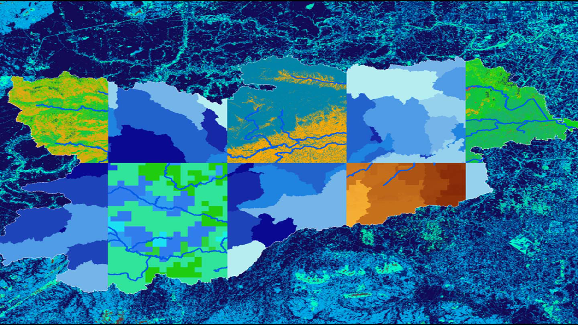
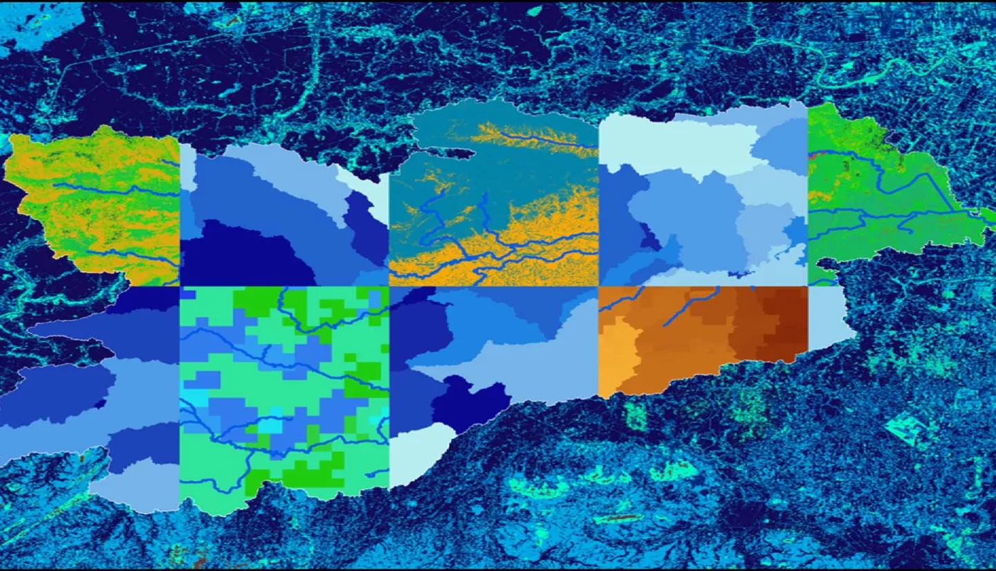
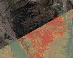
The Chao Phraya River and surrounding watershed has seen an extensive increase in urban development in the last century, while simultaneously experiencing significant degradation in water quality. Covering 30% of Thailand, the Chao Phraya watershed encompasses rural areas and major metropolitan centers, including Bangkok. The poorest water quality is found in the southernmost reaches of the river, which directly flows through the administrative capital. Due to rising concerns from the Bangkok Metropolitan Administration (BMA) and the Asian Institute of Technology (AIT), this study identifies locations to prioritize watershed remediation efforts. Using the Tropical Rainfall Measuring Mission (TRMM) Multi-Satellite Precipitation Analysis (TMPA) and Shuttle Radar Topography Mission (SRTM) datasets as inputs, this study applied the Soil and Water Assessment Tool (SWAT) to model the change in water quality over 5-year increments from 2003-2017. The change in water quality, defined as sediment concentration, was analyzed in comparison with the historical changes in the urban footprint. Additionally, a regression analysis was completed to determine the potential relationship between urbanization and sediment concentrations. The team found that the greatest increases in sediment contributions occurred in the upper and middle sub-basins of the watershed. No correlation was found between percent change in urbanization and percent change in sediment contribution from 2003-2017, suggesting that urban land cover change does not directly impact sediment loads. The results from this analysis will be used by project end users for future mitigation efforts and, more generally, to expand their use of GIS and NASA Earth observations.