Southern Wyoming Ecological Forecasting (Fall 2021)
Team: Dahlia Shahin (Project Lead), Emily Snyder, Kyle Paulekas, Michael Segala, and Sanju Khatri
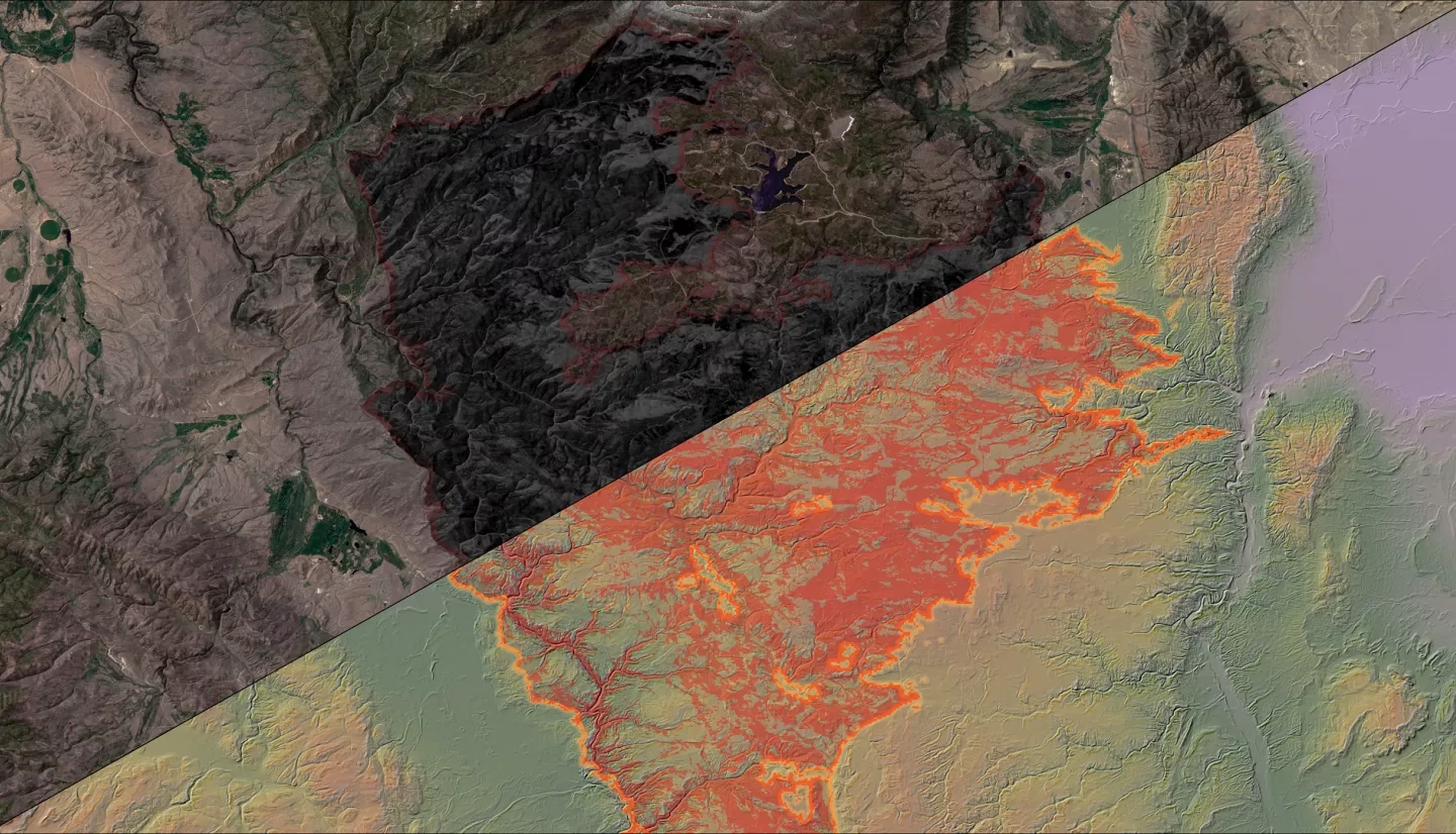
Summary: Cheatgrass (Bromus tectorum) is a prominent invasive species in the Intermountain West that has the potential to out-compete native plant species, reduce biodiversity, and reduce the quality of habitat for ungulates. Furthermore, because cheatgrass readily establishes in disturbed landscapes, it can potentially increase fuel loads and exacerbate wildfire risk. In 2020, the Mullen Fire burned 176,878 acres in Carbon and Albany Counties, Wyoming and Jackson County, Colorado. Large fires such as this one raise concern for partners at the United States Forest Service and the United States Geological Survey Fort Collins Science Center, who are tasked with rapidly detecting and controlling invasive species in the post-fire environment. We developed a Random Forest model trained by in-situ field data and spectral indices such as Normalized Difference Vegetation Index (NDVI), Soil Adjusted Vegetation Index, and Enhanced Vegetation Index derived from Landsat 8 Operational Land Imager, Sentinel-2 MultiSpectral Instrument, and Shuttle Radar Topography Mission to detect and map cheatgrass presence during the 2021 growing season. The team successfully created a spectral cheatgrass detection map in the study area (RMSE = 13.71, R2 = 0.34). We also produced a NDVI time-series derived from Sentinel-2 MSI to analyze vegetation recovery patterns.
Related Impact