Team Members: Claire Masteller (Washington University), Jose Constantine (Williams College), Hossein Hosseiny (Washington Univeristy in St. Louis)
Executive Summary: Low-income and minority communities are often vulnerable to frequent flooding due to lack of infrastructure for surface runoff mitigation practices and flood monitoring systems. However, due to lack of measured data, the assessment and modeling of flooding conditions in vulnerable communities remain. The primary objective of this Community Feasibility Study is to integrate satellite-based data with community-engaged monitoring and resident experiences to document ongoing flooding hazards in a low income, predominately Black community in Centreville, IL.
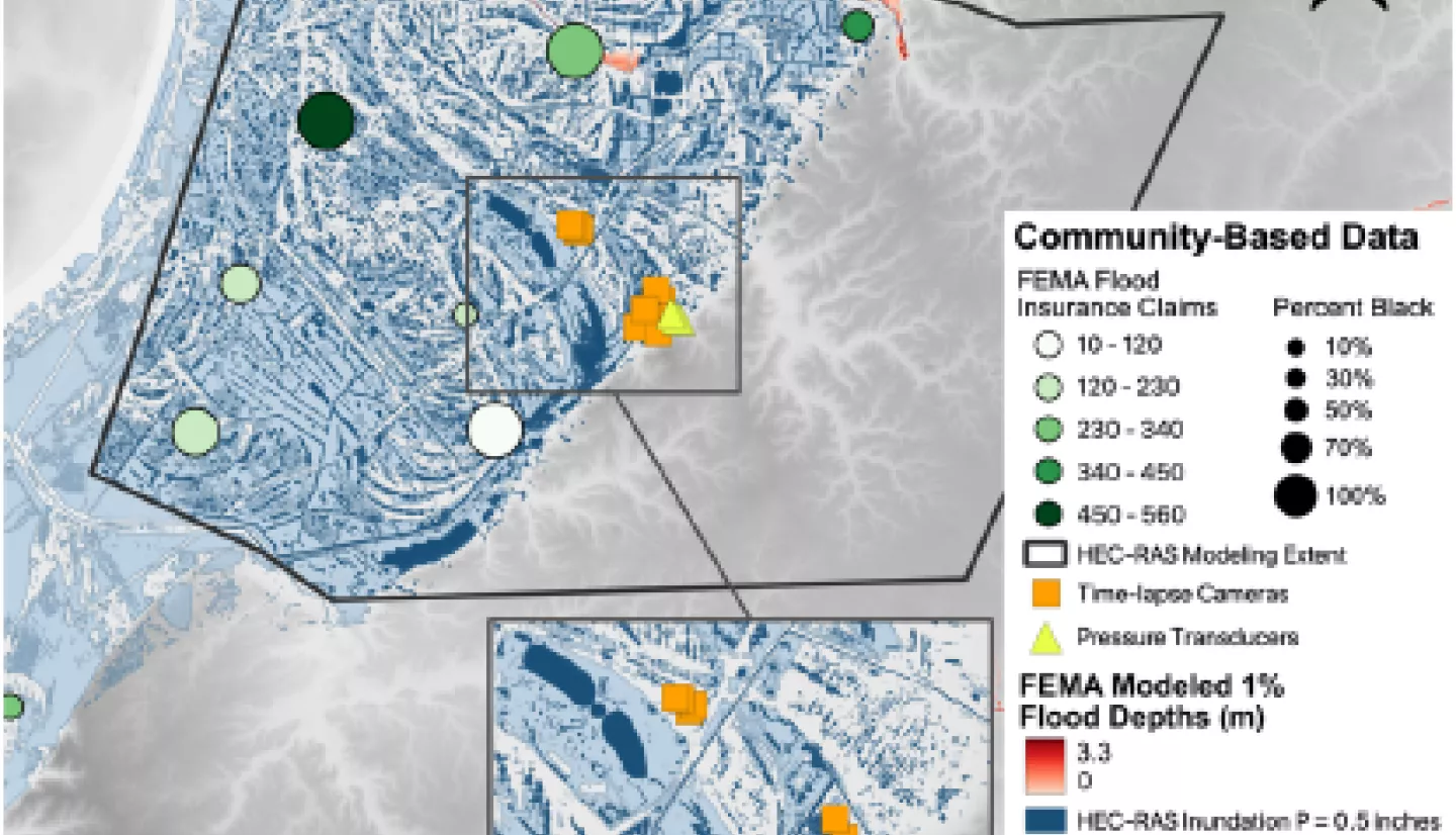
The investigators have an established and ongoing collaboration with Centreville residents and other stakeholders including the community-run Centreville Citizens for Change organization, Equity Legal Services, Inc., and the Metropolitan St. Louis Equal Housing and Opportunity Council (EHOC). Through these partnerships the research team has implemented a community-engaged flood monitoring system with guidance from residents. Preliminary results have documented persistent flooding in Centreville and informed a simple hydrologic model. However, the full extent of flooding in Centreville remains unquantified and the environmental drivers of flooding remain poorly constrained.
The investigators aim to leverage satellite-collected data products (precipitation, soil moisture, imagery, and radar data) to better quantify the environmental drivers of flooding in Centreville, map resulting inundation extent and variability across the Centreville community, and two develop a versatile, data-driven model for urban flooding using machine learning tools. In order to achieve these objectives they are undergoing three main research activities:
RA1: Comparison of satellite based data products, community engaged measurements, and resident experiences to quantify the frequency, extent, and impact of flooding in Centreville
RA2: Development of a flexible, data-driven flood model which leverages satellite-data products and ground-based observations to predict flood risk
RA3: Dissemination of flood model and risk assessment to project partners and communitystakeholders to guide mitigation
In sum, these research and engagement activities will leverage their findings, and by extension, a suite of satellite-collected data products, to help achieve community goals for environmental justice.