Imagen
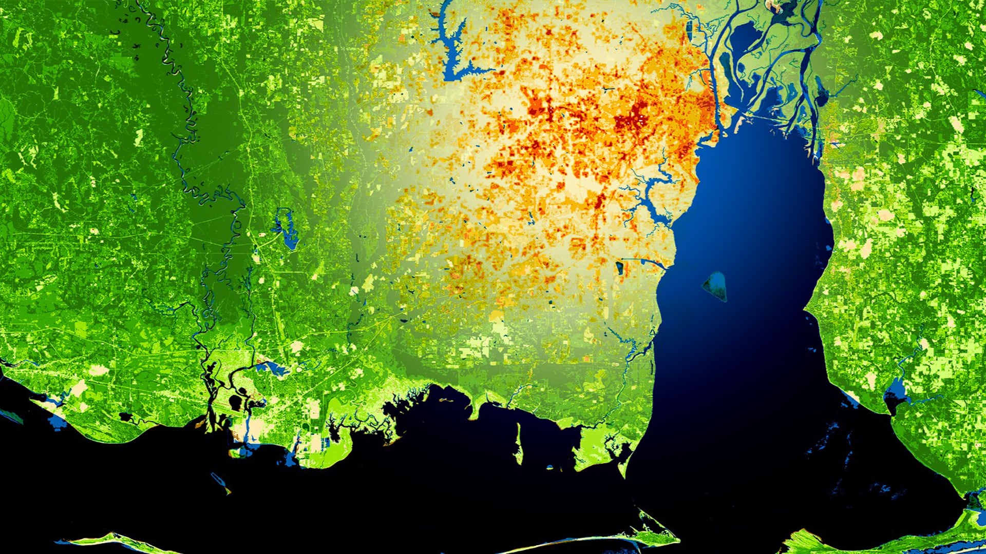
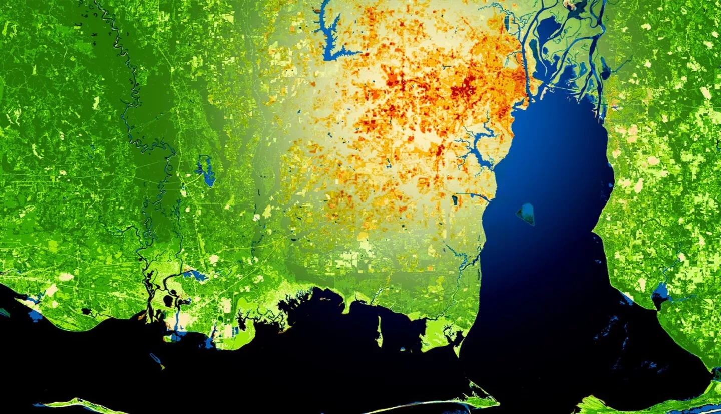
This project utilized satellite Earth observations to assess locations in Mobile County, Alabama, that are vulnerable to the urban heat island effect (UHI) and flood impacts. Our partner, Groundwork Mobile County (GWMC), and other local entities need information on UHIs and flooding risk to develop mitigation strategies for reducing such threats. To locate communities with UHI impacts between 2005 and 2019, our team used Landsat 5 Thematic Mapper (TM), Landsat 8 Thermal Infrared Sensor (TIRS) and Terra Moderate Resolution Imaging Spectroradiometer (MODIS) to evaluate land surface temperature. Low elevation areas susceptible to flooding were distinguished using Shuttle Radar Topography Mission (SRTM) data. The team assessed flash flood vulnerability with Sentinel-1 C-band Synthetic Aperture Radar (C-SAR) and LiDAR elevation data. Lastly, the team processed data from Landsat 5 TM and Landsat 8 Operational Land Imager (OLI) to compute the Normalized Difference Vegetation Index (NDVI) and compared that with Sentinel-2 Multispectral Instrument (MSI) data to evaluate impervious surface area and thus, the increase in urban development over time. A Social Vulnerability Index (SoVI) was produced for Mobile County based on a five-point scale, comparing demographic characteristics with UHIs and flood potential. To compute social vulnerability maps, the team retrieved data from the Agency of Toxic Substances and Disease Registry (ATSDR) dataset. Of the 114 census tracts, 6 tracts showed high risk for both flooding and extreme urban heat. Our project provided GWMC with end products that help in planning mitigation strategies for reducing flood risks and UHI effects.