Imagen

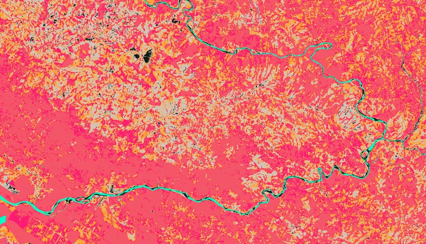
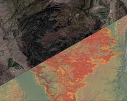
Seven percent of all scientifically known life forms lie within the 202,230 square miles of Central America, making this area ecologically unique and increasing the need for environmental management. The Mesoamerican Biological Corridor forms a conservation partnership throughout Central America to establish a forested corridor of over 600 protected areas. Although conservation programs exist, deforestation still afflicts the area, putting strain on these diverse ecosystems. La Amistad International Park in southern Costa Rica and northern Panama in particular faces conflicting land use changes. Expanding agricultural development and urbanization, combined with concern over indigenous land rights, have raised questions about the implementation of sustainability goals and communication strategies within the region. To help address these issues, the NASA DEVELOP Costa Rica & Panama Ecological Forecasting II team continued a partnership with the Ministry of Environment and Energy in Costa Rica and the National Environmental Authority in Panama. The team created a Land Use Conflict Identification Strategy (LUCIS) model based on land cover maps for 2019 and 2029 that were created in term I using imagery from Landsat 8 Operational Land Imager (OLI). With partner input, the team applied weights to different objectives and combined suitability maps to identify areas of potential biodiversity conflict. Additionally, the team created a Short-term Forest Change (SFTC) Tool using Terra Moderate Resolution Imaging Spectroradiometer, Landsat 8 OLI, and Sentinel-2 Multispectral Instrument to help the partners identify areas of immediate, major forest changes. The LUCIS model indicated higher agricultural growth when compared to the ecological category.