Imagen
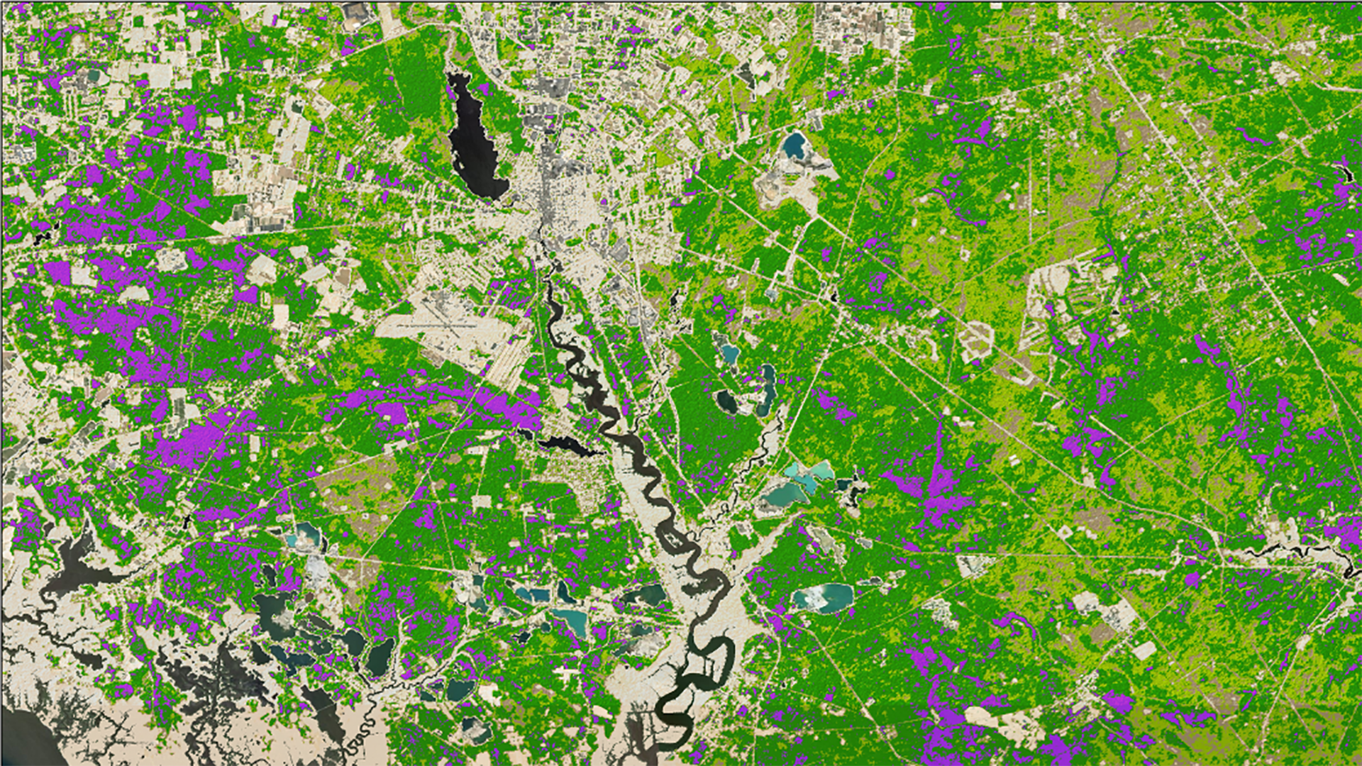

As New Jersey's population increases, more of this population is relocating to the wildland-urban interface (WUI) of the south-central Pinelands region. Due to this increase in human activity coupled with local environmental conditions, local authorities are concerned about an increased possibility of wildfires that could damage both the area's infrastructure and ecosystem. To counteract this risk, it is necessary to develop methods for accurate wildfire assessment and mitigation efforts. This project partnered with the New Jersey Pinelands Commission (NJPC) to develop a Fire Risk Assessment Tool that identifies areas with high fire risk based on land cover characteristics. The team incorporated vegetation indices derived from Landsat 8 Operational Land Imager (OLI) and Sentinel-2 Multi-Spectral Instrument (MSI), land-use classification derived from LandFire data and elevation into a fuzzy logic model to generate a 30 x 30 m Fire Risk Assessment Map. The map was used to analyze fire susceptibility in the Pinelands WUI and to identify optimal areas for urban expansion. Fifty three percent of the total area within the Pinelands WUI was classified as having a moderate fire risk, while high and extremely-high fire risk accounted for 13%. An estimated 200,000 acres of land with a low to moderate risk of fire were identified as areas that would be suitable for development. The results and maps produced will be used by the New Jersey Pinelands Commission to guide urban development planning and decision making.