InVEST Urban Development (2023 Spring)
Team: Son Do & Jessica Besnier
Summary:
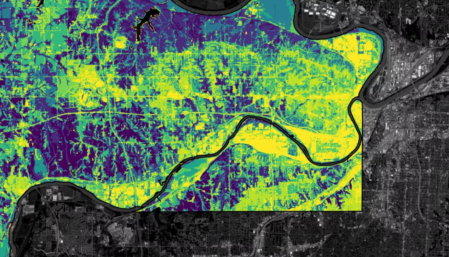
Urban flooding poses as one of the biggest issues for cities today as its impacts are amplified by both climate change and urbanization. The Natural Capital Project’s Integrated Valuation of Ecosystem Services and Tradeoffs (InVEST) Urban Flood Risk Mitigation (UFRM) model, which benefits from its simplicity and robustness, is commonly used in NASA DEVELOP projects for disaster mitigation, urban planning, and environmental justice issues. While InVEST UFRM model was able to produce the surface water runoff and retention map sufficient for the scopes of past projects, the model accuracy and spatial variability need improvement. Since the current InVEST UFRM model employs constant rainfall depth for all pixels in the area of interest (AOI), the model suffers from inaccurately estimating rainfall depth, runoff volume, and flood depth. Therefore, we adapted the model so that satellite-based precipitation raster datasets (i.e., Integrated Multi-satellitE Retrievals for Global Precipitation Measurement [GPM IMERG]) can be used instead of a single constant value. We simulated the flood events on August 21st and August 22nd, 2017, in Wyandotte County, Kansas City using both our modified and the original InVEST UFRM model and then compared the results after incorporating rainfall raster into the model. Areas with developed land on the land use map predicted moderate to high flood volume in the original volume regardless of the actual amount of precipitation. The modified model considered the rainfall depth’s spatial variation achieving less overestimation of flood runoff and volume at low-to-moderate rainfall area.
Related Impact