Bhutan Agriculture III (Summer 2023)
Team: Sonam Seldon Tshering (Project Lead), Garab Kuenphen Dorji, Ugyen Thinley Dorji, Sangay Choden, Tenzin Lhaden
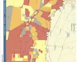
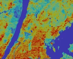
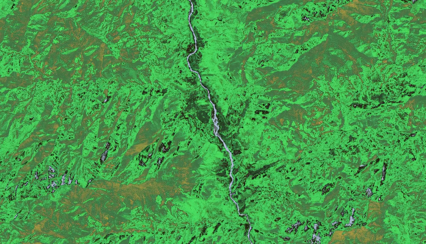
Summary: The Bhutan Agriculture III team aimed to improve agricultural efficiency in Bhutan, a nation heavily reliant on agriculture, while also facing challenges such as geophysical limitations and lack of scientific agricultural limitations. The team worked under the supervision of the Science Advisors from NASA SERVIR, with the end partner; Bhutan’s Department of Agriculture (DoA), and with the collaborators; the Bhutan Foundation, National Plant Protection Centre (NPPC), Agricultural Research Department Centre (ARDC), National Statistics Bureau (NSB), and the Ugyen Wangchuck Institute for Conservation and Environment Research (UWICER). The team gathered 5000 points from the five dzongkhags that yield the most rice in Bhutan (Paro, Punakha, Samtse, Sarpang and Wangue Phodrang) using Collect Earth Online (CEO). With the data collected, the team trained and split the data into training and validation data on Google Earth Engine (GEE). The team developed crop masks and monitored rice distribution from 2015 to 2022 utilizing NASA Earth Observations such as Landsat 8 Operational Land Imager (OLI), Landsat 8 Top of Atmosphere (TOA), Landsat 9 OLI-2, Sentinel-1 C-Band Synthetic Aperture Radar (C-SAR), Sentinel-2 MultiSpectral Instrument (MSI) and Shuttle Radar Topography Mission (SRTM). This data supports better agricultural decision-making for the governing body of Bhutan, enhancing farming efficiency and fostering sustainable practices, ultimately overcoming data inaccuracy and bolstering food security in the country. After running the data on the Random Forest (RF) model the team got an accuracy score of 81.48%, a kappa score of 55.75% and an F1 score of 86.11%.
Related Impact