Sarasota Climate (2024 Spring)
Team: William Hadley (Project Lead), Casmir Brown, Catherine Gallagher, Theresia Phoa
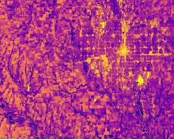
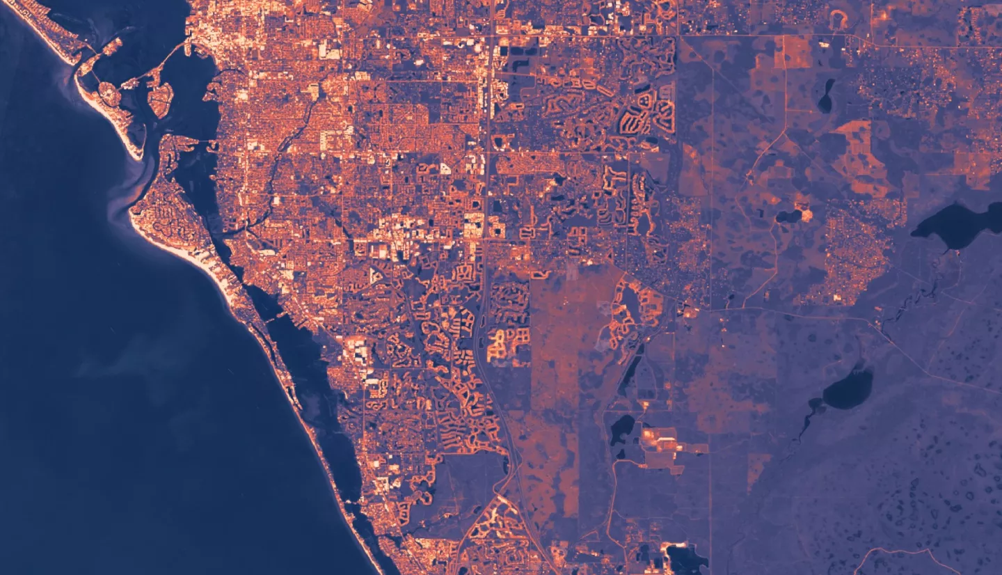
Summary: The coastal county of Sarasota, Florida, is located within the humid subtropical climate region and experiences an average of 250 days of sunshine every year. The county has large, urbanized communities which are vulnerable to urban heat island (UHI) effects. These rapidly growing communities contribute to the increasing surface temperatures and placing more residents at risk of heat-related illness. In partnership with Sarasota County Sustainability, the Sarasota Climate team utilized Earth observation data from NASA Landsat 8 and Landsat 9’s Thermal Infrared Sensors (TIRS), and the International Space Station’s Ecosystem Spaceborne Thermal Radiometer Experiment on Space Station (ECOSTRESS) to model UHI effects within the county during the Summer for the last five years, 2019 to 2023. Data analysis with the Integrated Valuation of Ecosystem Services and Tradeoffs (InVEST) and Urban Heat Exposure Assessment Tempe 1.0 (UHEAT 1.0) models and within ModelBuilder produced maps that identified the land surface temperature (LST) variance within the county, the regions that are most susceptible to extreme heat, and areas least capable of mitigating the effects of UHI. The results revealed that heat intensity varies significantly across Sarasota County with the highest temperatures in the more developed western part of the county. Additionally, the team identified that there are at least three vulnerable communities that exist in high-heat regions, including North Sarasota, Venice, and North Port. These regions have an overlap between socioeconomic sensitivity and environmental hazard that indicate a high priority in future heat mitigation efforts.
Related Impact