Imagen
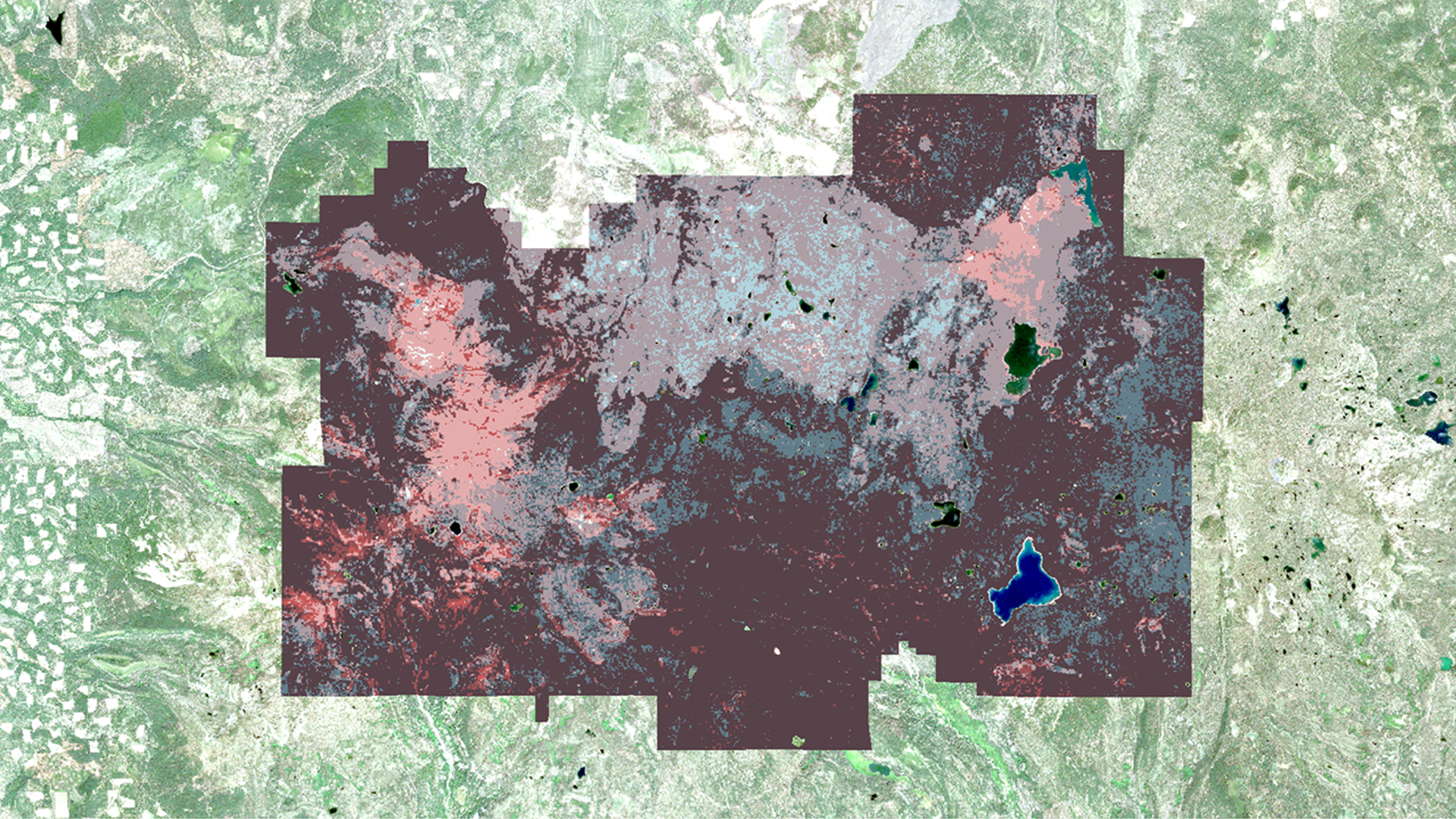

Nearly three quarters of Lassen Volcanic National Park (LVNP) is designated as Wilderness under the Wilderness Act of 1964, meaning it is to be managed "to preserve its natural conditions… with the imprint of man's work substantially unnoticeable." This prevents land managers from clearing excess vegetative fuels that have accumulated due to fire suppression policy. Therefore, LVNP must rely on fire to restore healthy levels of vegetation. Devastation following the 2012 Reading Fire demonstrated the strength of accumulated fuel loads. Detailed cataloguing of fuel loads is necessary to predict the behavior and severity of any fire allowed to burn in LVNP. To provide these estimates, NASA Earth observations were used to generate maps of historical and present-day tree mortality, and to evaluate advantages in using lidar data to obtain detailed fuel load measurements. We estimated tree mortality using a linear trend regression analysis implemented in Google Earth Engine (GEE), to process time series of multispectral data from Sentinel-2 and the Landsat series (TM, ETM+, OLI). Lidar data were related to spatial layers of species coverage and other environmental factors to estimate fuel loads. These products will help partners at LVNP to periodically update their mortality maps and fuel loading estimates in their ongoing efforts to maintain a healthy and safe Wilderness.