Imagen


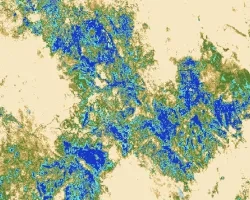
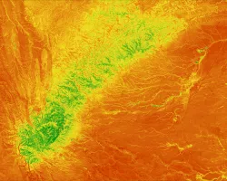
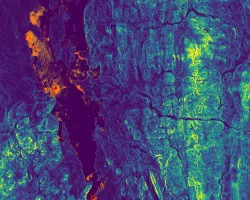
Extreme heat during the summer months is a major public health issue in many cities worldwide. Local governments are increasing efforts to mitigate heat in cities through the implementation of infrastructure adaptations, including expansion of the urban tree canopy and white roofing, as well as revising design guidelines and principles for new construction. These strategies will be most beneficial for public health if they are deployed in places where risks of heat exposure are elevated as a result of higher temperatures and higher social vulnerability. Spatial variability in heat in the city arises because of the different ways in which the built environment impacts energy exchange between the surface and atmosphere. Social vulnerability is also unevenly distributed across urban areas and previous research demonstrates that socially disadvantaged populations often live in the hottest parts of the city. In this project, we used Landsat and Advanced Space-borne Thermal Emission and Reflection Radiometer (ASTER) data to construct a time series of Las Cruces' urban heat patterns and assess the influence that urban morphology has on those patterns. Extreme heat vulnerability indicators were developed utilizing census and health records and aerial imagery from the National Agriculture Imagery Program (NAIP). These heat vulnerability indicators describe the sensitivity of the population to extreme heat and identify where vulnerable populations reside. The Las Cruces Sustainability Office will use the heat vulnerability indicators, urban heat island assessment, and urban heat island morphology comparison to improve the city's resilience and mitigation efforts.