Imagen
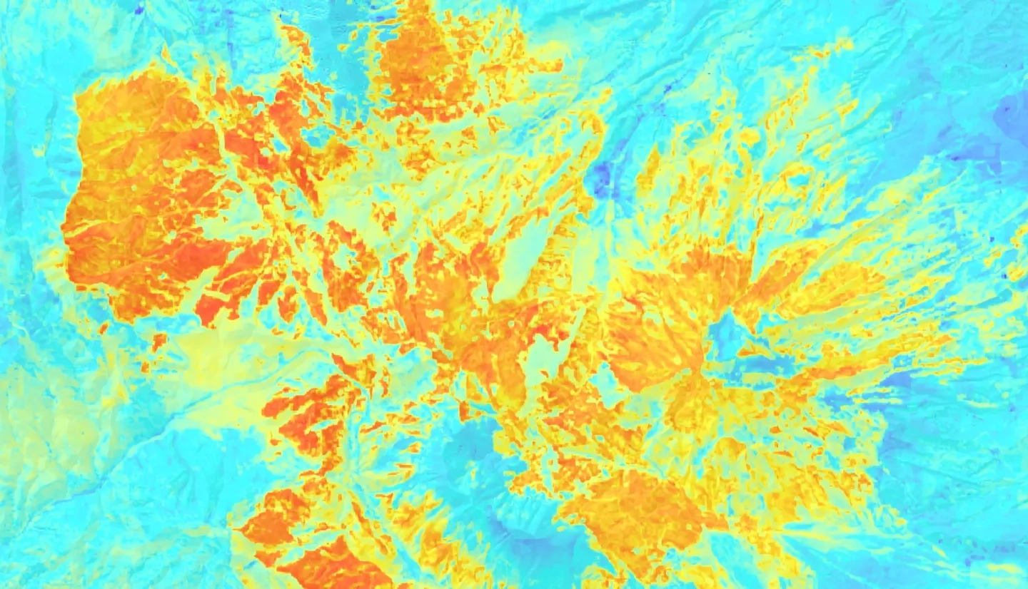
Both wildfires and conifer-defoliating insect outbreaks have increased in frequency and severity in recent years. Western spruce budworm (Choristoneura freemani), a widespread defoliator in western U.S. forests, has impacted over 6,000 hectares of forest in southern Colorado. The forest managers for southern Colorado’s Tercio and Trinchera ranches are concerned that fuel loading from budworm-related tree mortality will increase the risk of catastrophic wildfire on their land. To address this, we selected a study area encompassing the 2018 Spring Creek Fire footprint and both ranches. Then, we used remote sensing observations from NASA sensors to 1) analyze and map regional tree mortality prior to the 2018 Spring Creek Fire; 2) quantify and map burn severity for the Spring Creek Fire; and 3) explore interactions between pre-fire tree mortality and burn severity using generalized linear models (GLM). From twenty-four predictor variables, including tree mortality, we identified key predictors using the Variable Selection Using Random Forests (VSURF) R package and modeled pre-fire tree mortality using the randomForest R package. Burn severity quantification metrics included differenced Normalized Burn Ratio (dNBR), Relative differenced Normalized Burn Ratio (RdNBR), and Relativized Burn Ratio (RBR). The maps created from this research provided our ranch partners and the Colorado State Forest Service with a comprehensive assessment of tree mortality on affected lands, facilitating future restoration and management efforts. Additionally, an accompanying methods tutorial will enable the partners to replicate this analysis for other years and locations.