Imagen
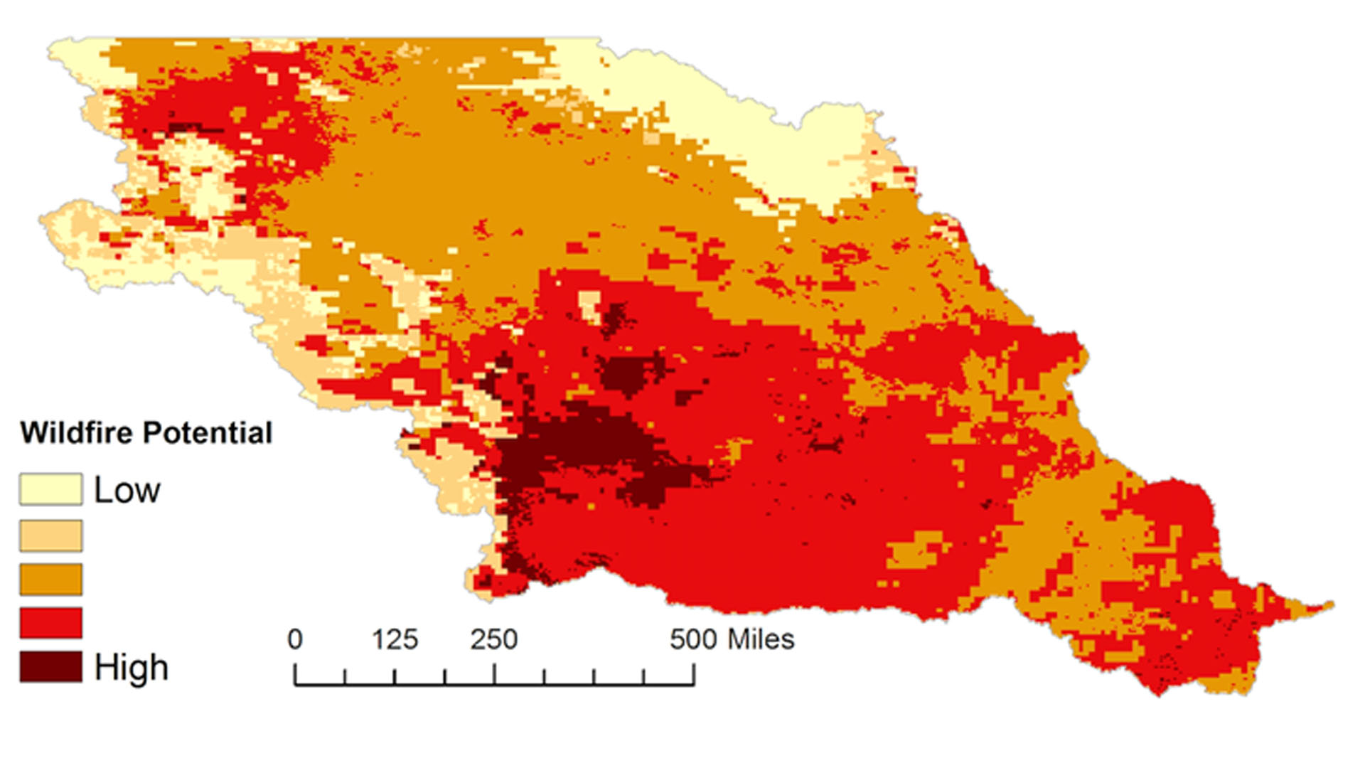

Grasslands in the Missouri River Basin (MRB) cover the majority of the landscape and are essential for livestock grazing and agriculture. However, they are susceptible to wildland fires, with each year averaging approximately 6.6 million acres (2000-2010 average - National Interagency Fire Center) burned in this region. With sparse data sources for highlighting fire potential, regional fire managers in the MRB are unable to quickly discern spatial differences in the potential of wildland fires. The region is in need of a robust, communicable, and easily distributed indicator of wildland fire potential. This project compared fuel moisture content derived from NASA's MODIS sensor aboard the Terra and Aqua satellites, fire weather parameters (e.g., wind speeds, temperature, and relative humidity) from the University of Idaho's gridMET surface meteorological data and NOAA's Real-Time Mesoscale Analysis (RTMA), and precipitation estimates from the Precipitation Estimation from Remotely Sensed Information using Artificial Neural Networks Climate Data Records (PERSIANN-CDR) and Global Precipitation Measurement Mission (GPM) to train and construct a wildland fire potential matrix of the MRB with ten years of data (2002-2011). After determining which weather indicators significantly contribute to large wildland fires, the team created a program for generating fire potential maps. This interface allows wildland fire managers and the general public to quickly discern the potential for complex wildland fires throughout the MRB.