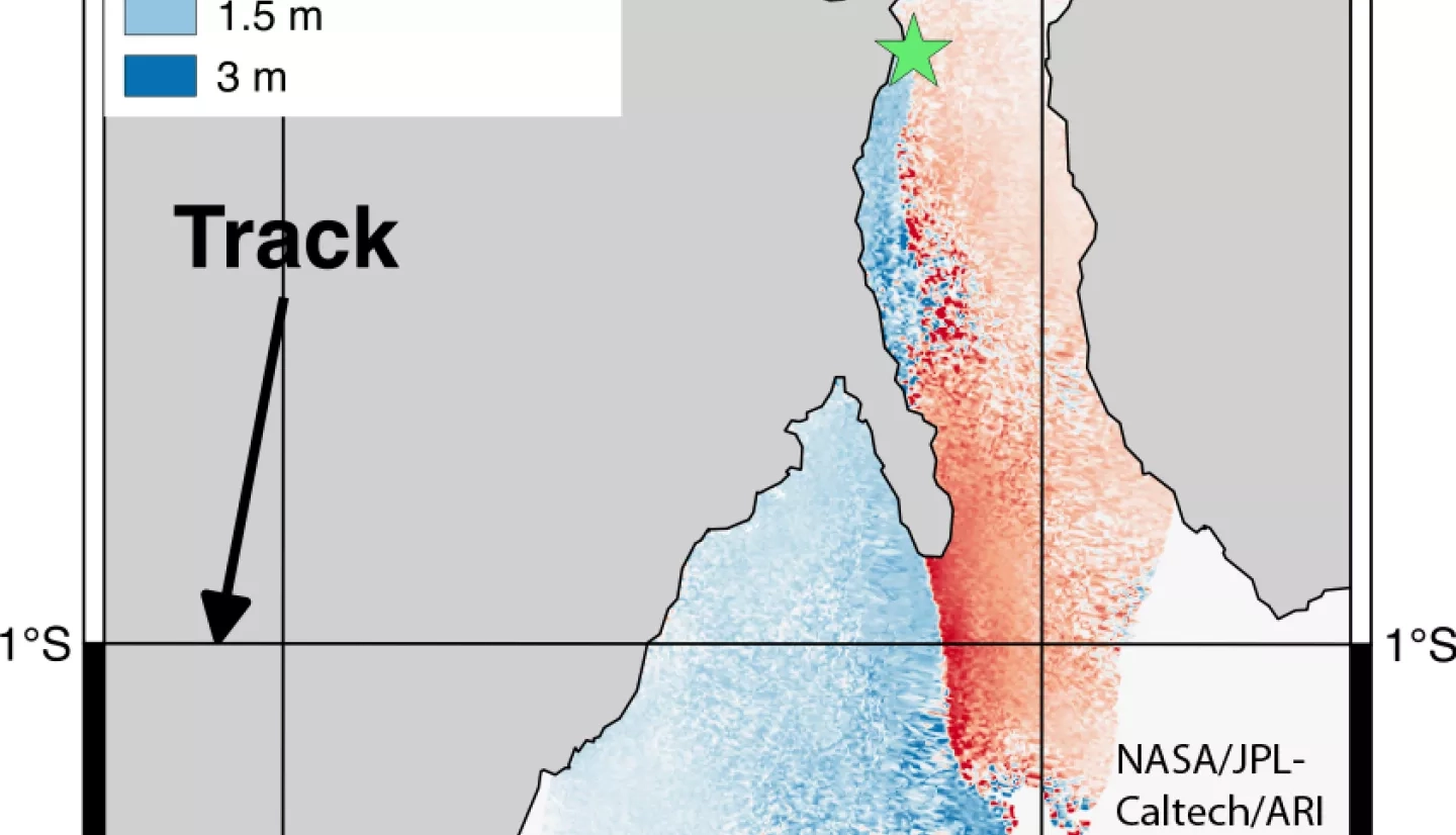
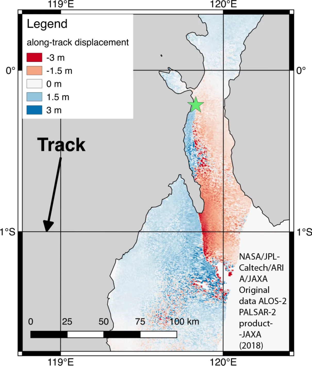
Scientists with the Advanced Rapid Imaging and Analysis project (ARIA), a collaboration between NASA’s Jet Propulsion Laboratory in Pasadena, California, and Caltech, also in Pasadena, using synthetic aperture radar (SAR) data from the Japanese Aerospace Exploration Agency (JAXA) Advanced Land Observing Satellite-2 (ALOS-2) PALSAR-2, generated maps of the deformation of Earth’s surface caused by the Sept. 28, 2018 magnitude 7.5 earthquake under Sulawesi island, Indonesia, near the city of Palu. The along-track deformation map measures horizontal deformation in the satellite-track direction, roughly south. The false-color maps show the amount of permanent surface movement that occurred almost entirely due to the quake, as viewed by the satellite, during a 42-day interval between two ALOS-2 wide-swath images acquired on August 20 and October 1, 2018 (both UTC).
NASA's ARIA Along-Track Deformation Map
`
The green star on the maps shows the M7.5 earthquake epicenter from the US Geological Survey (USGS) National Earthquake Information Center, the location where the earthquake started. The interferogram maps show that the earthquake fault runs south from the epicenter along the neck of Sulawesi island, then goes offshore into the Palu Bay. The earthquake fault then goes back on land directly beneath the west side of Palu city and continues to the south. Through these maps, NASA and its partners are contributing important observations and expertise that can assist with response to earthquakes and other natural or human-produced hazards.
From the pattern of deformation in the along-track map, scientists have determined that the earthquake fault slip on a fault beneath the city of Palu caused as much as 16 feet (65meters) of horizontal motion of the ground surface. White areas are places where the radar measurement was not possible, largely due to dense forests in the middle of the island.
The original ALOS-2 PALSAR-2 data is copyright JAXA (2018) provided under JAXA ALOS RA6 PI project 3278.