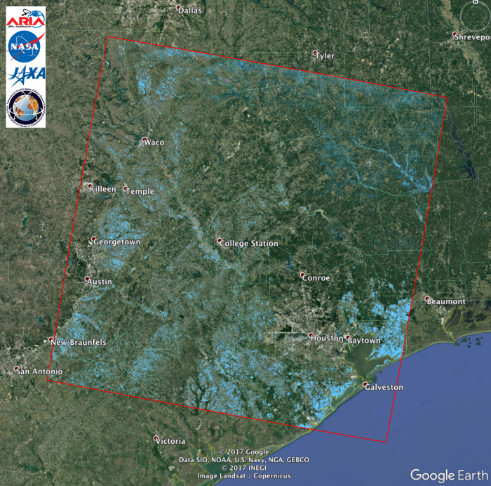
The above image is a screenshot of the flood extent map created by the ARIA team at NASA-JPL/Caltech, derived from the ALOS-2 ScanSAR data acquired on 8/27/17 (~1:30PM Central Time) over Texas including Houston. This Flood Proxy Map (FPM) covers an area of 350-by-350 km and is derived from Japan Aerospace Exploration Agency's (JAXA's) ALOS-2 PALSAR-2 pre- (2017-07-30) and post-event (2017-08-27) Synthetic Aperture Radar (SAR) amplitude images.
The pixels in light blue indicate areas likely flooded. Individual pixel size is about 50-by-50 m. Anecdotal preliminary validation was implemented with some number of local ground observations. This FPM should be used as guidance to identify areas that are likely flooded, and may be less reliable over urban areas. The FPM was created by Advanced Rapid Imaging and Analysis (ARIA) team at NASA-JPL/Catech, and the ALOS-2 data were accessed through the International Charter.


