Imagen
2015 was the first year that the ARSET program began offering wildfire trainings. Beginning with an introductory webinar on remote sensing for wildfire applications, ARSET reached over 270 attendees from over 180 organizations across the world. As a follow-up, a more advanced workshop trained over 40 participants from federal, state, local, and academic organizations.
Both trainings raised awareness of NASA remote sensing missions that are relevant to wildfire management, and introduced tools and products that professionals can use to enhance their decision-making capabilities. They were developed with a new, collaborative approach.
ARSET partnered with Keith Weber, the GIS Director at Idaho State University’s GIS Training and Research Center, a NASA Applied Sciences funded PI, and DEVELOP advisor. Weber’s persistence resulted in a network of invested partners, including the NASA Idaho Space Consortium, university researchers, and the U.S. Forest Service’s Remote Sensing Applications Center (RSAC).
The end result was a training delivered by several institutions within the framework of ARSET’s gradual learning approach. The first component of the training was a five-week introductory webinar on wildfire applications. The second was an in-person workshop in Pocatello, ID.
Five one-hour sessions were held every Tuesday between March 31-April 28, 2015. Attendees represented international governmental organizations, NGOs, the private sector, federal, state, municipal, and academic organizations from over 40 countries. The webinar provided an overview of data products, tools, and access portals relevant to enhanced decision-making and assessment methods for wildfire applications. A participant from Crater Lake National Park was excited to share his experience with his colleagues: “Great series. I am hoping to do a 1-hour summary PowerPoint of the whole series for our resource specialists and fire crew who wanted to attend, but couldn’t spare the time.”
The in-person workshop featured in-depth lectures to teach attendees about monitoring pre- and post-burn land conditions and obtaining near real-time wildfire hotspot data. Hands-on activities introduced participants to tools including:
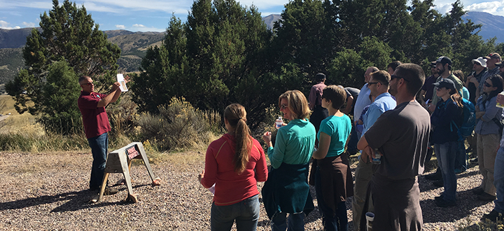
Breakout sessions facilitated discussions around how agencies manage fire, how they currently use remote sensing, and current bottlenecks in their workflow that remote sensing might solve. Participants from the Bureau of Land Management also led a tour of the 2012 Charlotte fire site – a training case study – to reinforce the connection between remote sensing and on-site fire management activities. One participant said that the greatest benefit of the training was “seeing new ways to use existing data and networking with individuals that would be helpful [to work with] in the future. Those contacts are really important because there are not many people in my office that know anything about remote sensing.”
In late 2016, ARSET is planning an introductory webinar series on near real-time monitoring for wildfires and land management. Dates have yet to be announced.


