Happy Valentine's Day, from the ARSET program! You can download a PDF to cut out and print this year's Valentines.
Satellite imagery is available at different resolutions. These resolutions can be spatial, temporal, spectral, and radiometric. Learn more about the different types of resolution and how they impact satellite imagery with ARSET's Fundamentals of Remote Sensing training.
NASA Earth observations don't just provide us with beautiful pictures. The data that NASA's satellites collect can apply to real-life situations, from monitoring disasters to tracking changes in land use. All of ARSET's online trainings are available as recordings for free. Learn to love NASA Earth observations and apply satellite data to you work. View all of ARSET's online trainings »
Many of NASA's Earth observing satellites capture imagery along the visible spectrum. Imagery can be displayed in natural and false color red-green-blue composites. Learn more about satellite imagery in ARSET's Fundamentals of Remote Sensing training.
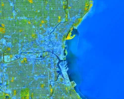
Land classification is an important first step in analyzing land cover and how land is used. ARSET has trainings available on how to perform land classifications using NASA Earth observations, how to perform accuracy assessments of land classifications, and how to monitor changes in land over time.


