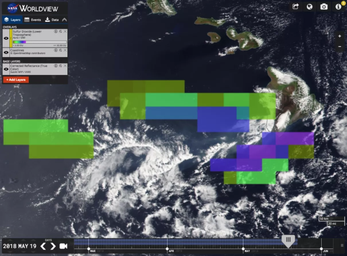
Total column amount of volcanic sulfur dioxide (SO2) from Kilauea volcanic eruption on May 19 2018 in free troposphere measured by Ozone Monitoring Instrument (OMI) on board NASA Aura satellite overlayed on SNPP/VIIRS True Color map. SO2 is criteria pollutant gas, which is harmful to people, plants and animals, causes acid rain and volcanic haze (vog). High resolution VIIRS true color map shows dense volcanic aerosol plume emitted from Kilauea main crater and advected in SW direction by trade winds and converted to vog downwind. OMI SO2 map reveals much larger geographical extent of volcanic SO2, which is important for volcanic plume dispersion forecasts for aviation avoidance and volcanic fog forecasts.
Published


