Published
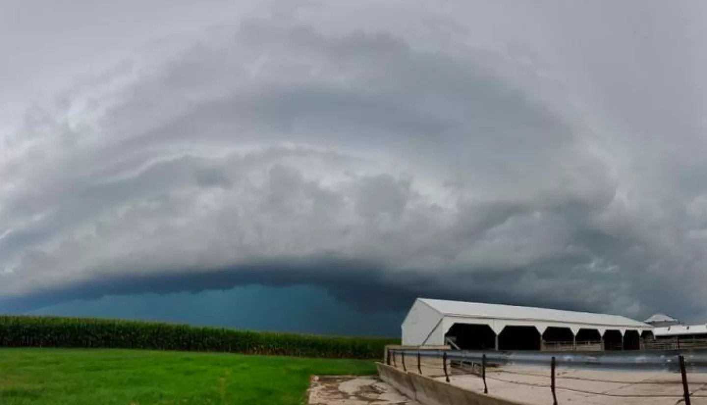
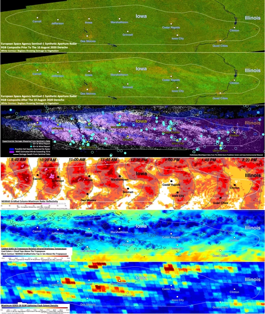
Kris Bedka, a severe weather expert, based at NASA's Langley Research Center, recently talked with Michelle O'Neill, from NPR affiliate, WVIK, about the unusually strong derecho that passed through the Quad Cities region of Illinois and Indiana in August 2020. Bedka related how high-tech images from satellites and radar help farmers, insurance companies, and scientists learn about the severity and scope of damage from the fast-moving storms. Bedka also shared how NASA's analysis of the extreme windstorm will help scientists learn about severe weather and its potential impacts worldwide.
Read the NPR Story
Learn more about Bedka's research
2862


