What is a Mapathon?
To prevent the loss of life and infrastructure that typically follows a hazard, decision-makers must first understand the threats that their communities face. One method of helping people conceptualize threats is through mapping. Maps provide a visual representation of the hazards that an area may encounter, which helps emergency management organizations plan more efficient ways to reduce the impact of disasters. However, it can be difficult to provide accurate coverage to the entire world and address the needs of specific communities, hence the need to host mapathons.
Similar to a hackathon, a mapathon is a collaborative event where members of the public come together to quickly develop new tools that improve the accuracy and usefulness of maps within their community. Following the event, organizations involved in the disaster response and recovery process use the newly refined maps to provide a more detailed risk assessment of an area. As a result, mapathons can help minimize the overall damage and loss of life that hazards inflict on a community, and are an important first step for improving disaster preparedness.
District University-NASA Mapathon for Risk Assessment
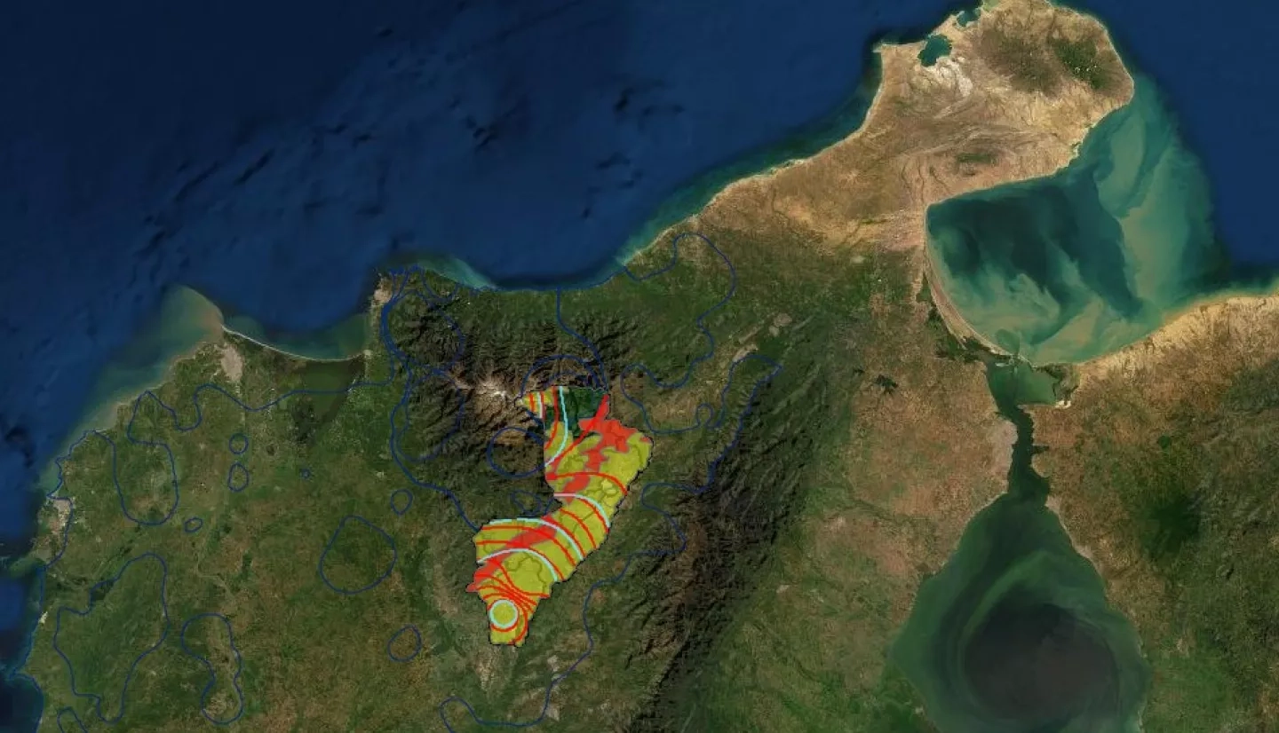
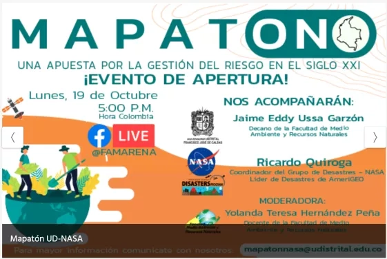
Colombia is situated within the Pacific Ring of Fire––a horseshoe-shaped area that encircles the Pacific Ocean and is notorious for frequently occurring earthquakes and volcanic activity––and as a result experiences a higher number of hazards. The country has 15 active volcanoes, endures an increased rate of earthquakes, and is prone to flooding and landslides during the rainy season. Unfortunately, this means that particularly at risk municipalities often struggle to recover from recurring disasters. To help the afflicted areas, NASA’s Earth Applied Sciences Disasters Program and the District University of Bogotá’s Environment and Natural Resources department teamed up to host a mapathon from Nov. 24 to Dec. 4. The event’s purpose was to create maps and models, using open data from remote sensing satellite instruments, that depict the patterns of multiple hazards. Local decision-makers will be able to use the products produced in the mapathon to rebuild their community’s future through improved land use planning and disaster risk reduction.
The mapathon spanned multiple agencies, including: the District University of Bogotá’s Environment and Natural Resources department, the NASA Disasters Program, the Environmental Systems Research Institute (ESRI) of Colombia, the United Nations Office for Disaster Risk Reduction (UNDRR) of Panama, the Institute of Hydrology, Meteorology, and Environmental Studies (IDEAM), the National Unit for Disaster Risk Management (UNGRD) Colombia, GEO-Solutions, and the Territorial Renovation Agency (ART) of Colombia. Through their combined efforts, these organizations help support the Sendai Framework for Disaster Risk Reduction 2015-2030––an international document that articulates principles and targets to reduce disaster risk and further resilience in the countries involved in order to improve their disaster preparedness. The DU-NASA Mapathon used the Sendai Framework to guide the objectives and goals of the event.
Participants in the District University-NASA Mapathon
The event had 50 student participants from the District University’s Environment and Natural Resources department and engineering departments. Each student was knowledgeable in either vulnerability analysis and risk management, programming, or the use of Geographic Information Systems (GIS). Participants were split into groups and competed in multiple categories throughout the week, all while receiving feedback from NASA scientists on their work. The winning group was selected for their project’s innovativeness, replicability, and use of open data.
The event had multiple guests from the NASA Disasters Program as well. Ricardo Quiroga a researcher and disaster coordinator from NASA’s Langley Research Center (LaRC), presented at the mapathon. Jean-Paul Vernier, a researcher and disaster coordinator also from Langley, shared tools for monitoring forest fires. Garret Layne, a Disasters Program GIS specialist, introduced and demonstrated the NASA Disasters Mapping Portal, and Robert McSwain, an aerospace engineer from Langley, presented drone applications for risk management Betzy Hernandez, the Capacity Building Lead for SERVIR at the NASA Marshall Space Flight Center, and Emil Cherrington, the Regional Science Coordination Lead for West Africa also at Marshall, gave an overview of NASA SERVIR tools. Each of these experts used their diverse scientific knowledge to inform and inspire the students participating in the mapathon.
What does This Mean for the People of Colombia?
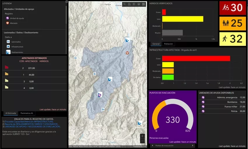
With the combined use of NASA data and the District University’s talented students, the mapathon fostered the creation of nine application prototypes to support decision-making at local levels in some of Colombia’s most vulnerable districts. For example, one of the groups devised a tool called “EmerGIS for Comprehensive Risk Management” which utilizes spatial analysis and landscape information to identify which populations are at a high risk for landslides. This tool makes it easier for emergency responsders to determine the landslide resilience of a community and figure out which areas require immediate assistance following an event.
This mapathon is just one example of how academic institutions can play a prominent role in connecting NASA data with local communities. With improved disaster preparedness comes a reduced loss of life and a quicker recovery from hazards. For the people of Colombia, this means an opportunity to grow their economy and improve their living standards with lower chances of having to start all over again. Moving forward, the products produced in the DU-NASA Mapathon will help local decision-makers create more informed decisions, and reduce the impact of disasters while their communities recover.


