Eleven years after an earthquake devastated the Haitian capital of Port-Au-Prince, another major earthquake has shaken the Caribbean nation. The epicenter of the magnitude 7.2 earthquake was centered about 100 kilometers (60 miles) west of the 2010 quake, in a mountainous area between Petit-Trou-de-Nippes and Aquin. Like the previous event, this earthquake occurred along the Enriquillo-Plantain Garden fault, an area where two tectonic plates grind against each other.
The earthquake exposed more than one million people to very strong to severe shaking, according to the U.S. Geological Survey. In preliminary estimates, news media and Haiti’s civil protection agency are reporting large numbers of deaths and extensive damage to buildings and infrastructure.
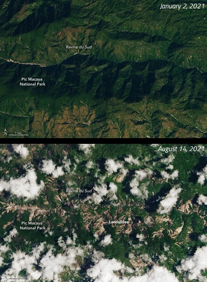
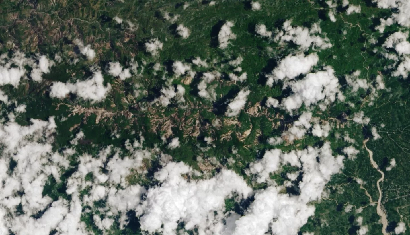
A break in the clouds allowed the Operational Land Imager (OLI) on Landsat 8 to acquire this natural-color view of landslides in and around Pic Macaya National Park in southwestern Haiti on August 14, 2021, the same day the earthquake hit. For comparison, a second image shows the same area on a clear day in January 2021.
NASA’s disasters program is monitoring the situation and coordinating with the United States Agency for International Development and other partners to share relevant data about the event with emergency responders. Maps and data to support response and recovery efforts are being shared on the NASA Disasters Mapping Portal.
Read the full article at NASA's Earth Observatory: Earthquake in Haiti Triggers Landslides


