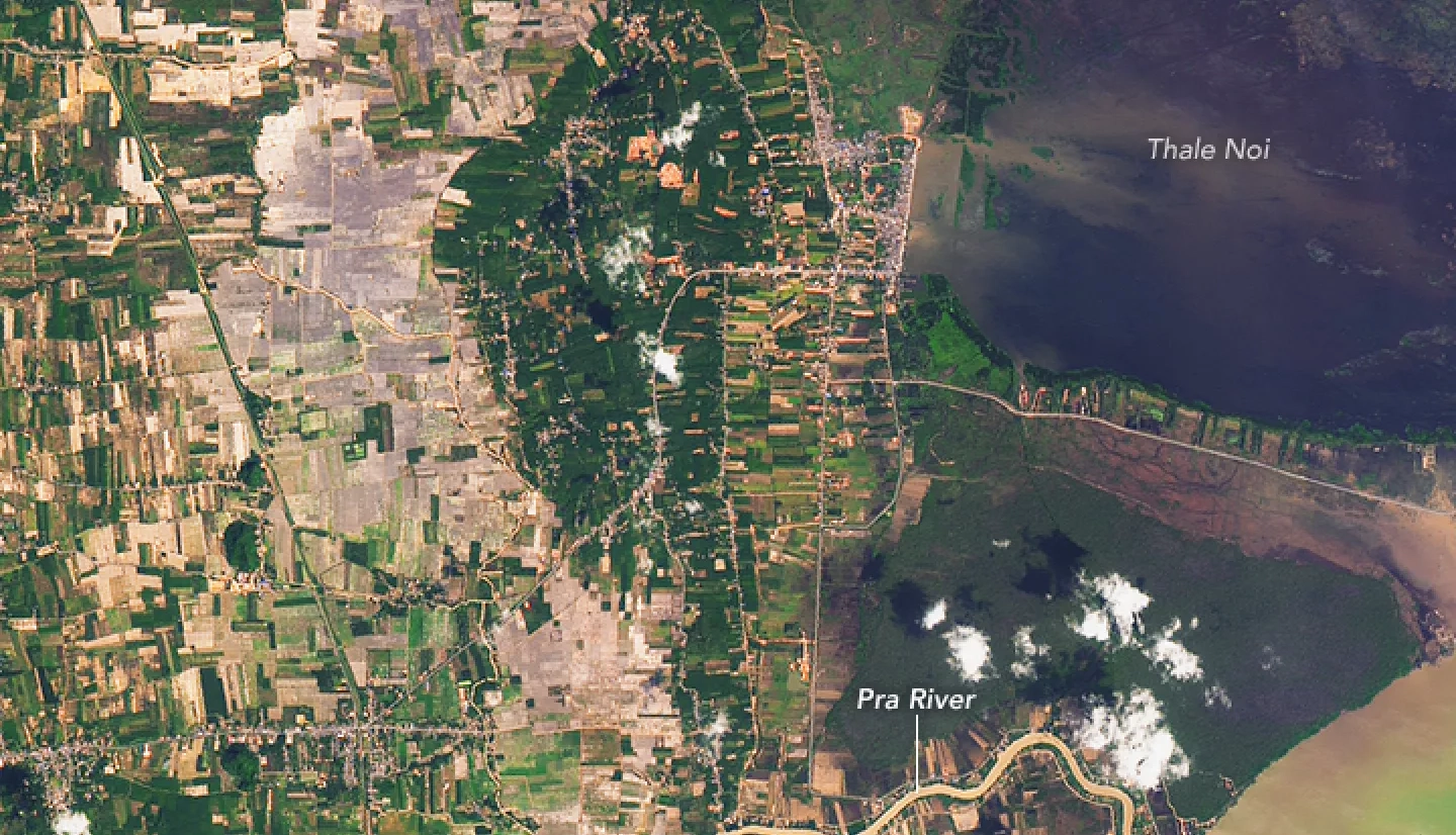
Several days of heavy rainfall swamped much of southern Thailand in January 2017. While monsoon-related floods are common in Thailand, the wet season usually ends in November.
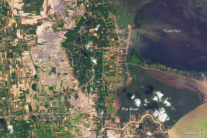
The Operational Land Imager (OLI) on the Landsat 8 satellite captured this image of flooded land near the Pra River on January 9, 2017. For comparison, the second image shows the same area on February 2, 2014, when waters were lower.
The rainfall, which began on January 1, 2017, is some of the most severe to hit Thailand in three decades, according to Thai authorities. More than 300,000 homes have been affected, and damage to infrastructure is widespread. At least 36 people have died.
While the worst of the rain and floods have subsided and cleanup has begun in many areas, forecasters warn that additional rounds of heavy rain may hit southern Thailand in the coming days.
References
- Bangkok Post (2017, January 12) 36 dead, one missing in floods, many homeless. Accessed January 12, 2017.
- Bangkok Post (2017, January 12) Bang Saphan Hospital reopens after flooded days. Accessed January 12, 2017.
- ReliefWeb (2017, January 9) Thailand Floods. Accessed January 12, 2017.
- Reuters (2017, January 9) Thai floods kill 21 and hit rubber production. Accessed January 12, 2017.
- The Weather Channel (2017, January 9) ‘Worst Rainfall in 30 Years’: Thailand Flooding Hits 700,000 People, Leaves 21 Dead. Accessed January 12, 2017.


