Published
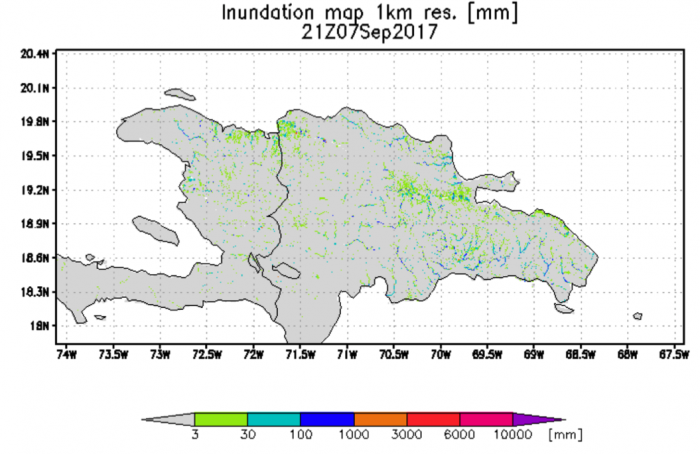
Some heavy rainfall in Haiti and Domincan Republic produced river flooding as Irma skirted to north of island.
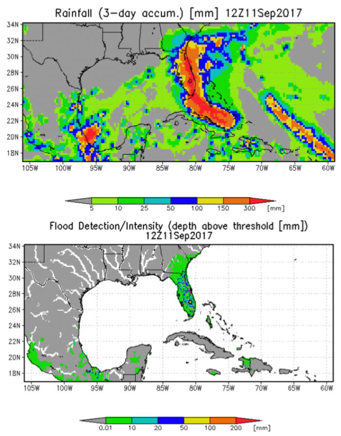
The above image shows the NASA GEOS-5 rainfall forecast over next three days with Irma tracking up center of Florida peninsula with maximum rainfall from southern tip and along east coast with amounts over 300 mm (12”). Also seen are rainfall tracks of Katia over southeast Mexico and Jose over mostly open ocean. The lower panel shows Florida peninsula with substantial flooding. Also shown is some flooding in Mexico with Katia.
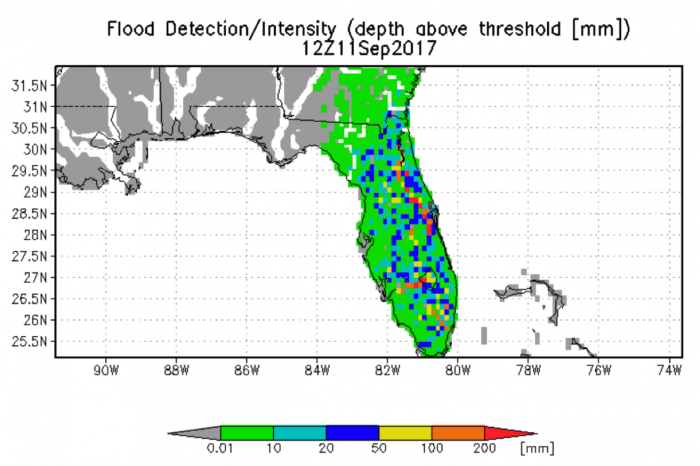
Detailed view of forecasted flooding in Florida on Monday Sept. 11th from Hurricane Irma.


