
Published
Repeat flights during the current eruption are using GLISTIN to detect changes in Kilauea's topography associated with new lava flows, with the goal of measuring the erupted volume as a function of time and the total volume of the event. These observations prove extremely useful to model the evolution of these volcanic processes.
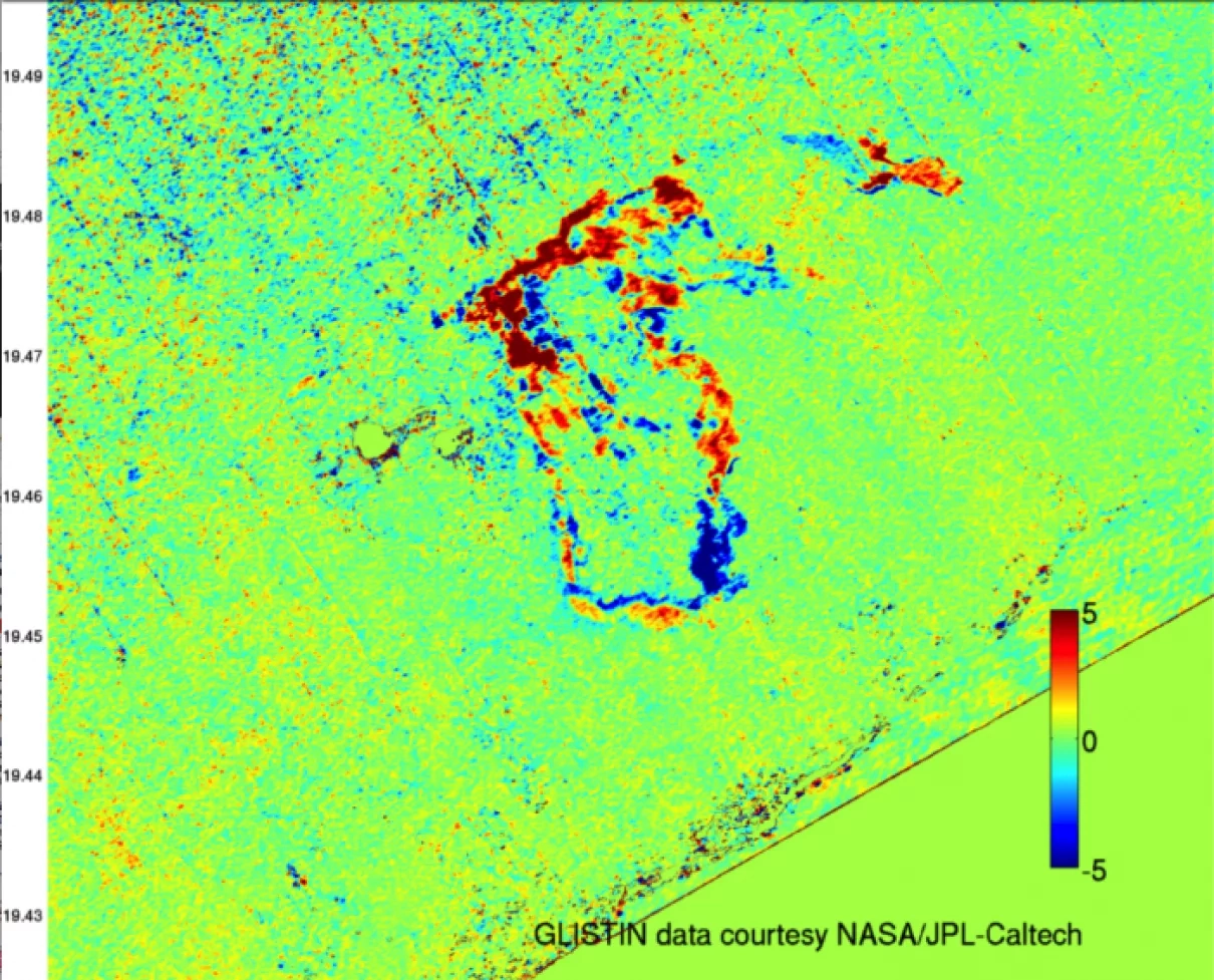
This is a topography difference map captured by GLISTIN over the Lower East Rift Zone. The difference in topography is caused by lava movement.
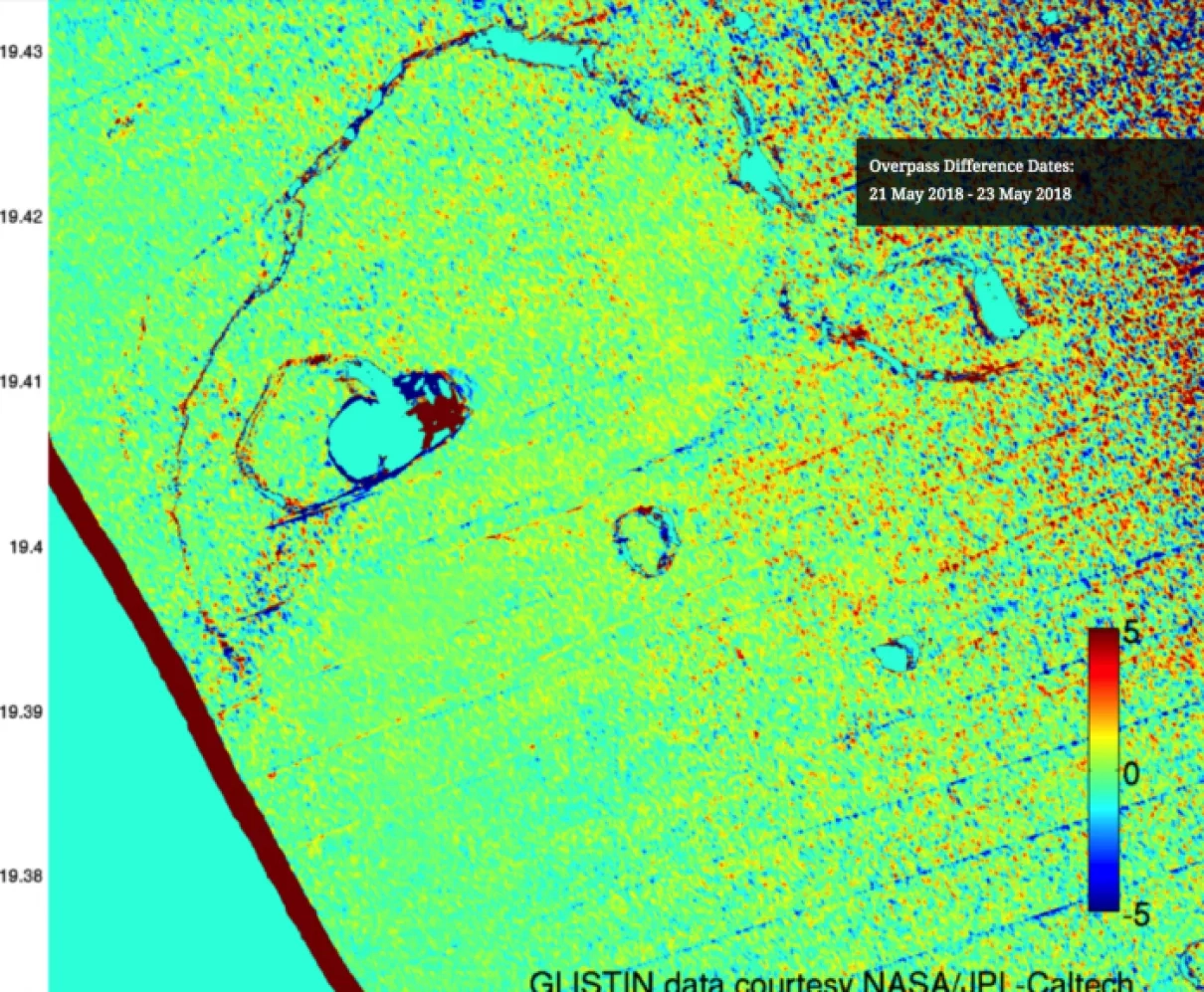
This is the same type of topography difference map showing the Kilauea Summit. This series of difference maps highlights the enlargement of the Halem'aum'au crater.
860


