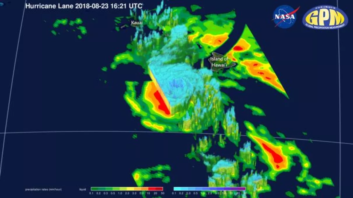
Battling increased vertical shear, Hurricane Lane struggles northward, down from its Category 5 peak but still featuring winds of over 110 knots. The storm has already begun impacting the Hawaiian Islands, bringing over a foot of rain to Hilo via its outer bands. Lane is expected to continue northward, approaching the island chain, before slowly veering westward as it continues to lose strength. This weakening will not diminish its likely primary impacts, which will be intense coastal erosion and damage and torrential rainfall, upwards of 30 inches in some locations. The anticipated slower track will only exacerbate this precipitation, leading to flooding throughout the eastern islands.
NOTE: The apparent curved gap in precipitation is due to missing data from where two satellite swaths are joined, it does not indicate an actual lack of precipitation.


