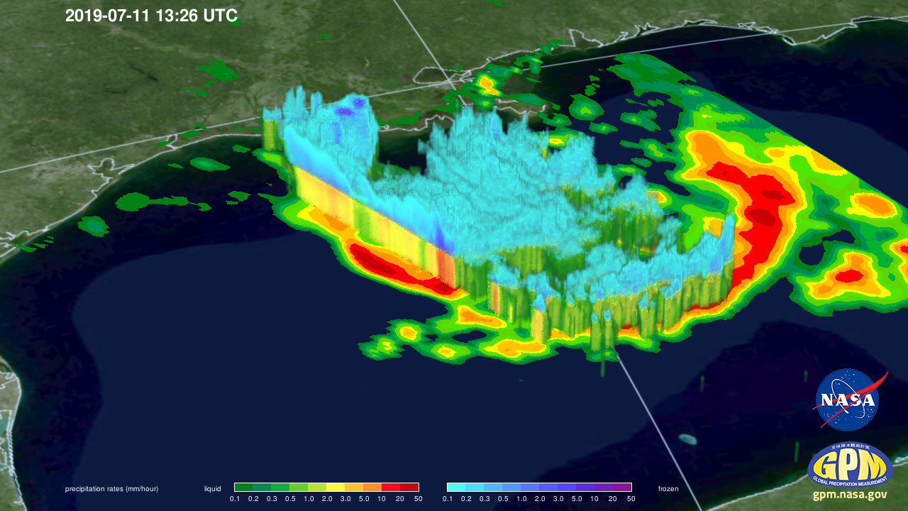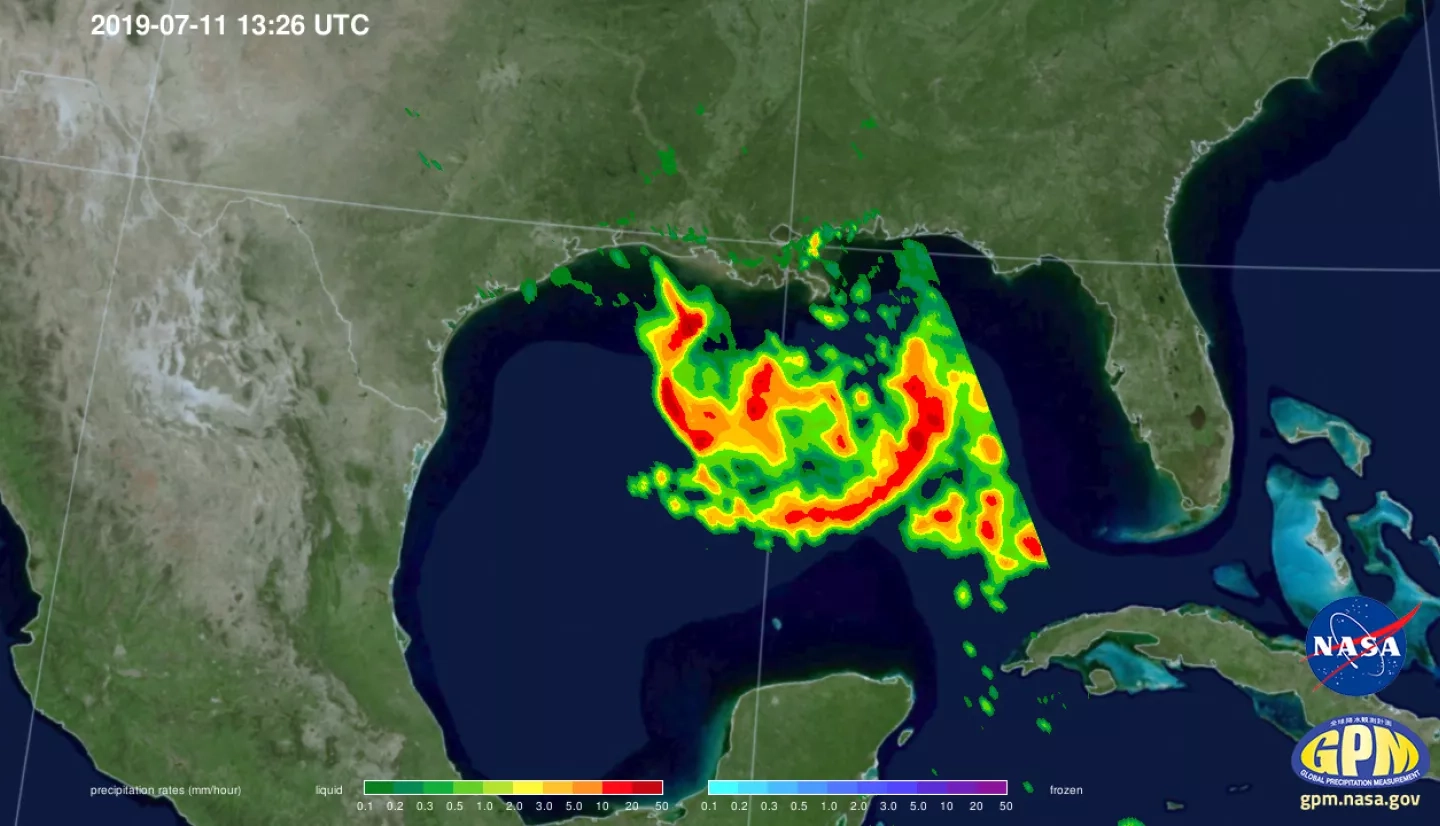
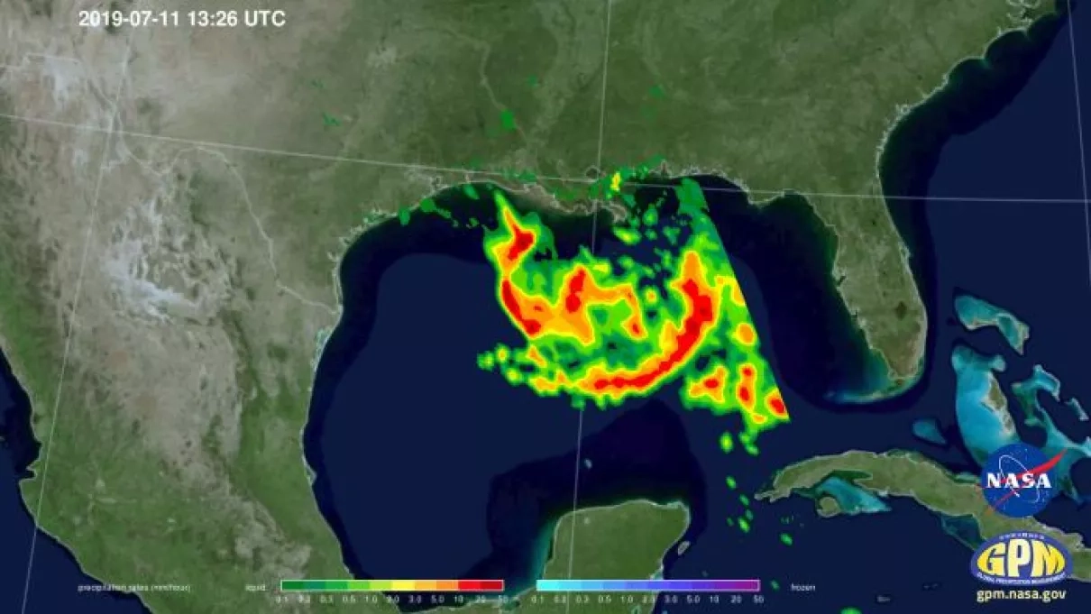
NASA / JAXA’s GPM Core Observatory passed over developing Tropical Depression 2 (which was upgraded to Tropical Storm Barry later in the morning) in the Gulf of Mexico the morning of July 11th 2019 at 8:26am CT, capturing estimates of rainfall rates within the storm. The first image shows rainfall rates collected by GPM’s Microwave Imager, while the second image shows 3D rainfall rates within the atmospheric column from GPM’s Dual-frequency Precipitation Radar (DPR). The DPR measured storm top heights as high as 18 km, which is extremely high and indicative of intense thunderstorm activity south of central Louisiana. Rainfall rates with these storms exceeded 100 mm/hr as well. Despite these intense storms, activity was not yet organized near the storm center and so flooding due to rainfall, rather than strong winds and storm surge, are the primary threat with Barry at this time.
Learn more about TD2 / Tropical Storm Barry on the NASA Hurricanes blog